Norman Bay (also known as Norman Beach) is the sweeping main ocean beach within Wilsons Promontory National Park, Gippsland. Fringed by low scrub and heathland, this exposed beach faces Bass Strait with crystalline waters that on calm days reveal sandy shallows and rocky reef edges. Part of the Wilsons Promontory Marine National Park, it offers snorkellers a chance to explore temperate reef life right off the shore. The gentle slope near the Tidal River mouth is safest, while the open beach can be treacherous with strong currents and dumping waves.
Norman Bay
IntermediateSKIP
SKIP
Poor conditions. Stay out today.
Showing last known conditions
Wave Height 0.1 mSwell Period 13 sWind Speed 17 knPrecipitation 22 mmTidal Phase flood
Last evaluated
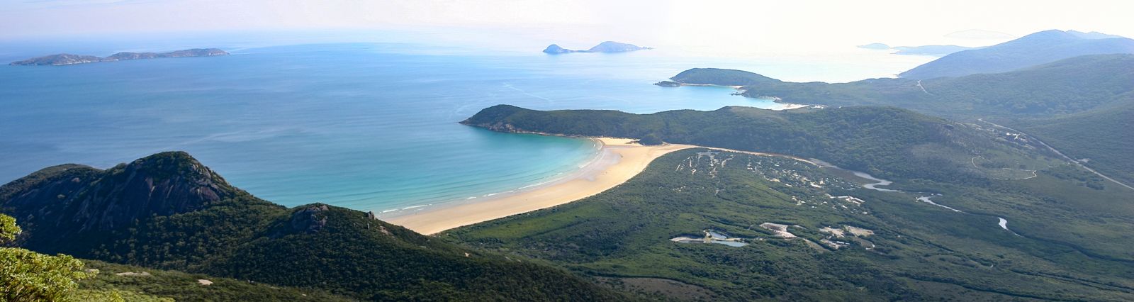 © Martin Kraft
The spot
Community-maintained
Community contribution: submitted by Daniel
Know before you go
Logged by the community, confirmed by mods
Moderate risk: Strong currents
Norman Bay faces Bass Strait and is subject to strong rip currents and ocean sweep, especially away from the Tidal River mouth.
Moderate risk: Dumping swell
Exposed to Bass Strait swell; large dumping waves can arrive suddenly, making entry and exit hazardous.
Low risk: Submerged rocks and drop-offs
Submerged and slippery rocks with sudden drop-offs are present along the beach, particularly at the southern end.
Low risk: Cold water temperatures
Temperate waters can be very cold (10-16°C) year-round, increasing the risk of hypothermia even in summer.
Wildlife Guide
No wildlife notes for this spot yet.
Gallery
5 photos from the community
Getting in
Shore entry
Entry
Norman Bay is located in Wilsons Promontory National Park, about 2.5 hours south-east of Melbourne via the South Gippsland Highway. Enter the park at the Tidal River entrance gate and follow the road to the main beach carpark near the Tidal River bridge.
Parking & facilities
Large sealed carpark is available at Norman Beach near the Tidal River bridge. Parking is included in the park entry fee. Spaces fill quickly on weekends and during summer holidays.
parkingtoiletsshowersdrinking_waterpicnic_tables
Park entry fee applies: standard vehicle fee for Wilsons Promontory National Park (approx. AUD 14 per vehicle per day as of 2025).
Spot Map
Community
Gallery ┬╖ 5 photos
Trust
Is this spot real, accurate, still loved?
Spots near Victoria

No nearby spots yet.
Needs verification
Quick verify
One tap helps the community keep this spot honest.
About this data
- Conditions last evaluated
- Spot data last updated
- Data sources
- Open-Meteo (marine & weather conditions), tide predictions via UTide, community contributors (descriptions, hazards, marine life).
- License
- Spot content licensed under CC BY-SA 4.0. How's the Spot is open source.
Weather & swell ┬╖ Open-Meteo marine & weather APIs Tides ┬╖ UTide harmonic analysis Sea & safety ┬╖ community reports