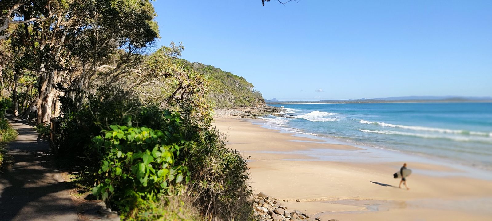
The headlands of Noosa National Park shelter a chain of granite-boulder coves and sandy pockets where crystalline swells roll in from the Coral Sea. Tea Tree Bay offers gentle shallows and rock-bommie habitat, while Granite Bay rewards those who paddle around the point with clearer water and turtle sightings. Helicopter Reef, just off the park's coastal trail, is a submerged reef platform frequented by green sea turtles, wobbegong sharks, and schools of bream. The park's protected marine zone has fostered a thriving ecosystem inside Laguna Bay, making every cove a distinct underwater encounter.
Noosa National Park
IntermediateGO
GO
It's a go.
Showing last known conditions
Wave Height 0.5 mSwell Period 6.0 sWind Speed 1.8 knPrecipitation 0.0 mmTidal Phase flood
Last evaluated
The spot
Community-maintained
Community contribution: submitted by Daniel
Know before you go
Logged by the community, confirmed by mods
Moderate risk: Headland currents
Strong currents can develop around the headlands between coves, particularly on an outgoing tide. Snorkelers should avoid swimming around points unless conditions are calm.
Moderate risk: Swell and shorebreak
Eastern Australian swells can produce dumping waves on exposed rock bommies and shorebreaks, especially in winter months.
Low risk: Bluebottles and jellyfish
Stinging jellyfish, including bluebottles (Physalia physalis), are occasionally swept into the coves during northerly winds and warmer months.
Low risk: Slippery rock entry
Some coves have slippery granite boulders at the waterline, making entry and exit treacherous, especially in surf.
Wildlife Guide
No wildlife notes for this spot yet.
Gallery
3 photos from the community
Getting in
Shore entry
Entry
From Noosa Heads, follow Park Road to the Noosa National Park entrance. The coastal walking trail leads to several snorkel-access points including Granite Bay, Tea Tree Bay, and Winch Cove. Parking is available at the park entrance car park on Park Road.
Parking & facilities
Pay-and-display car park at Noosa National Park entrance on Park Road. Limited spaces; arrive early in peak season.
parkingtoilets
Noosa National Park is free to enter. Parking fees apply at the Park Road car park.
Spot Map
Community
Gallery ┬╖ 3 photos
Trust
Is this spot real, accurate, still loved?
Spots near Queensland

No nearby spots yet.
Needs verification
Quick verify
One tap helps the community keep this spot honest.
About this data
- Conditions last evaluated
- Spot data last updated
- Data sources
- Open-Meteo (marine & weather conditions), tide predictions via UTide, community contributors (descriptions, hazards, marine life).
- License
- Spot content licensed under CC BY-SA 4.0. How's the Spot is open source.
Weather & swell ┬╖ Open-Meteo marine & weather APIs Tides ┬╖ UTide harmonic analysis Sea & safety ┬╖ community reports