The Nambucca River is a stunning estuarine snorkeling destination on the NSW Mid-North Coast, where clear tidal waters flow past sandy beaches, islands, and mangroves before meeting the sea at Nambucca Heads. At high tide the water turns crystal-clear, revealing a thriving underwater world of over 90 marine species. The river's sheltered estuary offers calm conditions ideal for snorkeling, with easy shore access from several points along the riverbanks and the famous V-Wall breakwall nearby. Dolphins and sea turtles are frequent visitors, making every snorkel an adventure in this hidden coastal gem.
Nambucca River
BeginnerGO
GO
It's a go.
Showing last known conditions
Wave Height 0.5 mSwell Period 6.1 sWind Speed 10.0 knPrecipitation 0.0 mmTidal Phase unknown
Last evaluated
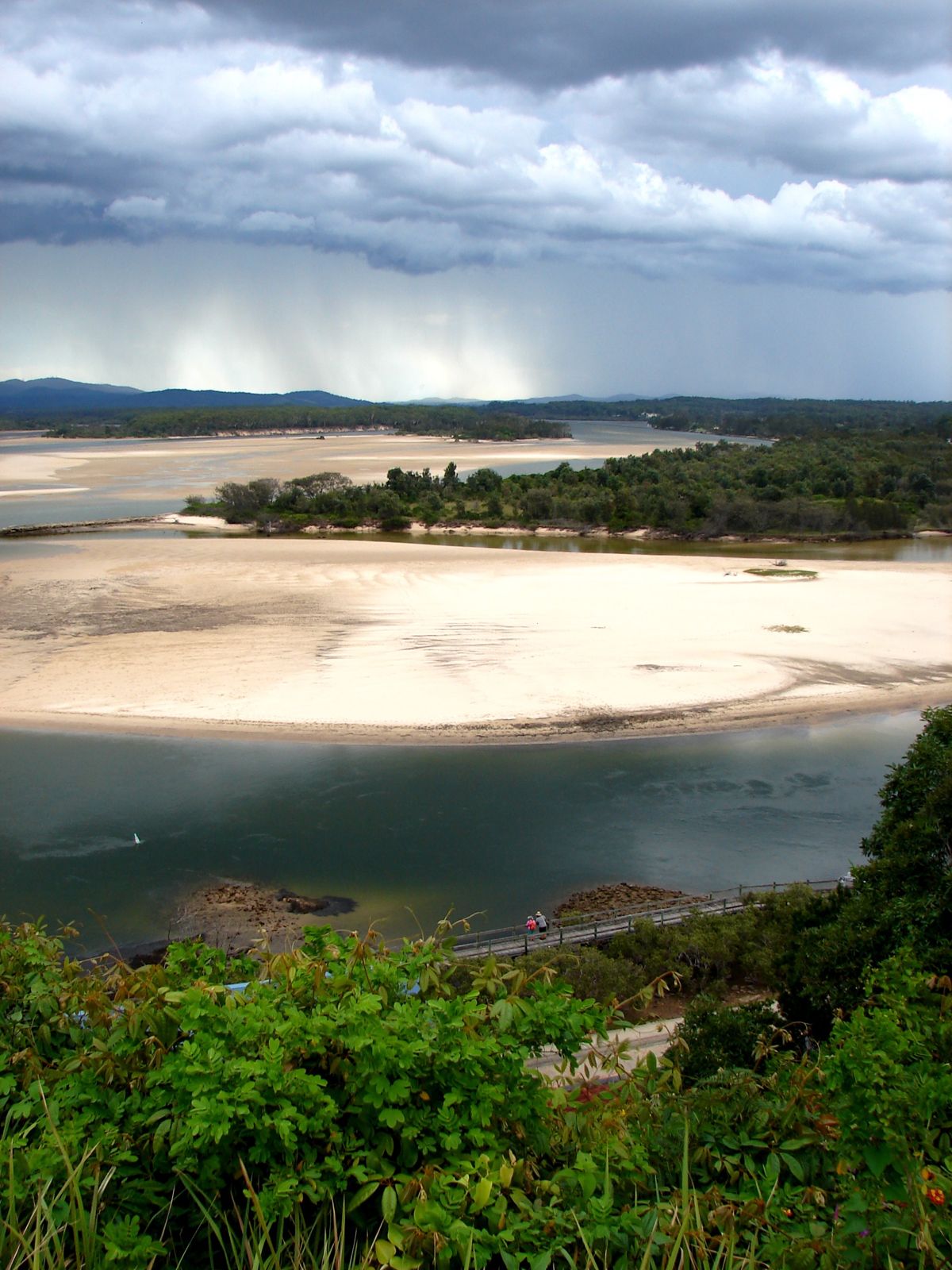 © Localapple
The spot
Community-maintained
Community contribution: submitted by Daniel
Know before you go
Logged by the community, confirmed by mods
Moderate risk: Outgoing Tide Current
Strong outgoing tidal flows can develop near the river mouth, especially on an ebb tide, which may carry swimmers seaward.
Low risk: Tidal current
The river estuary experiences tidal flows. Snorkel at high tide for calm, clear conditions and be mindful of moving water during outgoing tide.
Low risk: Boat traffic
The Nambucca River is used by water skiers, boaters and kayakers. Stay aware of vessels, especially in the broad open stretches.
Low risk: Stingers (Bluebottles)
Bluebottles and occasional jellyfish can drift into the estuary during warmer months (November to March).
Wildlife Guide
No wildlife notes for this spot yet.
Gallery
3 photos from the community
Getting in
Shore entry
Entry
Nambucca River is located at Nambucca Heads, approximately 40 minutes south of Coffs Harbour and 5 hours north of Sydney via the Pacific Highway. Turn off the highway into Nambucca Heads and follow Signs to the riverfront, V-Wall, or Riverside Rest accommodation area for direct shore access points.
Parking & facilities
Free street parking available near the riverfront and V-Wall area. Parking is also available at boat ramps and along the river boardwalk.
parkingtoiletspicnic_tablesboat_ramp
No fees for snorkeling. Free public access.
Spot Map
Community
Gallery ┬╖ 3 photos
Trust
Is this spot real, accurate, still loved?
Spots near New South Wales

No nearby spots yet.
Needs verification
Quick verify
One tap helps the community keep this spot honest.
About this data
- Conditions last evaluated
- Spot data last updated
- Data sources
- Open-Meteo (marine & weather conditions), tide predictions via UTide, community contributors (descriptions, hazards, marine life).
- License
- Spot content licensed under CC BY-SA 4.0. How's the Spot is open source.
Weather & swell ┬╖ Open-Meteo marine & weather APIs Tides ┬╖ UTide harmonic analysis Sea & safety ┬╖ community reports