Mushroom Rock is a small offshore granite island and reef system just off Hamelin Bay on Western Australia's southwest coast. This sheltered snorkeling site features crystal-clear waters, sandy patches between limestone ledges, and seagrass meadows in depths ranging from 1 to 6 metres. Famous for the resident friendly stingrays that glide through the shallows, the rock formation itself rises like a mushroom cap from the seabed — hence the name. The 1–2 km return snorkel trail circles the island, offering encounters with schools of bream, wrasse, and occasional eagle rays. Best visited in calm summer conditions (November to April) when water visibility peaks.
Mushroom Rock
IntermediateSKIP
SKIP
Poor conditions. Stay out today.
Showing last known conditions
Wave Height 2.6 mSwell Period 12 sWind Speed 0.4 knPrecipitation 2.2 mmTidal Phase ebb
Last evaluated
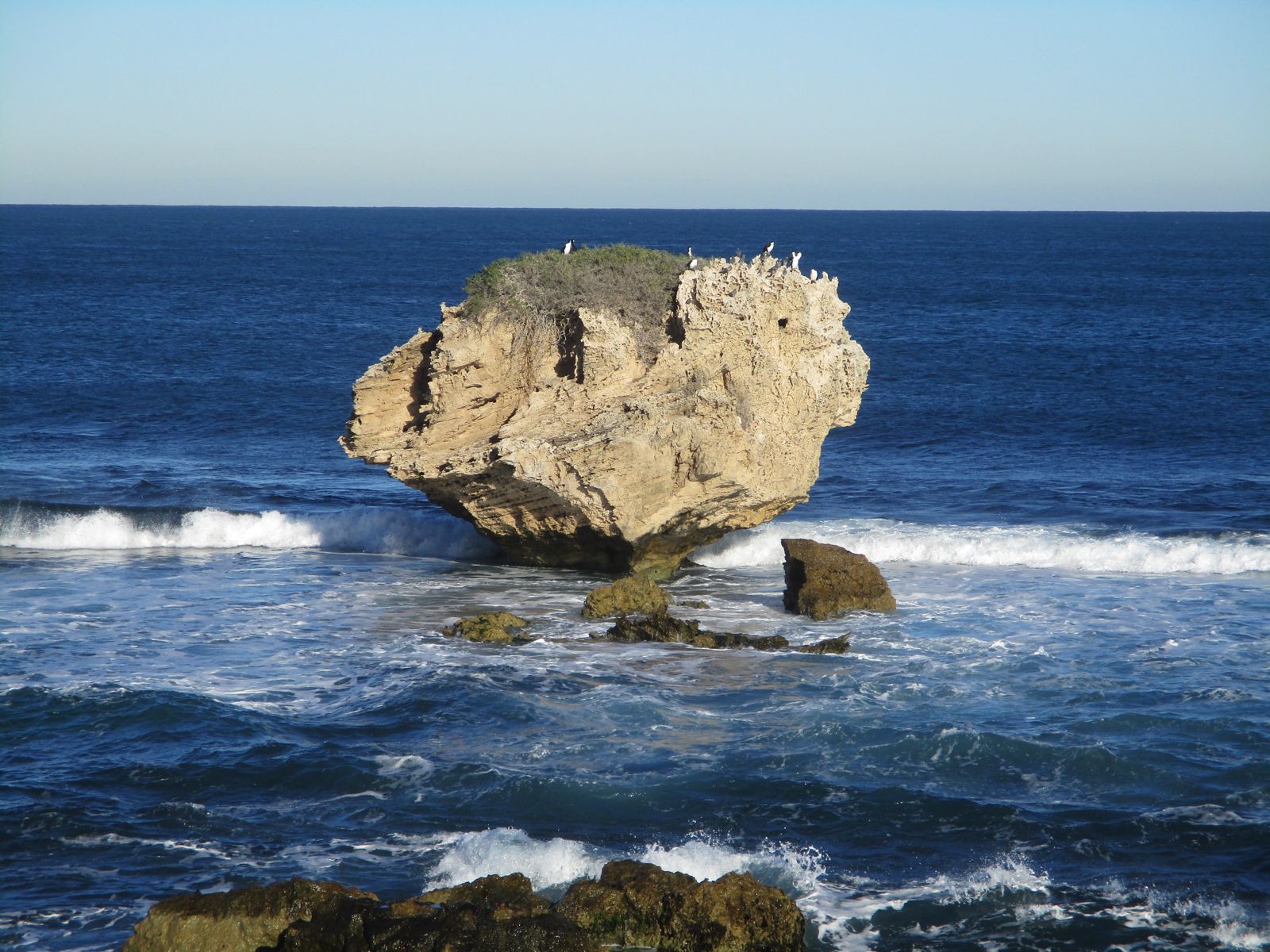 © Calistemon
The spot
Community-maintained
Community contribution: submitted by Daniel
Know before you go
Logged by the community, confirmed by mods
Moderate risk: Wind swell exposure
Mushroom Rock is exposed to ocean swell, particularly in westerly winds. Rough conditions can develop quickly, making the return swim challenging.
Low risk: Boat traffic
The reef is a popular stop for tour boats and fishing vessels. Maintain awareness and use a dive float or marker buoy.
Wildlife Guide
No wildlife notes for this spot yet.
Gallery
3 photos from the community
Getting in
Shore entry
Entry
From Augusta, head north on Caves Road for approximately 12 km and follow the signs to Hamelin Bay. Turn into Hamelin Bay Road and continue to the main beach car park. Mushroom Rock is visible offshore — snorkel out from the southern end of the beach.
Parking & facilities
Two main beach car parks are available at Hamelin Bay. They fill quickly during summer peak season (December–January). Arrive early or visit outside holiday periods.
toiletsparking
Free entry and parking. No fees required.
Spot Map
Community
Gallery ┬╖ 3 photos
Trust
Is this spot real, accurate, still loved?
Spots near Western Australia

No nearby spots yet.
Needs verification
Quick verify
One tap helps the community keep this spot honest.
About this data
- Conditions last evaluated
- Spot data last updated
- Data sources
- Open-Meteo (marine & weather conditions), tide predictions via UTide, community contributors (descriptions, hazards, marine life).
- License
- Spot content licensed under CC BY-SA 4.0. How's the Spot is open source.
Weather & swell ┬╖ Open-Meteo marine & weather APIs Tides ┬╖ UTide harmonic analysis Sea & safety ┬╖ community reports