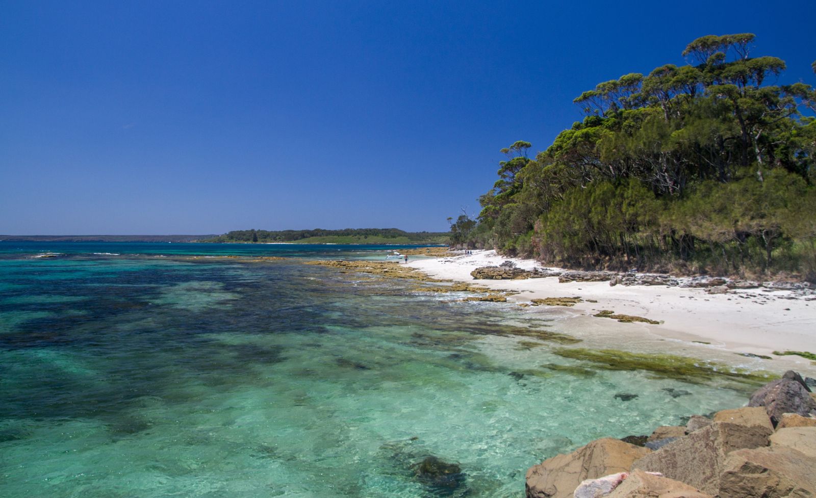
Tucked inside Booderee National Park at the entrance to Jervis Bay, Murrays Beach dazzles with squeaky-white silica sand that contrasts brilliantly against calm, crystalline turquoise water. Protected by Governor Head and Bowen Island, this unpatrolled beach offers excellent shore-entry snorkeling around rocky reef coves on both sides of the bay, where you can drift over colourful fish and rocky formations in exceptionally clear water. A short 300-metre woodland walk from the car park leads to this pristine, crowd-free slice of paradise.
Murrays Beach
BeginnerGO
GO
It's a go.
Showing last known conditions
Wave Height 0.1 mSwell Period 9.3 sWind Speed 12 knPrecipitation 19 mmTidal Phase slack
Last evaluated
 © Maksym Kozlenko
The spot
Community-maintained
Community contribution: submitted by Daniel
Know before you go
Logged by the community, confirmed by mods
Moderate risk: Unpatrolled beach
No lifeguards on duty — swim at your own risk. Always check conditions before entering.
Low risk: Sharp rocks at coves
Rock platforms and coves on both sides of the bay can be sharp; snorkelling shoes recommended, especially at low tide.
Low risk: Variable tide conditions
Some coves are reachable on foot only at low tide; incoming tide can cut off access to certain rock areas.
Low risk: Sharp rocks at low tide
Rock shelves and platforms bordering the coves can be sharp; snorkeling shoes recommended.
Low risk: Low tide access only to coves
Some of the smaller coves flanking the bay are only reachable on foot at low tide.
Wildlife Guide
No wildlife notes for this spot yet.
Gallery
4 photos from the community
Getting in
Shore entry
Entry
Murrays Beach is located within Booderee National Park, Jervis Bay. Drive to Jervis Bay Road and follow it to the end where the car park is located. The beach is accessible via a short walk through woodland.
Parking & facilities
Large car park at the end of Jervis Bay Road, Booderee National Park. A 300-metre walking trail leads from the car park to the beach.
toiletsparkingpicnic_tables
A Booderee National Park pass is required (day passes and annual passes available). This park is managed by Parks Australia, not NSW National Parks. Purchase online in advance.
Spot Map
Community
Gallery ┬╖ 4 photos
Trust
Is this spot real, accurate, still loved?
Spots near New South Wales

No nearby spots yet.
Needs verification
Quick verify
One tap helps the community keep this spot honest.
About this data
- Conditions last evaluated
- Spot data last updated
- Data sources
- Open-Meteo (marine & weather conditions), tide predictions via UTide, community contributors (descriptions, hazards, marine life).
- License
- Spot content licensed under CC BY-SA 4.0. How's the Spot is open source.
Weather & swell ┬╖ Open-Meteo marine & weather APIs Tides ┬╖ UTide harmonic analysis Sea & safety ┬╖ community reports