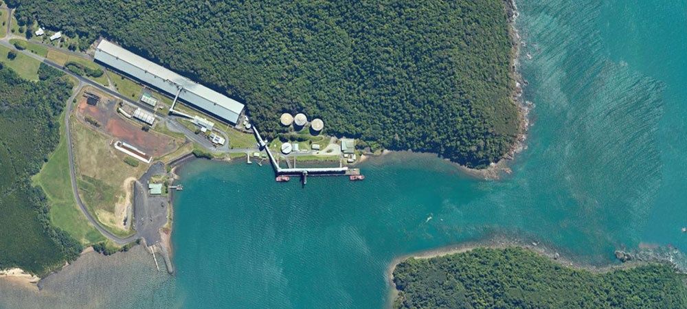
Mourilyan Harbour, located on the Moresby River about 10 km south of Innisfail, is a working harbour and the launch point for boat-based snorkelling trips to the nearby Great Barrier Reef. The harbour itself features a busy three-lane public boat ramp with excellent facilities including toilets, hot showers, and drinking water. While the harbour waters are murky and tidal—best suited as a departure point—the outer reef sites accessed from here offer excellent coral gardens and diverse marine life. Note: estuarine crocodiles inhabit these waters, so swimming from the shore is not recommended; always take a boat tour for reef snorkelling.
Mourilyan Harbour
IntermediateMAYBE
MAYBE
Fair. Experienced snorkellers only.
Showing last known conditions
Wave Height 0.0 mSwell Period 0.0 sWind Speed 5.3 knPrecipitation 16 mmTidal Phase flood
Last evaluated
DANGER: Explicit Risks Present
Mourilyan Harbour has hazards marked as danger. Entering the water here means you may face serious risks to your personal safety.
- Estuarine Crocodiles danger
Estuarine crocodiles (Crocodylus porosus) are known to inhabit the harbour and Moresby River waters. Do not swim from the shore or wade in the water.
The spot
Community-maintained
Community contribution: submitted by Daniel
Know before you go
Logged by the community, confirmed by mods
High risk: Estuarine Crocodiles
Estuarine crocodiles (Crocodylus porosus) are known to inhabit the harbour and Moresby River waters. Do not swim from the shore or wade in the water.
Moderate risk: Tidal Currents
Strong tidal flows through the harbour entrance and river channel can create challenging conditions for small boats and swimmers.
Moderate risk: Stinger Season
Stinging jellyfish (box jellyfish and Irukandji) may be present in tropical waters during the warmer months.
Low risk: Boat Traffic
The harbour is a working commercial port with boat traffic, including large vessels and frequent trailer boat activity at the ramp.
Wildlife Guide
No wildlife notes for this spot yet.
Gallery
2 photos from the community
Getting in
Boat
Entry
About 10 km south of Innisfail, Queensland. Turn off the Bruce Highway onto Mourilyan Harbour Road and follow it to the boat ramp area.
Parking & facilities
Dedicated parking bays for cars and boat trailers; avoid using the 15-minute bay or fisherman/trailer bays overnight.
parkingtoiletsshowersdrinking_water
Free (public boat ramp)
Spot Map
Community
Gallery ┬╖ 2 photos
Trust
Is this spot real, accurate, still loved?
Spots near Queensland

No nearby spots yet.
Needs verification
Quick verify
One tap helps the community keep this spot honest.
About this data
- Conditions last evaluated
- Spot data last updated
- Data sources
- Open-Meteo (marine & weather conditions), tide predictions via UTide, community contributors (descriptions, hazards, marine life).
- License
- Spot content licensed under CC BY-SA 4.0. How's the Spot is open source.
Weather & swell ┬╖ Open-Meteo marine & weather APIs Tides ┬╖ UTide harmonic analysis Sea & safety ┬╖ community reports