Stretching over two kilometres along the eastern shore of the Mornington Peninsula, Mount Martha Beach / Surf Beach offers a long, wide sandy foreshore backed by iconic colourful bathing boxes and native bushland. The protected waters of Port Phillip Bay provide generally calm conditions ideal for swimming and snorkelling, with a gently sloping seabed and sandy-bottom shallows that give way to deeper water offshore. Named a top-10 Australian beach in 2026, it's a picturesque and accessible snorkel spot for families and casual snorkellers exploring the bay's clear, temperate waters.
Mount Martha Beach / Surf Beach
BeginnerMAYBE
MAYBE
Fair. Experienced snorkellers only.
Showing last known conditions
Wave Height 0.1 mSwell Period 9.8 sWind Speed 1.7 knPrecipitation 29 mmTidal Phase flood
Last evaluated
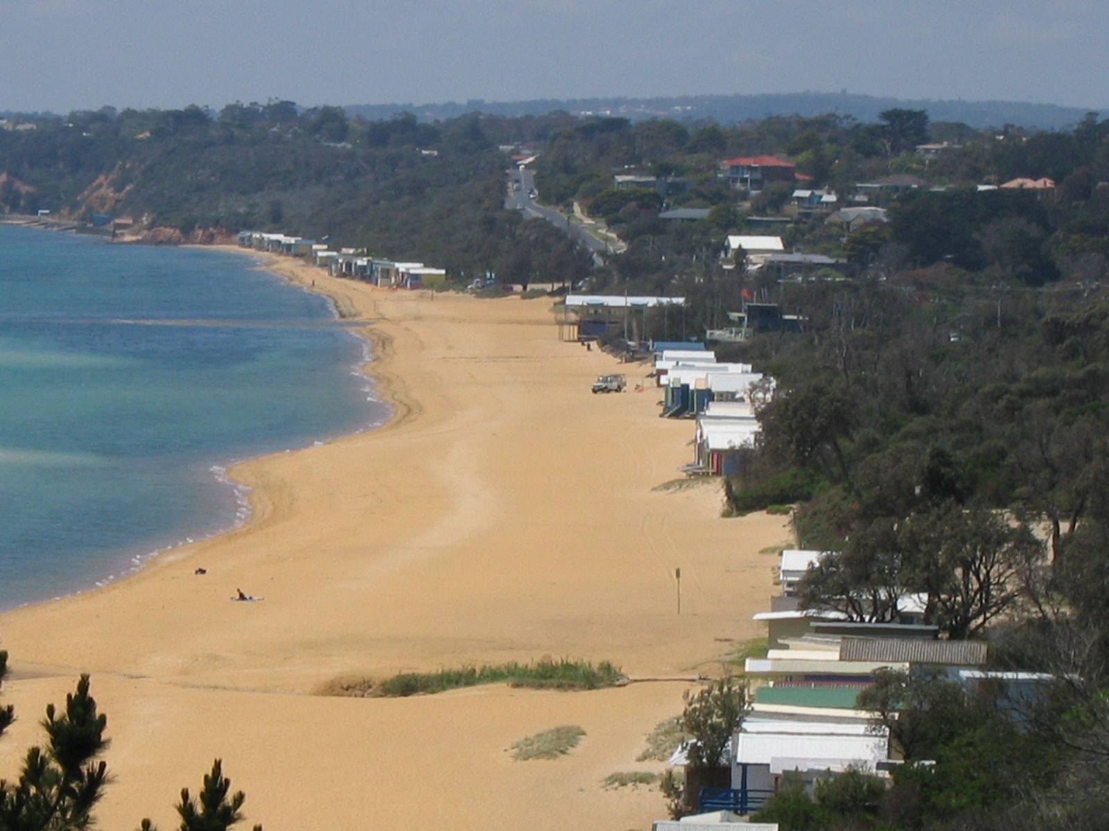 © Orderinchaos
The spot
Community-maintained
Community contribution: submitted by Daniel
Know before you go
Logged by the community, confirmed by mods
Low risk: Deep water close to shore
The water gets deep quickly a short distance from the shoreline, which can surprise weak swimmers.
Low risk: Vessel traffic
Boat launching facilities nearby mean occasional vessel traffic in the swimming area.
Wildlife Guide
No wildlife notes for this spot yet.
Gallery
3 photos from the community
Getting in
Shore entry
Entry
Located on the Mornington Peninsula, approximately 60 km south of Melbourne. Take the Nepean Highway to Mount Martha, then turn onto The Esplanade which runs parallel to the beach.
Parking & facilities
Foreshore car parking available along The Esplanade near the beach access points.
parkingtoiletspicnic_tables
No entry fee for beach access.
Spot Map
Community
Gallery ┬╖ 3 photos
Trust
Is this spot real, accurate, still loved?
Spots near Victoria

No nearby spots yet.
Needs verification
Quick verify
One tap helps the community keep this spot honest.
About this data
- Conditions last evaluated
- Spot data last updated
- Data sources
- Open-Meteo (marine & weather conditions), tide predictions via UTide, community contributors (descriptions, hazards, marine life).
- License
- Spot content licensed under CC BY-SA 4.0. How's the Spot is open source.
Weather & swell ┬╖ Open-Meteo marine & weather APIs Tides ┬╖ UTide harmonic analysis Sea & safety ┬╖ community reports