A stunningly beautiful north-facing cove within Torndirrup National Park, Misery Beach earned its grim name from the 19th-century whaling station that once sullied its shores — but today it is pure paradise. Sheltered by a granite headland (Isthmus Hill) and thickly vegetated hillsides, this 200-metre crescent of soft white sand looks out across the turquoise waters of King George Sound. Voted Australia's Best Beach in 2022 by Tourism Australia, it offers calm, clear conditions ideal for snorkelling, with views stretching to the Stirling Range on fine days.
Misery Beach
BeginnerGO
GO
It's a go.
Showing last known conditions
Wave Height 0.3 mSwell Period 11 sWind Speed 7.0 knPrecipitation 5.5 mmTidal Phase ebb
Last evaluated
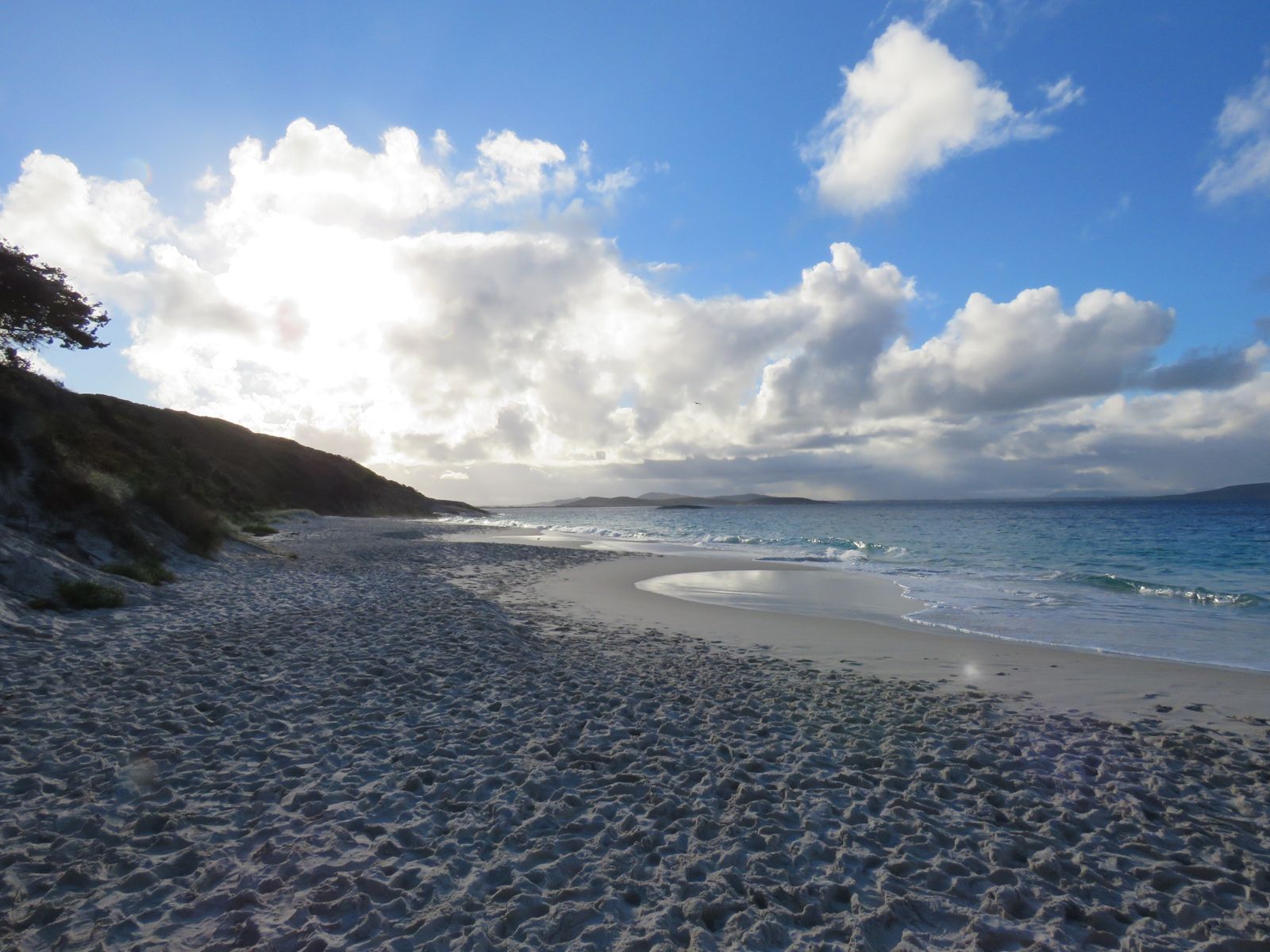 © Calistemon
The spot
Community-maintained
Community contribution: submitted by Daniel
Know before you go
Logged by the community, confirmed by mods
Low risk: Rip currents
Rips and strong currents may be present, especially near the rocky points. No lifeguards on duty.
Low risk: Rough ocean swell
Exposed ocean waters can be rough for swimming on windy days despite the beach's sheltered position.
Low risk: Uneven access path
Access from the car park involves a path with many steps and a wooden ramp with ridged slats — care needed, especially when wet.
Low risk: Shark presence
Sharks inhabit these waters. Swim with caution and heed local safety advice.
Low risk: Cold water temperatures
Water temperature drops to 17-18°C in winter and spring; thermal protection recommended for extended snorkelling.
Wildlife Guide
No wildlife notes for this spot yet.
Gallery
3 photos from the community
Getting in
Shore entry
Entry
About 20 km (25 min drive) from Albany city centre via Frenchman Bay Road. Just before the historic whaling station, turn right towards Salmon Holes, then left down Murray Rd, then right up the gravel road towards Isthmus Hill car park. A short track branches left to the beach.
Parking & facilities
Gravel car park near Isthmus Hill with unmarked spaces. No designated disabled bays.
Entry fees apply for Torndirrup National Park (vehicle entry fee required).
Spot Map
Community
Gallery ┬╖ 3 photos
Trust
Is this spot real, accurate, still loved?
Spots near Western Australia

No nearby spots yet.
Needs verification
Quick verify
One tap helps the community keep this spot honest.
About this data
- Conditions last evaluated
- Spot data last updated
- Data sources
- Open-Meteo (marine & weather conditions), tide predictions via UTide, community contributors (descriptions, hazards, marine life).
- License
- Spot content licensed under CC BY-SA 4.0. How's the Spot is open source.
Weather & swell ┬╖ Open-Meteo marine & weather APIs Tides ┬╖ UTide harmonic analysis Sea & safety ┬╖ community reports