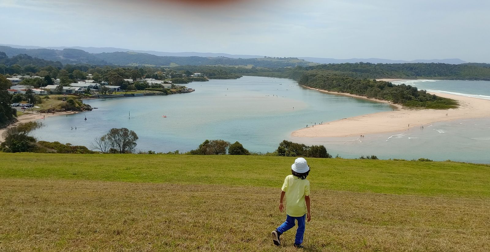
Where the sparkling turquoise Minnamurra River meets the Pacific Ocean on the NSW South Coast, this sheltered estuary offers calm, shallow waters perfect for snorkeling families and beginners. The river flows past sandy beaches and a sand spit at the mouth, with a unique rocky reef at the nearby "Boneyard" providing structure for marine life. Lush grassy headlands frame the scene, with Rangoon Island (Stack Island) visible offshore. The river's tidal personality means conditions change daily, but its protected waters are consistently more tranquil than the adjacent surf beaches.
Minnamurra River
BeginnerGO
GO
It's a go.
Showing last known conditions
Wave Height 0.3 mSwell Period 6.5 sWind Speed 7.3 knPrecipitation 12 mmTidal Phase flood
Last evaluated
 © MrActiniuM
The spot
Community-maintained
Community contribution: submitted by Daniel
Know before you go
Logged by the community, confirmed by mods
Moderate risk: Outgoing tide current
Strong outflow when the tide ebbs, especially near the river mouth where water channels through the sand spit. Swimmers and snorkelers should be cautious near the entrance.
Low risk: Boat traffic
Two boat ramps (Trevethan Reserve and James Oates Reserve) mean regular boat and jetski traffic on the river. Snorkelers should stay aware and near the edges.
Low risk: Changing sandbar at river mouth
The sand spit and river entrance shift with weather and tides, creating variable depth and potential submerged obstacles.
Wildlife Guide
No wildlife notes for this spot yet.
Gallery
3 photos from the community
Getting in
Shore entry
Entry
Located just north of Kiama on the NSW South Coast, about 90 minutes drive south of Sydney. Take the Minnamurra exit off the Princes Highway and follow River Street to the foreshore. The river is also the northern entry point of the Kiama Coast Walk.
Parking & facilities
Multiple parking options: Trevethan Reserve off River Street (main boat ramp and parking), James Oates Reserve off Charles Avenue, and street parking near the Minnamurra Headland. Ample car-trailer parking at the boat ramps.
parkingtoiletspicnic_tablesboat_ramp
Free entry. No fees for parking or river access.
Spot Map
Community
Gallery ┬╖ 3 photos
Trust
Is this spot real, accurate, still loved?
Spots near New South Wales

No nearby spots yet.
Needs verification
Quick verify
One tap helps the community keep this spot honest.
About this data
- Conditions last evaluated
- Spot data last updated
- Data sources
- Open-Meteo (marine & weather conditions), tide predictions via UTide, community contributors (descriptions, hazards, marine life).
- License
- Spot content licensed under CC BY-SA 4.0. How's the Spot is open source.
Weather & swell ┬╖ Open-Meteo marine & weather APIs Tides ┬╖ UTide harmonic analysis Sea & safety ┬╖ community reports