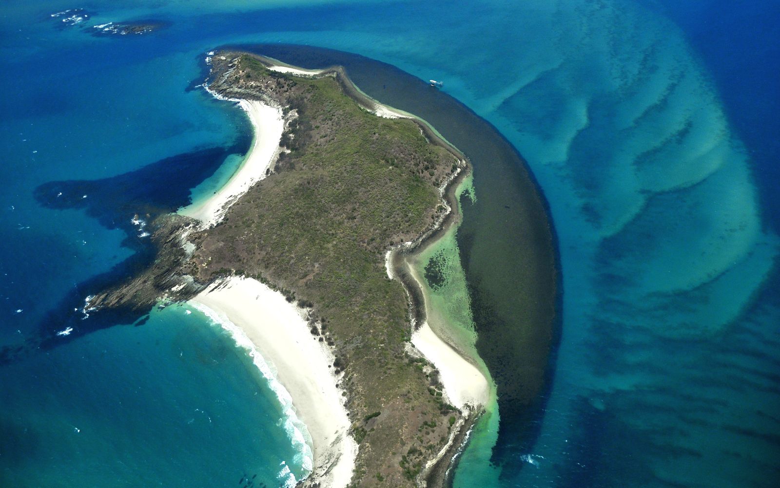
Middle Island is a pristine national park island in the Keppel Bay group, part of the Southern Great Barrier Reef. Two exceptional snorkel sites frame the island: Olive Point to the north, where fringing reefs teem with hard and soft corals just metres from shore, and the Underwater Observatory to the south — a historic coral-viewing structure that has transformed into an artificial reef bustling with fish life. Crystal-clear waters, white sandy beaches, and a sense of seclusion make this a rewarding spot for those who make the journey by private boat or charter. The observatory offers a uniquely sheltered and fascinating snorkel environment unlike anywhere else in the Keppels.
Middle Island (Keppel Bay)
IntermediateGO
GO
It's a go.
Showing last known conditions
Wave Height 0.1 mSwell Period 2.9 sWind Speed 5.0 knPrecipitation 0.0 mmTidal Phase flood
Last evaluated
The spot
Community-maintained
Community contribution: submitted by Daniel
Know before you go
Logged by the community, confirmed by mods
Moderate risk: Marine stingers
Marine stingers (including box jellyfish) are present in Keppel Bay waters during the warmer months, typically November to May.
Moderate risk: Remote location
Remote island with no on-site facilities, ranger station, or emergency services. Visitors must be entirely self-sufficient.
Low risk: Tidal currents
Tidal currents can be strong around the island, particularly at passage points between islands. Best snorkelled at mid-to-low tide in calm conditions.
Low risk: Sharp coral and rocks
Sharp coral and rocky outcrops near shore at both Olive Point and the Underwater Observatory. Care needed when entering and exiting the water.
Wildlife Guide
No wildlife notes for this spot yet.
Gallery
3 photos from the community
Getting in
Boat
Entry
Middle Island is part of the Keppel Bay Islands National Park, accessible by private vessel, water taxi, or commercial charter from Keppel Bay Marina in Yeppoon, Queensland. No ferry service runs directly to Middle Island itself — visitors typically arrange boat transfers from Yeppoon or join snorkel tours.
Parking & facilities
Paid parking available at Keppel Bay Marina in Yeppoon. Arrive early as spaces fill quickly during peak season.
Spot Map
Community
Gallery ┬╖ 3 photos
Trust
Is this spot real, accurate, still loved?
Spots near Queensland

No nearby spots yet.
Needs verification
Quick verify
One tap helps the community keep this spot honest.
About this data
- Conditions last evaluated
- Spot data last updated
- Data sources
- Open-Meteo (marine & weather conditions), tide predictions via UTide, community contributors (descriptions, hazards, marine life).
- License
- Spot content licensed under CC BY-SA 4.0. How's the Spot is open source.
Weather & swell ┬╖ Open-Meteo marine & weather APIs Tides ┬╖ UTide harmonic analysis Sea & safety ┬╖ community reports