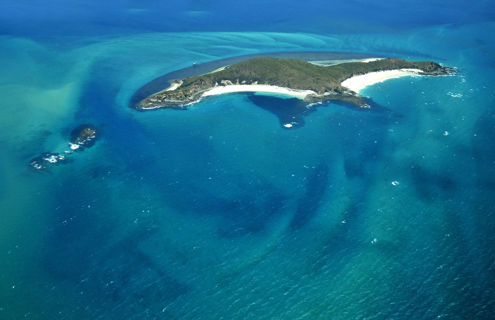
Middle Island, part of the Keppel Bay Islands National Park in the southern Great Barrier Reef, is fringed by vibrant coral reefs that offer exceptional snorkelling just metres from the beach. The standout site is Olive Point headland on the island's northern side, where a healthy fringe of hard and soft corals drops off into deeper water teeming with tropical reef fish. Protected by the reef, the waters are typically calm and clear, making it easy to explore the underwater gardens. The entire island is within a Marine Park 'green zone' (conservation park), so fishing is prohibited and marine life is abundant. Camping is available behind the dunes, giving snorkellers a true island escape just a short boat ride from the Capricorn Coast.
Middle Island fringing reefs
BeginnerGO
GO
It's a go.
Showing last known conditions
Wave Height 0.0 mSwell Period 3.3 sWind Speed 1.0 knPrecipitation 0.0 mmTidal Phase flood
Last evaluated
 © LBM1948
The spot
Community-maintained
Community contribution: submitted by Daniel
Know before you go
Logged by the community, confirmed by mods
Moderate risk: Marine stingers (box jellyfish)
Marine stingers (box jellyfish and Irukandji) are present in Keppel Bay waters during the warmer months, typically October through May.
Moderate risk: Strong tidal currents
Tidal flows around Middle Island can create strong currents, especially between the island and the mainland. Snorkellers should check tide times and avoid swimming against an outgoing tide.
Moderate risk: Marine stingers
Box jellyfish and Irukandji are present in Keppel Bay waters during the warmer months (October to May).
Moderate risk: Strong tidal currents around headland
Olive Point sits at a headland where tidal flows can be vigorous, especially on outgoing tides. Snorkelers should stay aware of current direction and avoid drifting around the point.
Moderate risk: Tidal currents around headland
Tidal currents can run strongly around the headland, especially on an outgoing tide. Snorkel with a guide who knows the local tide patterns.
Moderate risk: Marine stingers (seasonal)
Marine stingers (box jellyfish and Irukandji) are present in Queensland waters, primarily during the warmer months from October to May.
Moderate risk: Open ocean swell
The seaward side is exposed to the open Coral Sea with no protective reef barrier. Swells and chop can develop quickly, especially during afternoon sea breezes.
Low risk: Tidal currents
Moderate currents can run through the channels between islands, particularly around Olive Point headland.
Low risk: Boat traffic
Access is by boat only; swimmers and snorkelers should be vigilant around vessel channels.
Low risk: Outgoing tide current
Swift tidal currents can develop around the headland at Olive Point, especially on an outgoing tide. Snorkellers should be aware of tidal flow and avoid straying too far from shore.
Low risk: Abandoned structure debris
The deteriorating observatory structure contains metal and concrete elements. Snorkellers should avoid entering or touching the structure due to sharp edges and potential instability.
Low risk: Vessel traffic
The area is accessed by tour boats and private vessels. Snorkellers should be aware of boat traffic near the observatory site.
Low risk: Marine stinger season
Box jellyfish and other marine stingers are prevalent in Keppel Bay waters during the warmer months.
Low risk: Limited facilities on remote island
Middle Island is a national park with no shops, fresh water, or lifeguard services. Snorkelers must be fully self-sufficient.
Low risk: Sharp coral / rocky shoreline
Sharp coral and rocky reef edges close to the shore can cause cuts if standing or wading carelessly.
Wildlife Guide
No wildlife notes for this spot yet.
Gallery
3 photos from the community
Getting in
Boat
Entry
Middle Island is part of the Keppel Bay Islands National Park, reachable by private boat or water taxi from Rosslyn Bay Marina on the Capricorn Coast. There is no public ferry — visitors must arrange their own vessel. The island's camping area behind the dunes provides direct access to the fringing reefs at Olive Point headland.
Parking & facilities
Park at the public boat ramp carpark at Rosslyn Bay Marina, Sarina Street, Rosslyn. Spaces can fill on peak summer weekends. No vehicles are permitted on Middle Island itself.
Spot Map
Community
Gallery ┬╖ 3 photos
Trust
Is this spot real, accurate, still loved?
Spots near Queensland

No nearby spots yet.
Needs verification
Quick verify
One tap helps the community keep this spot honest.
About this data
- Conditions last evaluated
- Spot data last updated
- Data sources
- Open-Meteo (marine & weather conditions), tide predictions via UTide, community contributors (descriptions, hazards, marine life).
- License
- Spot content licensed under CC BY-SA 4.0. How's the Spot is open source.
Weather & swell ┬╖ Open-Meteo marine & weather APIs Tides ┬╖ UTide harmonic analysis Sea & safety ┬╖ community reports