Middle Island, the largest island in the Recherche Archipelago off Western Australia's south coast, offers a snorkeling experience framed by turquoise waters, dramatic granite headlands, and the famous bubblegum-pink Lake Hillier. The northern bays — particularly Belinda Beach — provide calm, safe anchorage with clear waters and excellent swimming beaches. This remote A-Class Nature Reserve lies about 130 km east of Esperance and 9 km south of Cape Arid National Park. Beyond the snorkel-friendly shoreline, the island's historical intrigue runs deep — it was once home to Australia's only recorded pirate, Black Jack Anderson, and you can still spot the wreck of the SS Penguin from the beach.
Middle Island
IntermediateSKIP
SKIP
Poor conditions. Stay out today.
Showing last known conditions
Wave Height 2.0 mSwell Period 10 sWind Speed 5.7 knPrecipitation 29 mmTidal Phase slack
Last evaluated
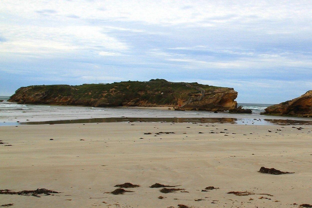 © マサケイ
DANGER: Explicit Risks Present
Middle Island has hazards marked as danger. Entering the water here means you may face serious risks to your personal safety.
- Southern Ocean swells and rip currents danger
Exposed southern coastline experiences large ocean swells. Northern bays are safer but conditions can change rapidly.
The spot
Community-maintained
Community contribution: submitted by Daniel
Know before you go
Logged by the community, confirmed by mods
High risk: Southern Ocean swells and rip currents
Exposed southern coastline experiences large ocean swells. Northern bays are safer but conditions can change rapidly.
Moderate risk: Remote location – limited emergency services
Middle Island is 130 km from Esperance; medical evacuation is hours away. Snorkelers should be self-sufficient.
Moderate risk: Uncharted reefs and shoals
The Recherche Archipelago has over 1,000 reefs, islets and obstacles. Submerged granite hazards near entry points.
Moderate risk: Variable Currents and Swells
Stingray Bay can experience unpredictable currents and ocean swells, especially during southerly winds.
Moderate risk: Strong currents and surge
The channel between Middle and Merri Islands can have strong surge and currents, especially on the Southern Ocean side.
Moderate risk: Sudden weather changes
Conditions can change rapidly into dangerously rough seas with large swells and strong currents.
Moderate risk: Swell and surf conditions
Best dived in low swell with light offshore northerly winds; white water indicates unsafe conditions.
Low risk: Limited fresh water and shade
No facilities on Middle Island; bring all drinking water and sun protection.
Low risk: Cold Water Temperatures
Southern Ocean waters are cold year-round (12–18°C). A wetsuit (5mm+) is essential for comfort and safety.
Low risk: Boat Traffic
The channel between Middle Island and the mainland sees recreational boat and kayak traffic. Snorkellers should remain visible.
Low risk: Slippery rock platforms
Rock platforms can be slippery; wear shoes with good grip when walking in the area.
Wildlife Guide
No wildlife notes for this spot yet.
Gallery
2 photos from the community
Getting in
Boat
Entry
Middle Island is 130 km east of Esperance, WA. Charter boats operate from Esperance (e.g. Black Jack Charters and Woody Island Eco Tours) — trips depart early morning (around 5 AM) and take approx. 5 hours to reach Belinda Beach via inflatable from the mother vessel. No public ferry service. Scenic flights are available but cannot land.
Parking & facilities
Park at the Esperance marina or tour operator base (check with your charter company). No parking on the island.
Charter day trips from Esperance cost approx. $110–$115 per adult. Private charter costs vary. No entry fee to the island itself.
Spot Map
Community
Gallery ┬╖ 2 photos
Trust
Is this spot real, accurate, still loved?
Spots near Victoria

No nearby spots yet.
Needs verification
Quick verify
One tap helps the community keep this spot honest.
About this data
- Conditions last evaluated
- Spot data last updated
- Data sources
- Open-Meteo (marine & weather conditions), tide predictions via UTide, community contributors (descriptions, hazards, marine life).
- License
- Spot content licensed under CC BY-SA 4.0. How's the Spot is open source.
Weather & swell ┬╖ Open-Meteo marine & weather APIs Tides ┬╖ UTide harmonic analysis Sea & safety ┬╖ community reports