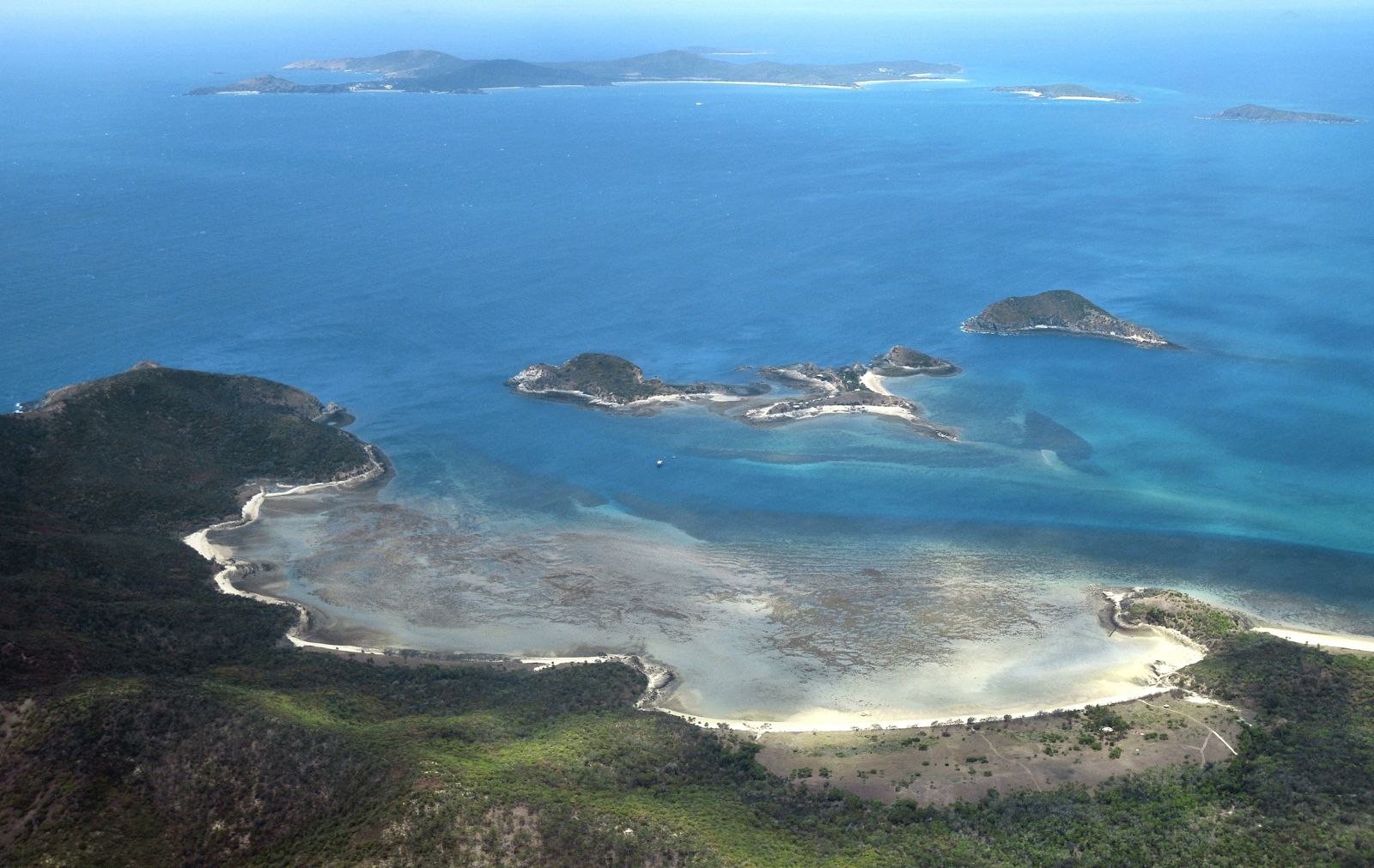
Miall Island is a secluded national park island in the Keppel Bay Islands group, 11 km east of Rosslyn Bay Harbour on Queensland's Capricorn Coast. Its standout feature is the extensive fringing reefs that wrap around the south-eastern and northern sides of the island, offering exceptional snorkelling and diving in calm, protected waters. At low tide, the reefs are exposed, allowing for incredible reef walking among hard and soft corals, tropical fish, and sea turtles. With only one campsite (max 6 people), this is a true off-grid island escape — untouched, remote, and utterly pristine, with the Southern Great Barrier Reef's vibrant marine life right at your feet.
Miall Island (fringing reefs)
IntermediateGO
GO
It's a go.
Showing last known conditions
Wave Height 0.0 mSwell Period 3.3 sWind Speed 1.0 knPrecipitation 0.0 mmTidal Phase flood
Last evaluated
The spot
Community-maintained
Community contribution: submitted by Daniel
Know before you go
Logged by the community, confirmed by mods
Moderate risk: Remote island isolation
As a remote island accessible only by boat, Miall has no on-site facilities, emergency services, or fresh water. Visitors must be fully self-sufficient.
Moderate risk: Marine stingers
Marine stingers (box jellyfish and Irukandji) are present in Keppel Bay waters during the warmer months (October to May). Wearing a stinger suit is strongly recommended.
Moderate risk: Marine stingers (box jellyfish)
Box jellyfish and Irukandji may be present in Keppel Bay waters during warmer months. Stinger suits recommended.
Moderate risk: Remote location — no facilities
Miall Island is completely off-grid with no ranger presence, toilets, drinking water, or emergency services. Campers must be fully self-sufficient.
Moderate risk: Boat access only
The island is accessible solely by private or water-taxi boat. No jetty or protected harbour — landing conditions depend on tide and weather.
Moderate risk: Strong tidal currents around fringing reefs
Tidal flows around the island's fringing reefs can create strong currents. Snorkellers should be aware of tide times and avoid venturing out on outgoing tides.
Moderate risk: Isolated camping — no communication
No mobile reception or communication facilities. In case of emergency, self-rescue or EPIRB is essential.
Low risk: Sharp coral and reef walking hazards
At low tide, the fringing reefs become exposed with sharp coral edges. Walking on the reef requires sturdy footwear and care to avoid cuts and to protect the coral.
Low risk: Tidal currents
Tidal currents can be strong around the island's fringing reefs, especially during tidal exchanges. Snorkellers should be aware of changing tide conditions.
Low risk: Sharp coral
Exposed reef edges with sharp coral. Avoid contact and never stand on coral.
Low risk: Remote location
Remote island with no facilities or emergency services. Self-sufficiency required.
Low risk: Strong tidal currents
Tidal flows around the island's fringing reefs can create strong currents, particularly on outgoing tides near reef edges.
Low risk: Boat traffic
Access is by private or water-taxi boat only. Be aware of vessels navigating the narrow approaches to the island.
Low risk: Low tide shallow reef
The fringing reefs become very shallow at low tide, exposing sharp coral. Snorkellers risk cuts and scrapes from coral. Best snorkelled at higher tides.
Wildlife Guide
No wildlife notes for this spot yet.
Gallery
1 photo from the community
Getting in
Boat
Entry
Miall Island is located 11 km east of Rosslyn Bay Harbour on the Capricorn Coast, Queensland. Access is by private boat, charter transfer, or guided tour only. Boat launching facilities are available at Rosslyn Bay Harbour with secure parking nearby.
Parking & facilities
Secure parking is available at Rosslyn Bay Harbour (contact [email protected] to book). Designated disabled parking is also available nearby.
parking
National park camping permits are required and must be booked online before departure. Charter transfer fees vary.
Spot Map
Community
Gallery ┬╖ 1 photos
Trust
Is this spot real, accurate, still loved?
Spots near Queensland

No nearby spots yet.
Needs verification
Quick verify
One tap helps the community keep this spot honest.
About this data
- Conditions last evaluated
- Spot data last updated
- Data sources
- Open-Meteo (marine & weather conditions), tide predictions via UTide, community contributors (descriptions, hazards, marine life).
- License
- Spot content licensed under CC BY-SA 4.0. How's the Spot is open source.
Weather & swell ┬╖ Open-Meteo marine & weather APIs Tides ┬╖ UTide harmonic analysis Sea & safety ┬╖ community reports