Maslin Beach (known locally as 'Maslins') is a stunning 3 km stretch of sand on the Fleurieu Peninsula, framed by towering ochre cliffs just 42 km south of Adelaide. Beneath the waves, snorkellers and divers explore dramatic shipwrecks, rocky reefs, and seagrass meadows teeming with life — including the famed Leafy Seadragon. The southern end is Australia's first legal nudist beach, while the northern end offers family-friendly swimming. With beach breaks for surfers and clifftop picnic spots at Blanche Point, this coastline is a true wild gem.
Maslin Beach
IntermediateGO
GO
It's a go.
Showing last known conditions
Wave Height 0.3 mSwell Period 3.0 sWind Speed 1.2 knPrecipitation 15 mmTidal Phase ebb
Last evaluated
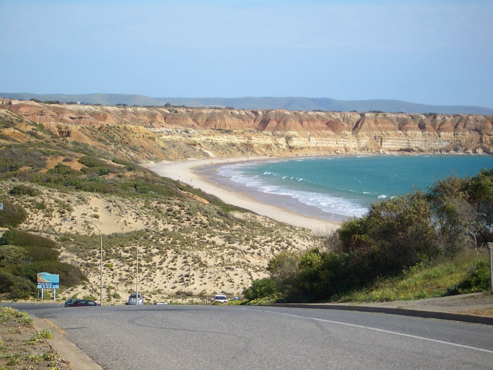 © User:Vmenkov
The spot
Community-maintained
Community contribution: submitted by Daniel
Know before you go
Logged by the community, confirmed by mods
Moderate risk: Rip currents
Strong rip currents can occur along the 3 km beach, especially near rocky outcrops. Swim between the flags when patrols are active.
Low risk: Swell and surf conditions
Maslin Beach receives consistent swell, creating beach breaks that can be challenging for inexperienced swimmers and snorkellers during larger swells.
Low risk: Rocky reef hazards
Rocky intertidal reefs and submerged rocks near the cliffs and southern end pose a collision hazard, especially when surf is up or visibility is low.
Low risk: Changing tides
Tidal movement can affect snorkelling conditions, with lower tides exposing reef areas and stronger currents during tide changes near the reef edge.
Wildlife Guide
No wildlife notes for this spot yet.
Gallery
3 photos from the community
Getting in
Shore entry
Entry
From Adelaide, drive south on Main South Road (A13) through Noarlunga and McLaren Vale. Turn right onto Maslin Beach Road and follow it down to the beach car park. Approximately 42 km, 45 minutes drive.
Parking & facilities
Large car park at the base of the cliffs near the northern end of the beach. Additional parking available at Blanche Point clifftop reserve.
toiletsparkingpicnic_tables
Free entry and parking. No entry fee required.
Spot Map
Community
Gallery ┬╖ 3 photos
Trust
Is this spot real, accurate, still loved?
Spots near South Australia

No nearby spots yet.
Needs verification
Quick verify
One tap helps the community keep this spot honest.
About this data
- Conditions last evaluated
- Spot data last updated
- Data sources
- Open-Meteo (marine & weather conditions), tide predictions via UTide, community contributors (descriptions, hazards, marine life).
- License
- Spot content licensed under CC BY-SA 4.0. How's the Spot is open source.
Weather & swell ┬╖ Open-Meteo marine & weather APIs Tides ┬╖ UTide harmonic analysis Sea & safety ┬╖ community reports