Manta Bommie is a celebrated rocky reef just north of Point Lookout on North Stradbroke Island (Minjerribah), consistently ranked among Australia's top 10 dive and snorkel sites. The 'bommies' (submerged rock pinnacles) rise from sandy seafloor, attracting manta rays that visit a natural cleaning station during the warmer months. Snorkellers float above shallow sections (3-5m) while the reef drops to 15m, passing over ledges and gutters where leopard sharks, wobbegongs, eagle rays, stingrays, and green turtles cruise by. The visibility can reach 15-20m, and the sheer density of marine life around these pinnacles creates an immersive, aquarium-like experience just an hour from Brisbane.
Manta Ray Bommies (North Stradbroke Island)
IntermediateGO
GO
It's a go.
Showing last known conditions
Wave Height 0.4 mSwell Period 6.7 sWind Speed 4.9 knPrecipitation 0.0 mmTidal Phase flood
Last evaluated
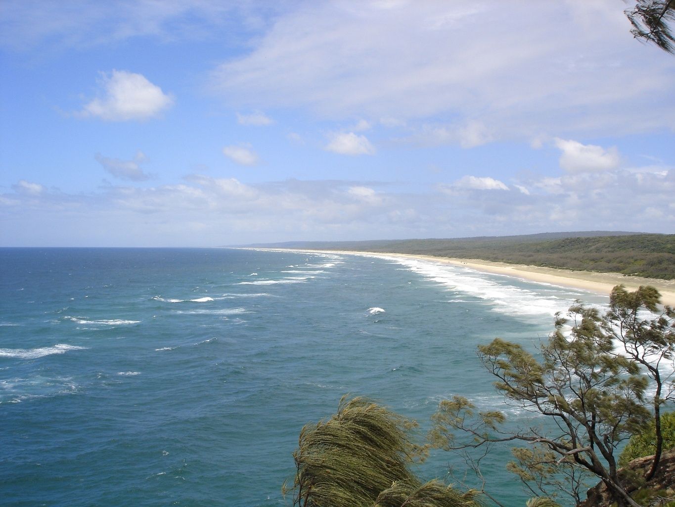 © w:en:Iorek85
The spot
Community-maintained
Community contribution: submitted by Daniel
Know before you go
Logged by the community, confirmed by mods
Moderate risk: Strong tidal currents
The eastern dive sites near Point Lookout (Shag Rock, Flat Rock) are exposed to powerful tidal flows that can sweep snorkelers off course. Moreton Bay side sites like Amity Point are more sheltered.
Moderate risk: Marine stingers
Box jellyfish and irukandji are present in Moreton Bay waters during the warmer months. Stinger suits are recommended from November through May.
Moderate risk: Electric rays under sand
A large population of electric rays buries itself in the sandy patches around the reef — avoid settling on the sand.
Moderate risk: Strong ocean currents
Swell and currents around Point Lookout and open beaches can be powerful, especially during rough conditions. Sheltered coves near Main Beach can turn from calm to dangerous with changing swell.
Moderate risk: Marine stingers (box jellyfish)
Box jellyfish and Irukandji may be present during the warmer months (Nov-May). Stinger suits are strongly recommended.
Moderate risk: Stinger Season (Marine Stingers)
Box jellyfish and Irukandji may be present in Moreton Bay during the stinger season. Wearing a stinger suit is highly recommended from November to May.
Low risk: Sharp reef and rock ledges
The rocky reef formations around Shag Rock and the gorge areas have sharp coral and rock edges that can cause cuts without protective footwear.
Low risk: Swell and surge
Eastern side dive sites experience ocean swell and surge, especially in winter (June–August), making conditions challenging for less experienced snorkelers.
Low risk: Boat traffic
Some dive sites (particularly Shag Rock and Flat Rock) are accessed by boat and share waters with vessel traffic. Snorkelers should remain vigilant near navigation channels.
Low risk: Ocean current
Moderate currents can develop around the rock formation, especially between the eastern and western sides.
Low risk: Swell exposure
Conditions vary by swell direction; the exposed side can experience surge and rougher conditions.
Low risk: Swim-through surge
The cave-like swim-through can have strong surge; assess conditions before entering.
Low risk: Sharks
Grey nurse sharks inhabit deeper waters around the island, particularly in winter. While generally not aggressive to snorkelers, their presence warrants caution near drop-offs and deeper channels.
Low risk: Strong Currents
Tidal currents can be strong around the rocky bommies, especially during tide changes. Less experienced snorkellers should be cautious and stay close to the boat.
Low risk: Sharp Reef
The rocky bommies and reef ledges are sharp and abrasive. Snorkellers should wear protective footwear and avoid touching the reef.
Low risk: Variable Visibility
Visibility can change with tides and weather, ranging from 5-20m. Poor visibility can make navigation around the bommies more difficult.
Low risk: Strong currents at times
Tidal currents can develop around the rock, especially when swell pushes through the swim-through channels. Check conditions with a local operator before entering.
Low risk: Surge in swim-through channels
The cave-like swim-through connecting the eastern and western sides can experience surge, particularly on days with larger swell.
Wildlife Guide
No wildlife notes for this spot yet.
Gallery
2 photos from the community
Getting in
Boat
Entry
Manta Bommie is located off the northern coast of North Stradbroke Island (Minjerribah), just north of Point Lookout within Moreton Bay Marine Park. Access is by private boat or organised dive/snorkel charter from Manta Lodge & Scuba Centre (departing from Point Lookout on North Stradbroke Island) or from the mainland at Cleveland or other Brisbane-area departure points. A vehicular ferry from Cleveland to Dunwich operates regularly, or fly into Brisbane Airport then take the ferry.
Parking & facilities
Parking is available at the ferry terminals (Cleveland) and at Point Lookout on North Stradbroke Island, but limited. Many visitors take a tour that includes transport.
parkingtoilets
No direct fee to visit the site, but ferry fees apply to reach the island. Dive/snorkel charters range from approximately $200-$545 per person depending on the operator and trip length.
Spot Map
Community
Gallery ┬╖ 2 photos
Trust
Is this spot real, accurate, still loved?
Spots near Queensland

No nearby spots yet.
Needs verification
Quick verify
One tap helps the community keep this spot honest.
About this data
- Conditions last evaluated
- Spot data last updated
- Data sources
- Open-Meteo (marine & weather conditions), tide predictions via UTide, community contributors (descriptions, hazards, marine life).
- License
- Spot content licensed under CC BY-SA 4.0. How's the Spot is open source.
Weather & swell ┬╖ Open-Meteo marine & weather APIs Tides ┬╖ UTide harmonic analysis Sea & safety ┬╖ community reports