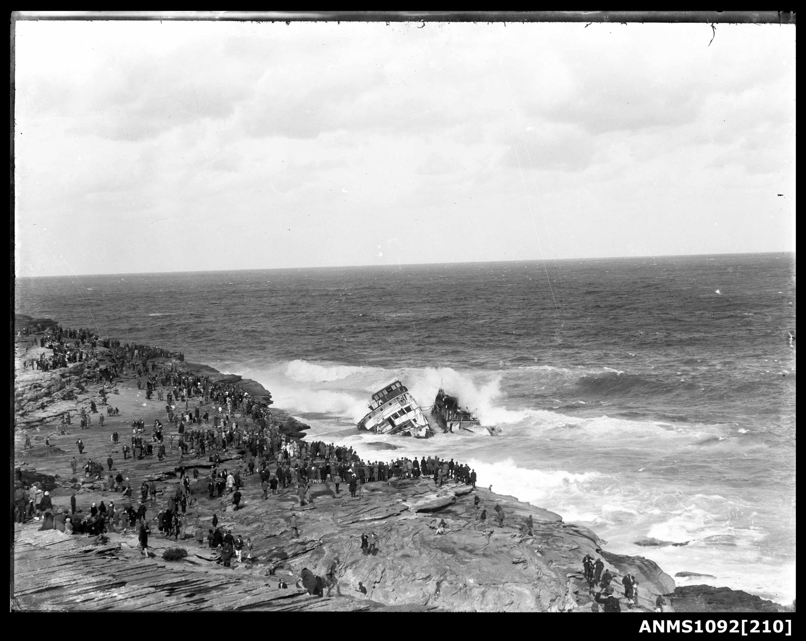
The wreck of the MV Malabar, a 4,512-ton Burns Philp motor vessel that ran aground on 2 April 1931 in dense fog on the northern side of Long Bay, Sydney. Now a premier shore-accessible dive and snorkel site, the wreckage lies scattered across the rocky reef in 13–18 m of water, with the ship's massive funnel and exhaust boiler still visible on the opposite side of the bay at Tupia Point. The site offers excellent swim-throughs, caves, and tunnels through the wreck structure, making it a fascinating blend of maritime history and underwater exploration right off Sydney's coastline.
Malboro (MV Malabar wreck)
IntermediateGO
GO
It's a go.
Showing last known conditions
Wave Height 0.3 mSwell Period 6.5 sWind Speed 7.6 knPrecipitation 7.6 mmTidal Phase flood
Last evaluated
The spot
Community-maintained
Community contribution: submitted by Daniel
Know before you go
Logged by the community, confirmed by mods
Moderate risk: Depth and currents
Wreck depth of 13–18 m requires intermediate ability; currents can pick up around the reef structure when seas are up.
Low risk: Boat traffic
The wreck lies in a busy coastal area with boat traffic entering and leaving Long Bay.
Low risk: Sharp wreck metal
Scattered wreckage includes exposed metal plates and jagged edges; cuts and entanglement possible.
Wildlife Guide
No wildlife notes for this spot yet.
Gallery
3 photos from the community
Getting in
Boat
Entry
The MV Malabar wreck sits at the northern end of Long Bay, off the coast of the Malabar suburb in Sydney's eastern suburbs. Best accessed by boat — launch from the Long Bay boat ramp (a 1 nautical mile ride). Land-based access is very limited; the site is not easily swimmable from shore due to distance.
Parking & facilities
Parking available at the Long Bay boat ramp carpark on Boundary Street, Malabar.
parkingboat_ramp
No direct fee for snorkeling; boat ramp may have parking fees.
Spot Map
Community
Gallery ┬╖ 3 photos
Trust
Is this spot real, accurate, still loved?
Spots near New South Wales

No nearby spots yet.
Needs verification
Quick verify
One tap helps the community keep this spot honest.
About this data
- Conditions last evaluated
- Spot data last updated
- Data sources
- Open-Meteo (marine & weather conditions), tide predictions via UTide, community contributors (descriptions, hazards, marine life).
- License
- Spot content licensed under CC BY-SA 4.0. How's the Spot is open source.
Weather & swell ┬╖ Open-Meteo marine & weather APIs Tides ┬╖ UTide harmonic analysis Sea & safety ┬╖ community reports