Lower Portals is a stunning wild-swimming and snorkeling spot tucked deep within Mount Barney National Park in the Gold Coast hinterland. A 3.7 km (one-way) Grade 4 hike through towering eucalypts and brush box trees leads to a deep, clear plunge pool on Mount Barney Creek, where boulders frame crystal-clear water against a dramatic mountain backdrop. This remote freshwater oasis offers a unique inland snorkeling experience far from coastal crowds, with excellent visibility in the still pools.
Lower Portals
IntermediateMAYBE
MAYBE
Fair. Experienced snorkellers only.
Showing last known conditions
Wave Height 0.0 mSwell Period 0.0 sWind Speed 3.2 knPrecipitation 0.0 mmTidal Phase unknown
Last evaluated
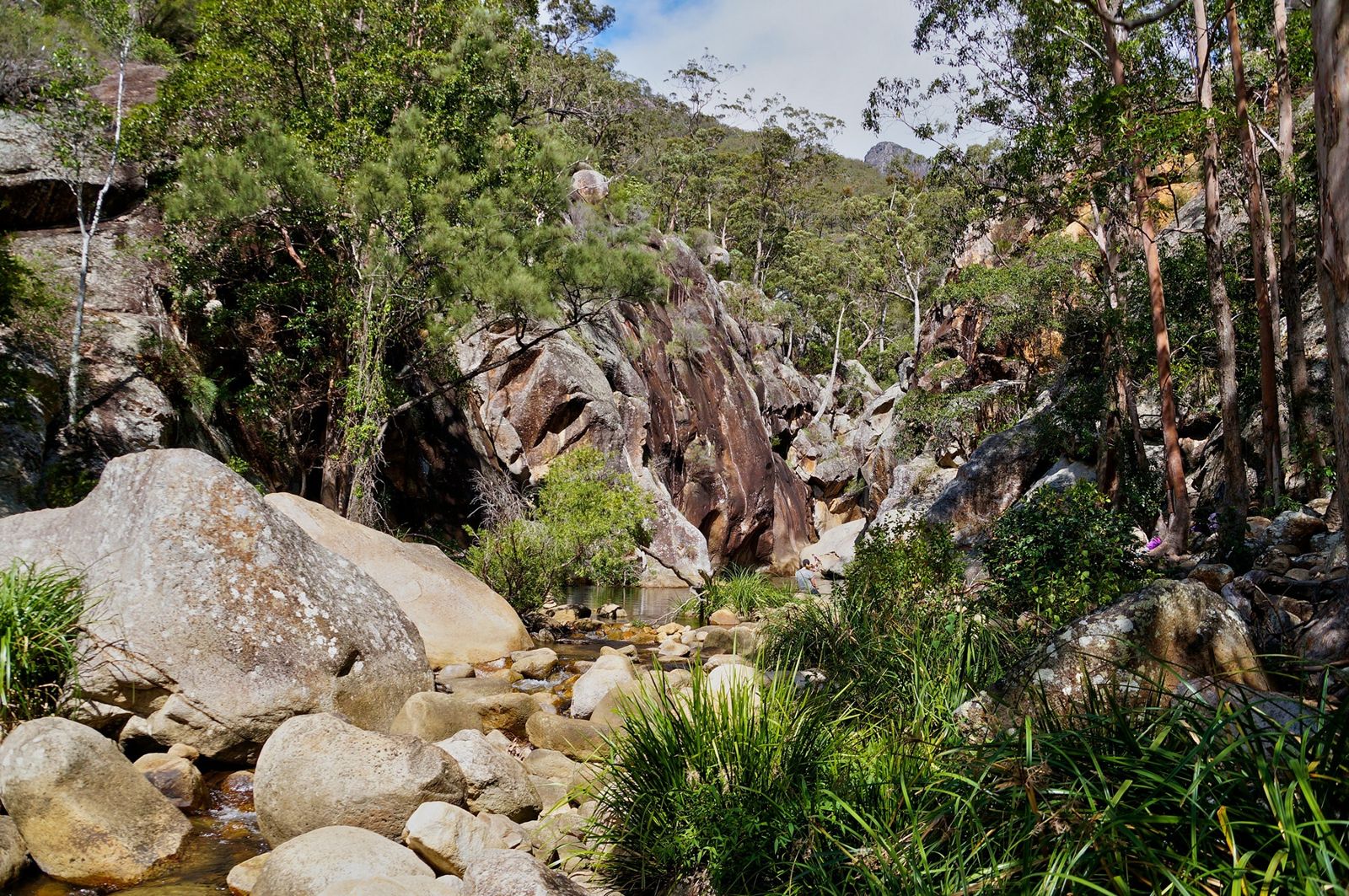 © Tatters ✾ from Brisbane, Australia
The spot
Community-maintained
Community contribution: submitted by Daniel
Know before you go
Logged by the community, confirmed by mods
Moderate risk: Flash Flood Risk
Mount Barney Creek can rise rapidly after heavy rain upstream, turning the portal into a dangerous torrent.
Low risk: Slippery Rocks
Granite boulders around the pool are extremely slippery when wet, requiring careful footing.
Low risk: Bushwalking Grade 4 Track
The 3.7 km access trail is steep, rough, and uneven with exposed sections — requires good fitness and sturdy footwear.
Low risk: Cold Water
Mountain-fed creek water remains very cold year-round, which can cause cold shock and cramping.
Low risk: Limited Mobile Reception
No mobile phone reception in the gorge — emergency assistance is difficult to summon.
Wildlife Guide
No wildlife notes for this spot yet.
Gallery
3 photos from the community
Getting in
Shore entry
Entry
From Brisbane, drive south on the M1/Cunningham Highway to Boonah, then follow signs to Mount Barney National Park. The trailhead is at the Lower Portals car park on Upper Logan Road, approximately 2 hours from Brisbane CBD.
Parking & facilities
Limited unpaved car park at the trailhead on Upper Logan Road. Arrive early on weekends and public holidays as it fills quickly.
parking
No entry fee for Mount Barney National Park (Queensland Parks pass not required for day visits).
Spot Map
Community
Gallery ┬╖ 3 photos
Trust
Is this spot real, accurate, still loved?
Spots near New South Wales

No nearby spots yet.
Needs verification
Quick verify
One tap helps the community keep this spot honest.
About this data
- Conditions last evaluated
- Spot data last updated
- Data sources
- Open-Meteo (marine & weather conditions), tide predictions via UTide, community contributors (descriptions, hazards, marine life).
- License
- Spot content licensed under CC BY-SA 4.0. How's the Spot is open source.
Weather & swell ┬╖ Open-Meteo marine & weather APIs Tides ┬╖ UTide harmonic analysis Sea & safety ┬╖ community reports