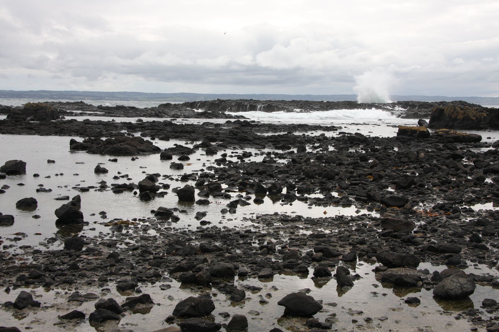
Cowrie Beach is a west-facing, rocky bay on Phillip Island's western shore between Point Grant and Point Sambell, set within the Phillip Island Conservation Reserve. A steep 400-metre-long sandy beach is backed by low dunes and bluffs, bordered by basalt platforms and reefs that emerge dramatically at low tide. The shallow, sheltered waters make for an easy snorkel over patchy weed and reef, with promising gutters close to shore to explore when conditions allow. Best dived at high tide after easterly winds.
Cowrie Beach
BeginnerSKIP
SKIP
Poor conditions. Stay out today.
Showing last known conditions
Wave Height 1.3 mSwell Period 13 sWind Speed 2.4 knPrecipitation 24 mmTidal Phase flood
Last evaluated
 © Shuicai
The spot
Community-maintained
Community contribution: submitted by Daniel
Know before you go
Logged by the community, confirmed by mods
Moderate risk: Exposed basalt rocks and reefs
Basalt platforms and reefs border the bay and almost fill it at low tide, creating sharp, slippery entry/exit hazards.
Moderate risk: Low tide reef exposure
At low tide the bay fills with exposed rocks and reefs, making snorkeling impractical and access treacherous.
Low risk: Southerly wind swell
The west-facing bay can receive moderate swell from southerly winds, reducing visibility and safety.
Wildlife Guide
No wildlife notes for this spot yet.
Gallery
2 photos from the community
Getting in
Shore entry
Entry
From Ventnor on Phillip Island, take Ventnor Road south toward Point Grant. The small car park is on the grassy bluffs overlooking the southern corner of Cowrie Bay, about 1 km north of Point Grant.
Parking & facilities
Small car park on the grassy bluffs at the southern end of the bay, off Ventnor Road.
No fees. Located within Phillip Island Conservation Reserve.
Spot Map
Community
Gallery ┬╖ 2 photos
Trust
Is this spot real, accurate, still loved?
Spots near Victoria

No nearby spots yet.
Needs verification
Quick verify
One tap helps the community keep this spot honest.
About this data
- Conditions last evaluated
- Spot data last updated
- Data sources
- Open-Meteo (marine & weather conditions), tide predictions via UTide, community contributors (descriptions, hazards, marine life).
- License
- Spot content licensed under CC BY-SA 4.0. How's the Spot is open source.
Weather & swell ┬╖ Open-Meteo marine & weather APIs Tides ┬╖ UTide harmonic analysis Sea & safety ┬╖ community reports