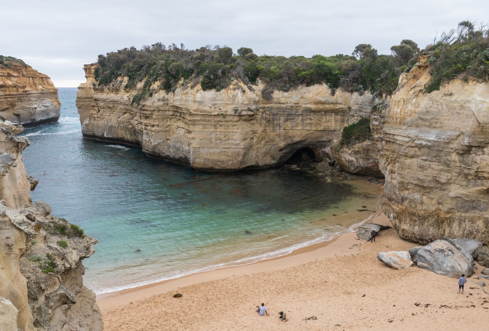
Part of the iconic Shipwreck Coast within Port Campbell National Park, Loch Ard Gorge is a dramatic sea-carved canyon flanked by towering limestone cliffs and offshore stacks like the Razorback and Island Arch. Named after the 1878 Loch Ard shipwreck, this stunning site features a sheltered sandy beach at the gorge mouth, scenic lookouts including the new Poombeeyt Koontapool blowhole platform, and interconnected walking trails offering sweeping views of the Southern Ocean. The gorge is a breathtaking blend of geological wonder, maritime history, and wild coastal beauty.
Loch Ard Gorge
AdvancedSKIP
SKIP
Poor conditions. Stay out today.
Showing last known conditions
Wave Height 2.2 mSwell Period 9.8 sWind Speed 4.2 knPrecipitation 22 mmTidal Phase flood
Last evaluated
 © DXR
© DXRDANGER: Explicit Risks Present
Loch Ard Gorge has hazards marked as danger. Entering the water here means you may face serious risks to your personal safety.
- Cliff Instability danger
Active geological instability with ongoing cliff movement; beach access steps closed due to risk of collapse.
- Cliff Instability & Falling Rocks danger
Active cliff movement has led to periodic beach closures; stay well clear of cliff bases and obey all signage.
The spot
Community-maintained
Community contribution: submitted by Daniel
Know before you go
Logged by the community, confirmed by mods
High risk: Cliff Instability
Active geological instability with ongoing cliff movement; beach access steps closed due to risk of collapse.
High risk: Cliff Instability & Falling Rocks
Active cliff movement has led to periodic beach closures; stay well clear of cliff bases and obey all signage.
Moderate risk: Strong Undertows & Currents
Calm-looking waters at the gorge mouth can quickly turn into dangerous undertows and rough surf conditions.
Moderate risk: Unpredictable Surf Conditions
The Southern Ocean produces powerful and unpredictable swells that surge into the gorge entrance.
Moderate risk: Strong Rip Currents
The Southern Ocean produces powerful rips and surges through the gorge mouth, especially during rough swells.
Moderate risk: Sudden Large Waves / Southerly Swell
Exposed to Southern Ocean swells; rogue waves can surge into the gorge unexpectedly even on calm days.
Low risk: Slippery Rocks
Wet rock platforms and uneven surfaces around the gorge are treacherous.
Low risk: Variable River and Tide Conditions
The mouth of the Sherbrooke River nearby has variable depth and width with unpredictable currents from river flow and tidal input.
Wildlife Guide
No wildlife notes for this spot yet.
Gallery
8 photos from the community
Getting in
Shore entry
Entry
Located just off the Great Ocean Road, about 10 minutes west of the Twelve Apostles and 3 km east of Port Campbell. Turn off the Great Ocean Road at the signed Loch Ard Gorge turnoff. Three separate car parks serve the precinct: the main Loch Ard Gorge car park (left after turning off), the Poombeeyt Koontapool/Blowhole car park (right), and the Mutton Bird Island car park.
Parking & facilities
Main car park for cars and long vehicles/caravans near the gorge. Additional limited parking at the Poombeeyt Koontapool (Blowhole) and Mutton Bird Island car parks on the western side. Follow road signs.
parkingtoiletspicnic_tables
Free entry — no fees required for access to Loch Ard Gorge and the Port Campbell National Park precinct.
Spot Map
Community
Gallery ┬╖ 8 photos
Trust
Is this spot real, accurate, still loved?
Spots near Victoria

No nearby spots yet.
Needs verification
Quick verify
One tap helps the community keep this spot honest.
About this data
- Conditions last evaluated
- Spot data last updated
- Data sources
- Open-Meteo (marine & weather conditions), tide predictions via UTide, community contributors (descriptions, hazards, marine life).
- License
- Spot content licensed under CC BY-SA 4.0. How's the Spot is open source.
Weather & swell ┬╖ Open-Meteo marine & weather APIs Tides ┬╖ UTide harmonic analysis Sea & safety ┬╖ community reports