Nestled on Rottnest Island's sheltered southern coast, Little Salmon Bay is a serene, turquoise cove protected by limestone headlands and designated as a Marine Sanctuary Zone. A 700-metre marked snorkel trail winds through soft coral gardens, seagrass meadows, and limestone ledges, with underwater interpretive plaques guiding swimmers past schools of Western Buffalo Bream, Green Moon Wrasse, and colourful coral bommies. Calm, shallow waters and fine white sand make it an ideal spot for beginners and families, accessible by a 25-minute bike ride or the Island Explorer bus (Stop 6).
Little Salmon Bay
BeginnerGO
GO
It's a go.
Showing last known conditions
Wave Height 0.3 mSwell Period 12 sWind Speed 0.7 knPrecipitation 0.5 mmTidal Phase ebb
Last evaluated
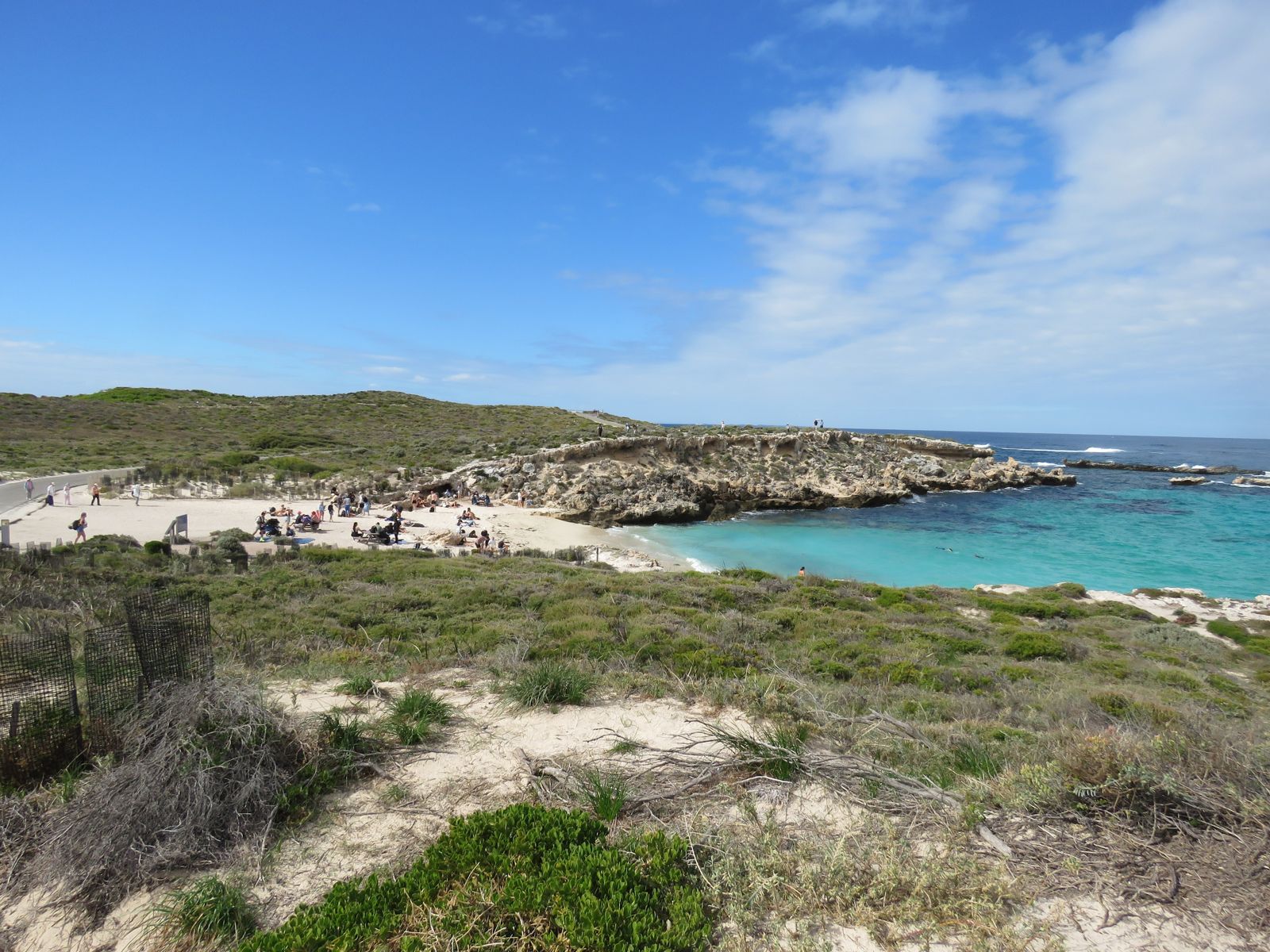 © Calistemon
The spot
Community-maintained
Community contribution: submitted by Daniel
Know before you go
Logged by the community, confirmed by mods
Low risk: No lifeguards on duty
There are no lifeguards stationed at Little Salmon Bay — swimmers should assess conditions and swim within their comfort zone.
Low risk: Sharp limestone reef shelves
Exposed limestone reef shelves and coral bommies near shore can cause cuts — reef shoes recommended.
Wildlife Guide
No wildlife notes for this spot yet.
Gallery
3 photos from the community
Getting in
Shore entry
Entry
Located on the southern coast of Rottnest Island. From Thomson Bay settlement, ride a bike ~5.2 km (25 min) or take the Island Explorer Bus to Stop 6, which drops you right at the beach. Also reachable via a 1-hour scenic coastal walk from Thomson Bay.
Parking & facilities
No dedicated car parking (Rottnest Island is car-free). Bicycle racks available near the beach entrance.
toilets
No entry fee. Access requires a Rottnest Island ferry ticket (from Fremantle or Perth) and/or Island Explorer bus pass.
Spot Map
Community
Gallery ┬╖ 3 photos
Trust
Is this spot real, accurate, still loved?
Spots near Western Australia

No nearby spots yet.
Needs verification
Quick verify
One tap helps the community keep this spot honest.
About this data
- Conditions last evaluated
- Spot data last updated
- Data sources
- Open-Meteo (marine & weather conditions), tide predictions via UTide, community contributors (descriptions, hazards, marine life).
- License
- Spot content licensed under CC BY-SA 4.0. How's the Spot is open source.
Weather & swell ┬╖ Open-Meteo marine & weather APIs Tides ┬╖ UTide harmonic analysis Sea & safety ┬╖ community reports