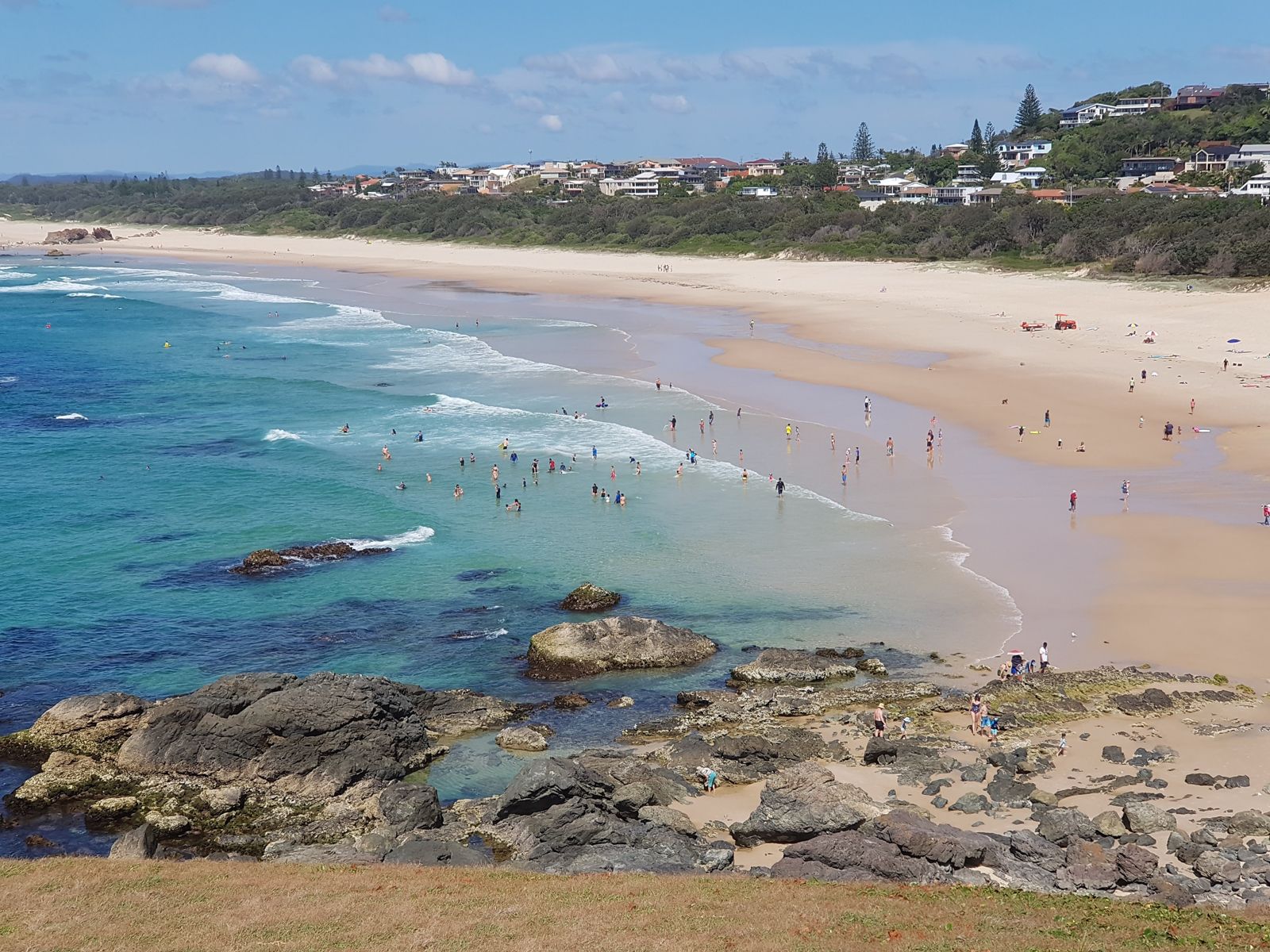
Stretching 10 km south from the historic Tacking Point Lighthouse (built 1879) near Port Macquarie, Lighthouse Beach is a sweeping, south-east facing sand beach with excellent snorkelling around the rocky headlands at its northern end. The reef platforms near Watonga Rocks and the base of the lighthouse offer calm, protected pockets teeming with fish. This beach is part of the stunning Port Macquarie Coastal Walk and is also famous for dolphin sightings, surf breaks, and seasonal whale watching. Its expansive shoreline means you can always find your own patch of sand.
Lighthouse Beach
IntermediateGO
GO
It's a go.
Showing last known conditions
Wave Height 0.4 mSwell Period 7.4 sWind Speed 2.0 knPrecipitation 0.2 mmTidal Phase slack
Last evaluated
 © Inas
The spot
Community-maintained
Community contribution: submitted by Daniel
Know before you go
Logged by the community, confirmed by mods
Moderate risk: Rip currents
Lighthouse Beach is a long, open beach with strong and frequently occurring rip currents, especially on larger swell days.
Low risk: Surf break hazards
The beach has several surf breaks that can produce powerful waves and shore dumps, hazardous for inexperienced swimmers and snorkellers.
Low risk: 4WD vehicle traffic
The southern end of the beach is a designated 4WD access area. Snorkellers should be aware of vehicles on the sand near vehicle entry points.
Wildlife Guide
No wildlife notes for this spot yet.
Gallery
3 photos from the community
Getting in
Shore entry
Entry
Lighthouse Beach is located 7 km south of Port Macquarie. From the town centre, head south on Pacific Drive, then turn onto Lighthouse Road. Follow Lighthouse Road to the Tacking Point Lighthouse precinct where parking is available. The beach is also accessible via Matthew Road at the southern end for 4WD access.
Parking & facilities
Free car parking is available at the Tacking Point Lighthouse area (limited spaces, no caravans or large motorhomes). Additional parking is available at the southern 4WD access point on Matthew Road.
parkingtoilets
Free entry and free parking.
Spot Map
Community
Gallery ┬╖ 3 photos
Trust
Is this spot real, accurate, still loved?
Spots near New South Wales

No nearby spots yet.
Needs verification
Quick verify
One tap helps the community keep this spot honest.
About this data
- Conditions last evaluated
- Spot data last updated
- Data sources
- Open-Meteo (marine & weather conditions), tide predictions via UTide, community contributors (descriptions, hazards, marine life).
- License
- Spot content licensed under CC BY-SA 4.0. How's the Spot is open source.
Weather & swell ┬╖ Open-Meteo marine & weather APIs Tides ┬╖ UTide harmonic analysis Sea & safety ┬╖ community reports