Lawrence Rocks Bay lies off the rugged coast near Portland, Western Victoria, where the Southern Ocean swells collide with volcanic reefs and rocky headlands. Named after the Lawrence Rocks — exposed basalt islets rising from deep water — this exposed shoreline offers dramatic snorkeling among kelp forests and gutweed draped over boulder fields. The bay is known for its wild, untamed character: clear oceanic water, surge channels, and abundant marine life drawn to the nutrient-rich upwelling. Best accessed on calm winter or autumn days, this is an adventurous spot for experienced snorkelers seeking solitude and raw coastal beauty.
Lawrence Rocks Bay (Lawrence Rocks)
AdvancedGO
GO
It's a go.
Showing last known conditions
Wave Height 0.3 mSwell Period 11 sWind Speed 6.8 knPrecipitation 16 mmTidal Phase slack
Last evaluated
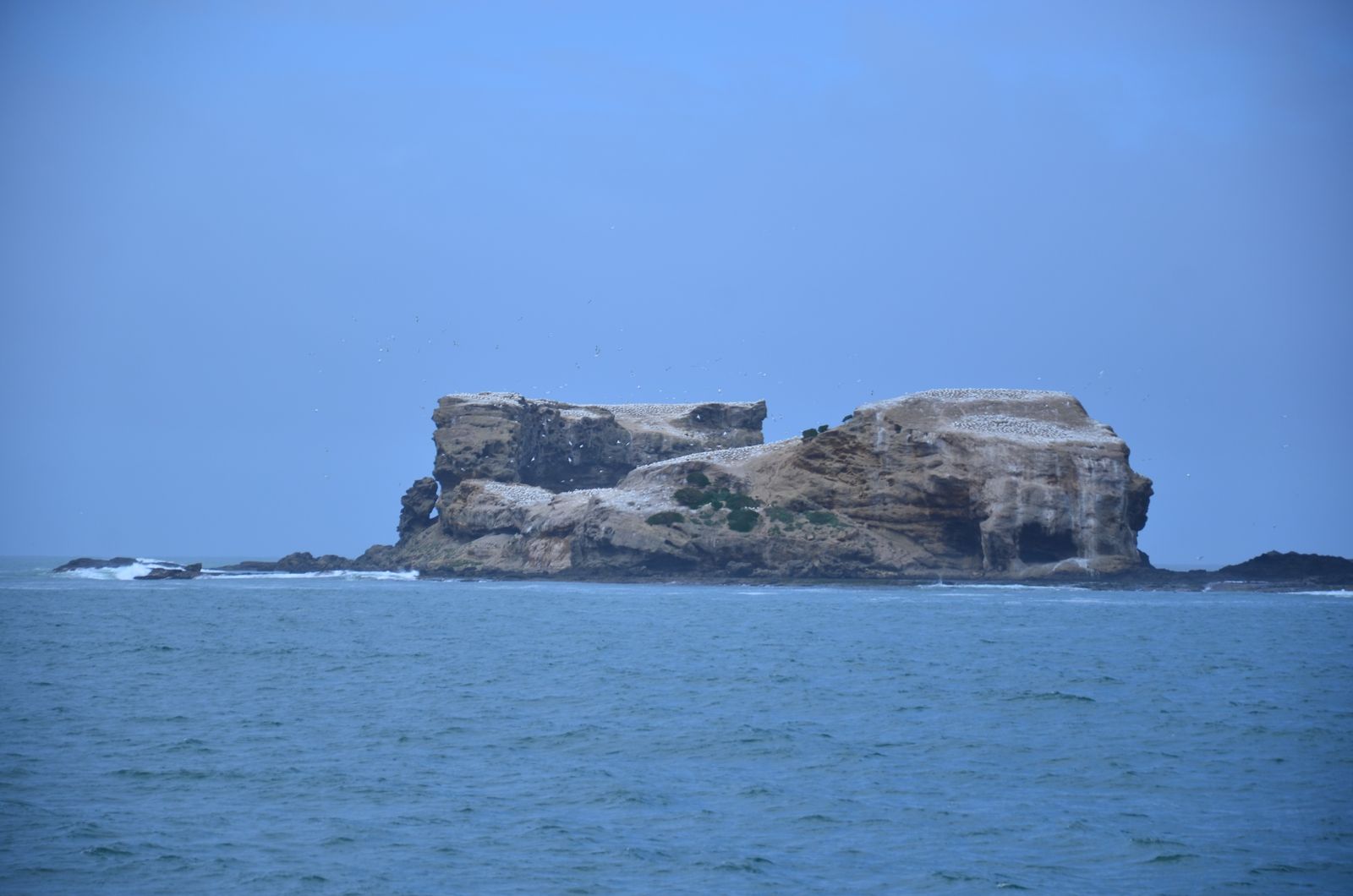 © Southern Coast Charters
DANGER: Explicit Risks Present
Lawrence Rocks Bay (Lawrence Rocks) has hazards marked as danger. Entering the water here means you may face serious risks to your personal safety.
- Southern Ocean swells danger
Large, powerful swells roll in from the Southern Ocean, creating dangerous surge conditions near the rocks and kelp beds.
The spot
Community-maintained
Community contribution: submitted by Daniel
Know before you go
Logged by the community, confirmed by mods
High risk: Southern Ocean swells
Large, powerful swells roll in from the Southern Ocean, creating dangerous surge conditions near the rocks and kelp beds.
Moderate risk: Exposed Open Ocean Swell
The rocks sit in exposed waters with significant southerly ocean swell, making conditions unpredictable and requiring calm weather windows.
Moderate risk: Strong Ocean Currents
Powerful tidal currents and surge run hard around the islets, particularly in rough weather, demanding good fitness and experience.
Moderate risk: Strong ocean swells
Exposed Southern Ocean location means powerful swells can roll in suddenly, creating dangerous surge conditions over the reef.
Moderate risk: Unpredictable currents
Tidal movements around the rocky reef system can generate strong, unpredictable currents, especially during tide changes.
Moderate risk: Strong rip currents
Rip currents form between the Lawrence Rocks and the mainland, particularly on outgoing tides.
Moderate risk: Cold water temperature
Water temperatures can drop below 12°C (54°F) in winter, with thermoclines causing rapid temperature changes.
Low risk: Boat-Only Access
No shore access from the mainland; requires boat charter or private vessel. Remote location adds risk in emergency situations.
Low risk: Sea Cave Hazards
Multiple sea caves and caverns in the boulder terrain can be disorienting and dangerous in surge conditions.
Low risk: Cold water temperatures
Southern Ocean waters remain cold year-round, posing hypothermia risk without proper wetsuit protection.
Low risk: Sharp reef and rock ledges
Volcanic reef formations have sharp edges and crevices that can cause cuts and scrapes.
Low risk: Variable visibility
Visibility can change rapidly with weather and swell conditions, dropping from clear to near-zero in hours.
Low risk: Sharp volcanic reef
Barnacle-encrusted basalt boulders and volcanic reef edges can cause deep cuts and abrasions.
Low risk: Isolated location
Remote beach with no immediate emergency services or phone reception in some areas.
Wildlife Guide
No wildlife notes for this spot yet.
Gallery
2 photos from the community
Getting in
Shore entry
Entry
From Portland, head south-west on Cape Nelson Road towards the Discovery Bay Coastal Park. The bay near Lawrence Rocks is accessed via unsealed tracks off the coastal route — a 4WD is recommended. Park near the clifftop and walk down to the shoreline via informal paths. The rocks themselves are offshore islets, so snorkeling is done from the adjacent mainland beaches and reefs.
Parking & facilities
Limited roadside parking on Cape Nelson Road near the coastal track entrances. No designated car park.
Free access.
Spot Map
Community
Gallery ┬╖ 2 photos
Trust
Is this spot real, accurate, still loved?
Spots near Victoria

No nearby spots yet.
Needs verification
Quick verify
One tap helps the community keep this spot honest.
About this data
- Conditions last evaluated
- Spot data last updated
- Data sources
- Open-Meteo (marine & weather conditions), tide predictions via UTide, community contributors (descriptions, hazards, marine life).
- License
- Spot content licensed under CC BY-SA 4.0. How's the Spot is open source.
Weather & swell ┬╖ Open-Meteo marine & weather APIs Tides ┬╖ UTide harmonic analysis Sea & safety ┬╖ community reports