Stretching 5 km along the western shore of Botany Bay, Lady Robinsons Beach (formerly Seven Mile Beach) is Sydney's longest beach, offering calm, protected waters ideal for snorkeling. The beach is sheltered from ocean swell by the bay, so conditions are generally flat and gentle. The Brighton-Le-Sands Baths provide a netted swimming area popular with families, while the sandy seabed stretches out into shallow waters. Backed by a paved promenade with picnic areas and play parks, this spot delivers a relaxed, community-driven seaside atmosphere with stunning sunset views over the bay towards Sydney Airport.
Lady Robinsons Beach
BeginnerGO
GO
It's a go.
Showing last known conditions
Wave Height 0.3 mSwell Period 6.5 sWind Speed 1.7 knPrecipitation 7.6 mmTidal Phase flood
Last evaluated
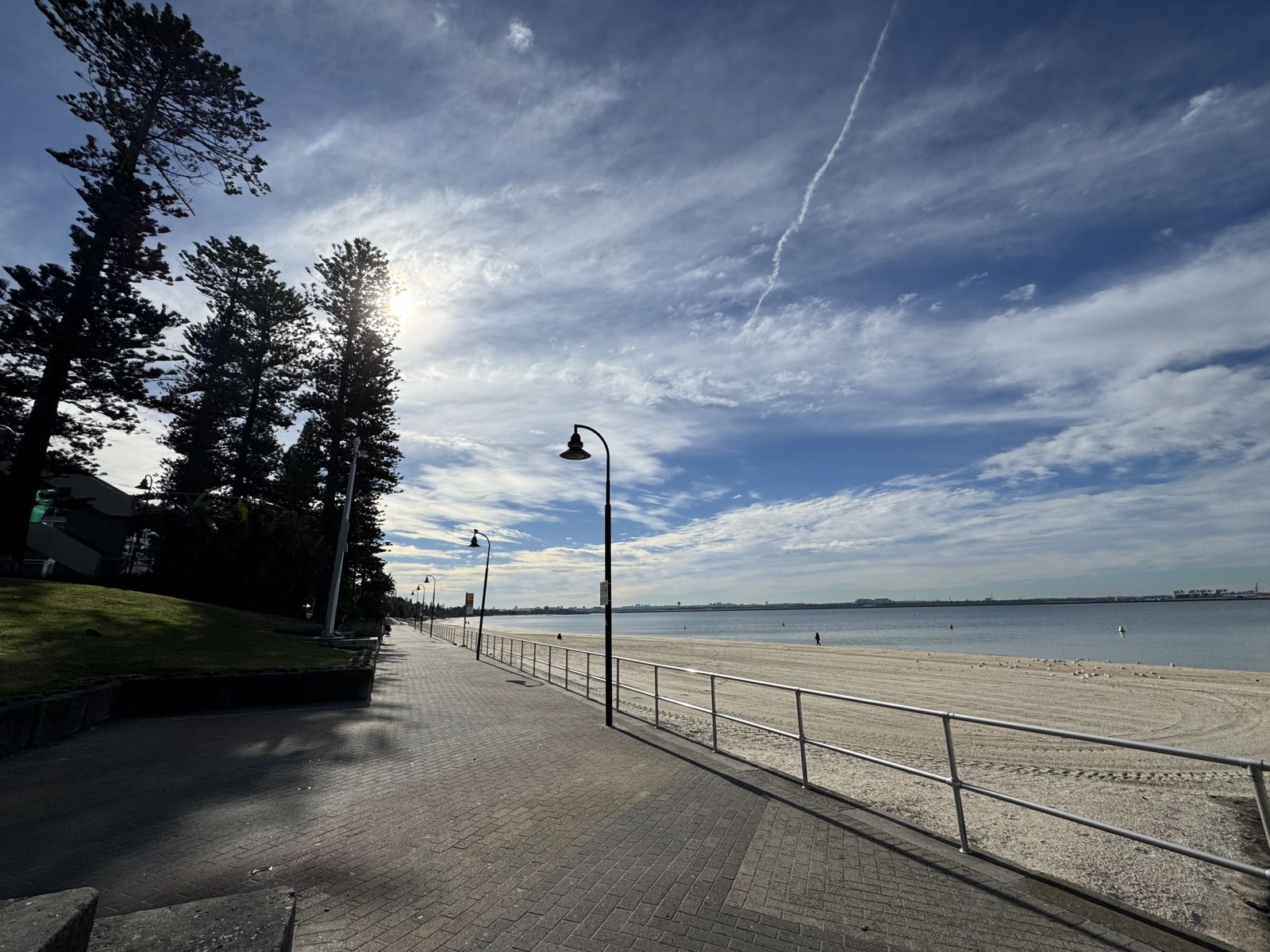 © FlyingKoala
The spot
Community-maintained
Community contribution: submitted by Daniel
Know before you go
Logged by the community, confirmed by mods
Low risk: Boat traffic near river mouths
The northern and southern ends near Cooks River and Georges River mouths see boat traffic entering and exiting Botany Bay. Swim well clear of these channels.
Low risk: Bluebottle jellyfish
Bluebottles (Physalia physalis) can drift into Botany Bay on northeasterly winds, particularly in warmer months.
Wildlife Guide
No wildlife notes for this spot yet.
Gallery
1 photo from the community
Getting in
Shore entry
Entry
Lady Robinsons Beach runs along the western shore of Botany Bay, accessed via Grand Parade / The Grand Parade through suburbs including Brighton-Le-Sands, Monterey, Ramsgate, and Sans Souci. From Sydney CBD, take the M1 south to General Holmes Drive, then turn onto The Grand Parade.
Parking & facilities
Large car parks are available off General Holmes Drive near the northern end (Brighton-Le-Sands), plus street parking along The Grand Parade at multiple points along the beach's length.
toiletsparkingshowerspicnic_tablesdrinking_water
Free access. No entry fees.
Spot Map
Community
Gallery ┬╖ 1 photos
Trust
Is this spot real, accurate, still loved?
Spots near New South Wales

No nearby spots yet.
Needs verification
Quick verify
One tap helps the community keep this spot honest.
About this data
- Conditions last evaluated
- Spot data last updated
- Data sources
- Open-Meteo (marine & weather conditions), tide predictions via UTide, community contributors (descriptions, hazards, marine life).
- License
- Spot content licensed under CC BY-SA 4.0. How's the Spot is open source.
Weather & swell ┬╖ Open-Meteo marine & weather APIs Tides ┬╖ UTide harmonic analysis Sea & safety ┬╖ community reports