Sheltered within Botany Bay on Sydney's urban coastline, La Perouse offers calm, clear waters popular for snorkelling — particularly the rocky reef encircling historic Bare Island. Accessed via a short footbridge from the headland, the underwater terrain features soft coral gardens, colourful sponge beds, and sandy gutters home to sea stars, pygmy seahorses, and the occasional weedy sea dragon. With no surf or rips, the bay's protected waters make it a rare easy-access spot where a famous movie fort doubles as a snorkelling landmark.
La Perouse (Bare Island)
BeginnerGO
GO
It's a go.
Showing last known conditions
Wave Height 0.3 mSwell Period 6.5 sWind Speed 1.5 knPrecipitation 7.6 mmTidal Phase flood
Last evaluated
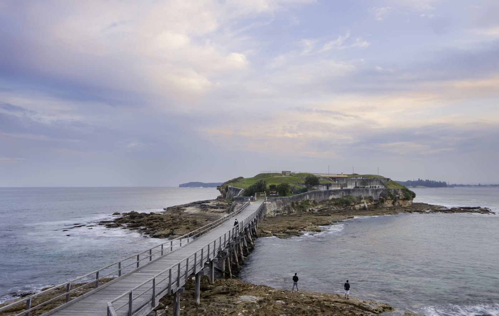 © Lenny K Photography
The spot
Community-maintained
Community contribution: submitted by Daniel
Know before you go
Logged by the community, confirmed by mods
Low risk: Boat traffic in channel
Small boats and dive charter vessels transit the channel between the shore and Bare Island. Stay aware and surface well clear of the footbridge channel.
Low risk: Patchy mobile reception
Limited mobile phone reception in parts of the park can hamper emergency calls.
Low risk: Unfenced cliffs on headland
The headland trails near the snorkel entry points have unfenced cliff edges. Exercise care when walking to access points.
Wildlife Guide
No wildlife notes for this spot yet.
Gallery
3 photos from the community
Getting in
Shore entry
Entry
La Perouse is 15 km south-east of the Sydney CBD. Take Anzac Parade south to its end at La Perouse. Alternatively, catch a direct bus from the CBD via Central Station (routes 390X, 394X, 397).
Parking & facilities
Free street parking on Anzac Parade and nearby side streets, plus a large council car park near the Bare Island footbridge. Gets very crowded on weekends and public holidays — arrive early.
toiletsdrinking_waterpicnic_tablesparking
No park entry fee. No fee for snorkelling. Fees apply only for the guided tour of Bare Island Fort.
Spot Map
Community
Gallery ┬╖ 3 photos
Trust
Is this spot real, accurate, still loved?
Spots near New South Wales

No nearby spots yet.
Needs verification
Quick verify
One tap helps the community keep this spot honest.
About this data
- Conditions last evaluated
- Spot data last updated
- Data sources
- Open-Meteo (marine & weather conditions), tide predictions via UTide, community contributors (descriptions, hazards, marine life).
- License
- Spot content licensed under CC BY-SA 4.0. How's the Spot is open source.
Weather & swell ┬╖ Open-Meteo marine & weather APIs Tides ┬╖ UTide harmonic analysis Sea & safety ┬╖ community reports