Korora Bay is a scenic stretch of coastline just north of Coffs Harbour, encompassing Hills Beach, the main Korora Beach, and Charlesworth Bay. The main beach is a straight 650 m sandy sweep backed by residential slopes, with a reef lying roughly 300 m offshore. While not a premier dedicated snorkel destination, the reef provides underwater interest, and the protected northeast-facing Charlesworth Bay, sheltered by Diggers Head and Fowlers Head, offers calmer conditions. Hills Beach has picnic shelters, BBQs, and a playground, making it a pleasant base for a beach day and a dip in the clear waters.
Korora Bay
BeginnerGO
GO
It's a go.
Showing last known conditions
Wave Height 0.7 mSwell Period 6.3 sWind Speed 7.5 knPrecipitation 0.0 mmTidal Phase flood
Last evaluated
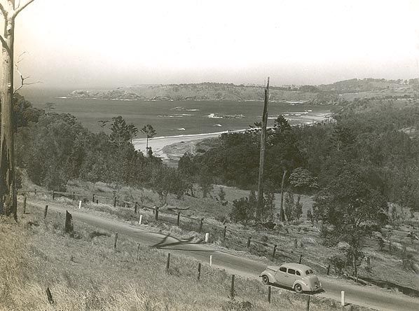 © Photographic Collection from Australia
The spot
Community-maintained
Community contribution: submitted by Daniel
Know before you go
Logged by the community, confirmed by mods
Moderate risk: Unpatrolled Beach
All Korora Bay beaches are unpatrolled. No lifeguards on duty; swim with caution.
Moderate risk: Rip Currents (higher waves)
Rips are absent under normal waves but will develop against the headland and rocks during higher wave conditions.
Low risk: Reef 300m Offshore
A reef lies roughly 300 m off the centre of the beach. Care needed to avoid injury when waves are breaking over the reef.
Wildlife Guide
No wildlife notes for this spot yet.
Gallery
4 photos from the community
Getting in
Shore entry
Entry
Korora Bay is located about 6 km north of Coffs Harbour city centre, on the Pacific Highway. Turn east onto Korora Bay Drive to reach the beach area.
Parking & facilities
Car parking available near Hills Beach at the end of Norman Hill Drive, which also provides access to Korora Beach.
toiletsparkingpicnic_tablesdrinking_water
No fees. Free public access.
Spot Map
Community
Gallery ┬╖ 4 photos
Trust
Is this spot real, accurate, still loved?
Spots near New South Wales

No nearby spots yet.
Needs verification
Quick verify
One tap helps the community keep this spot honest.
About this data
- Conditions last evaluated
- Spot data last updated
- Data sources
- Open-Meteo (marine & weather conditions), tide predictions via UTide, community contributors (descriptions, hazards, marine life).
- License
- Spot content licensed under CC BY-SA 4.0. How's the Spot is open source.
Weather & swell ┬╖ Open-Meteo marine & weather APIs Tides ┬╖ UTide harmonic analysis Sea & safety ┬╖ community reports