Kianinny Bay is a beautiful sheltered inlet in Tathra on NSW's Sapphire Coast, offering calm turquoise waters protected from coastal winds — perfect when ocean conditions turn rough. Snorkel a boulder-strewn seabed where colourful reef fish, starfish, and sea urchins hide among the rocks, and keep your eyes peeled for the famous resident smooth stingrays that glide in from the afternoon fishing boats. The bay also boasts a grassy picnic area, playground, BBQ facilities, and the start of the Kangarutha Walking Track through Bournda National Park. From Chamberlain Lookout above, you'll be treated to spectacular panoramic views of the bay and coastline.
Kianinny Bay
BeginnerGO
GO
It's a go.
Showing last known conditions
Wave Height 0.4 mSwell Period 6.3 sWind Speed 3.5 knPrecipitation 11 mmTidal Phase flood
Last evaluated
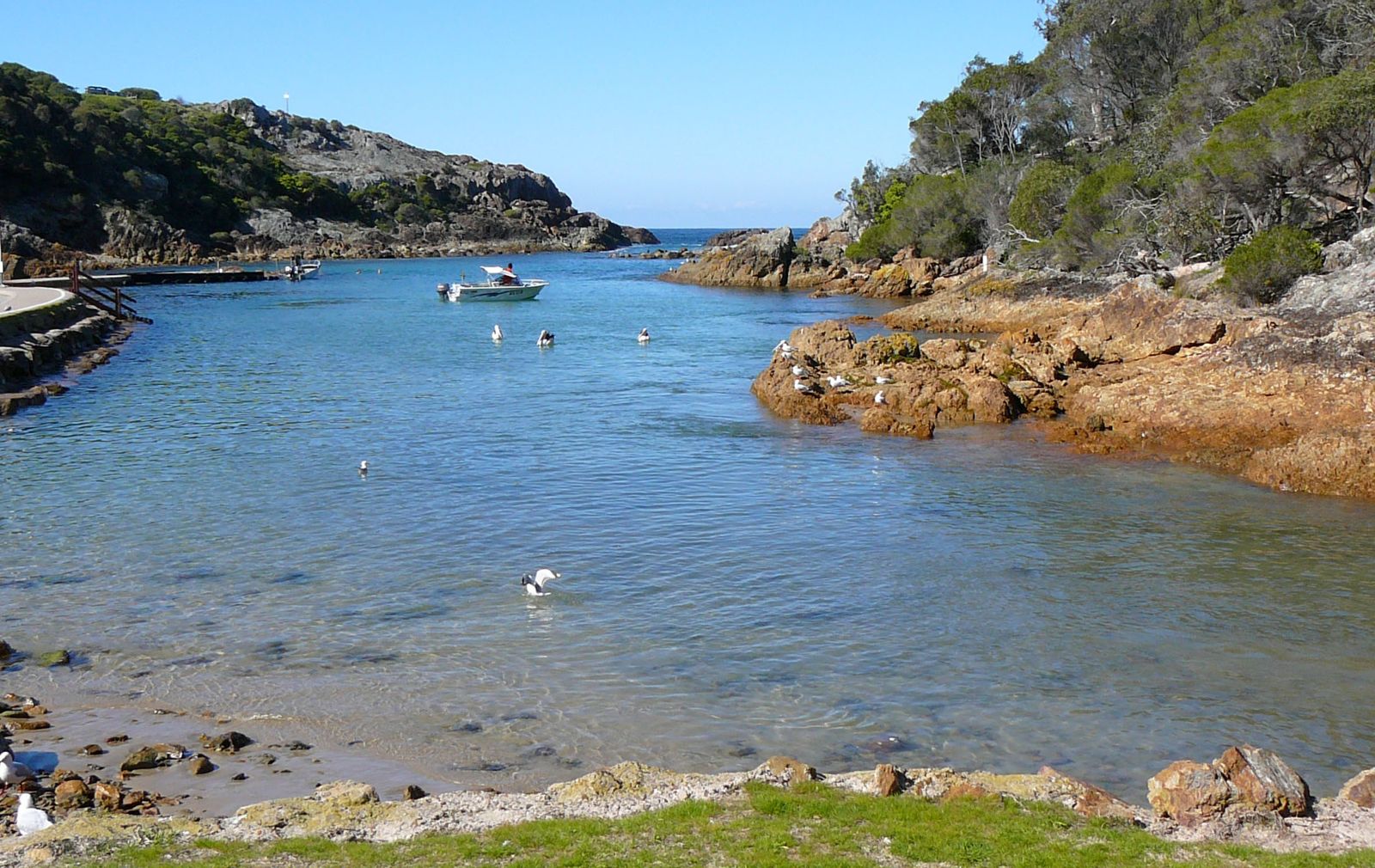 © Mark Andrews
The spot
Community-maintained
Community contribution: submitted by Daniel
Know before you go
Logged by the community, confirmed by mods
Moderate risk: Boat traffic
Active boat ramp with fishing vessels coming and going, especially around lunchtime and early afternoon. Stay on the left (northern) side of the bay away from the channel.
Low risk: Spearfishing pressure
Local spearfishing has reduced fish populations; larger fish are scarce and marine life may be less abundant than expected.
Low risk: Boulder-strewn floor
Uneven, rocky seabed with boulders and sea urchins underfoot. Wear reef shoes or fins.
Low risk: Boulder-strewn bottom
The bay floor is covered in scattered boulders and rocks that can be slippery and uneven underfoot when entering or exiting.
Wildlife Guide
No wildlife notes for this spot yet.
Gallery
3 photos from the community
Getting in
Shore entry
Entry
Kianinny Bay is located at the end of Kianinny Street, Tathra, NSW 2550. From Bega Street in Tathra, follow the turn-off to Kianinny Bay. It is 25 km north of Merimbula and about 430 km south of Sydney via the Princes Highway.
Parking & facilities
Two parking areas: a carpark near the grassed picnic area at the top of the hill, and a lower lot closer to the water — the lower lot is primarily for boats with trailers but offers overflow when quiet. Street parking also available.
toiletsparkingpicnic_tablesshowersboat_rampdrinking_water
Free entry. No fees for parking or access.
Spot Map
Community
Gallery ┬╖ 3 photos
Trust
Is this spot real, accurate, still loved?
Spots near Victoria

No nearby spots yet.
Needs verification
Quick verify
One tap helps the community keep this spot honest.
About this data
- Conditions last evaluated
- Spot data last updated
- Data sources
- Open-Meteo (marine & weather conditions), tide predictions via UTide, community contributors (descriptions, hazards, marine life).
- License
- Spot content licensed under CC BY-SA 4.0. How's the Spot is open source.
Weather & swell ┬╖ Open-Meteo marine & weather APIs Tides ┬╖ UTide harmonic analysis Sea & safety ┬╖ community reports