Jurien Bay Beach sits at the heart of the Turquoise Coast, where an extensive limestone reef system runs parallel to shore, creating a vast sheltered lagoon with crystal-clear turquoise water. The Jurien Bay Marine Park surrounds dozens of ecologically-important islands and hosts the only major breeding area for Australian sea lions on Western Australia's west coast. Snorkellers can explore several coral bommies just 20 metres offshore (in ~8 m depth) plus the Jurien Bay Underwater Interpretive Snorkel Trail — an artificial reef made of 70+ reef balls near the historic jetty piles, teeming with colourful fish, sponges and sea squirts. Seagrass meadows inside the reef shelter western rock lobsters, octopus, cuttlefish and myriad juvenile fish species.
Jurien Bay Beach
Poor conditions. Stay out today.
Showing last known conditions
Last evaluated
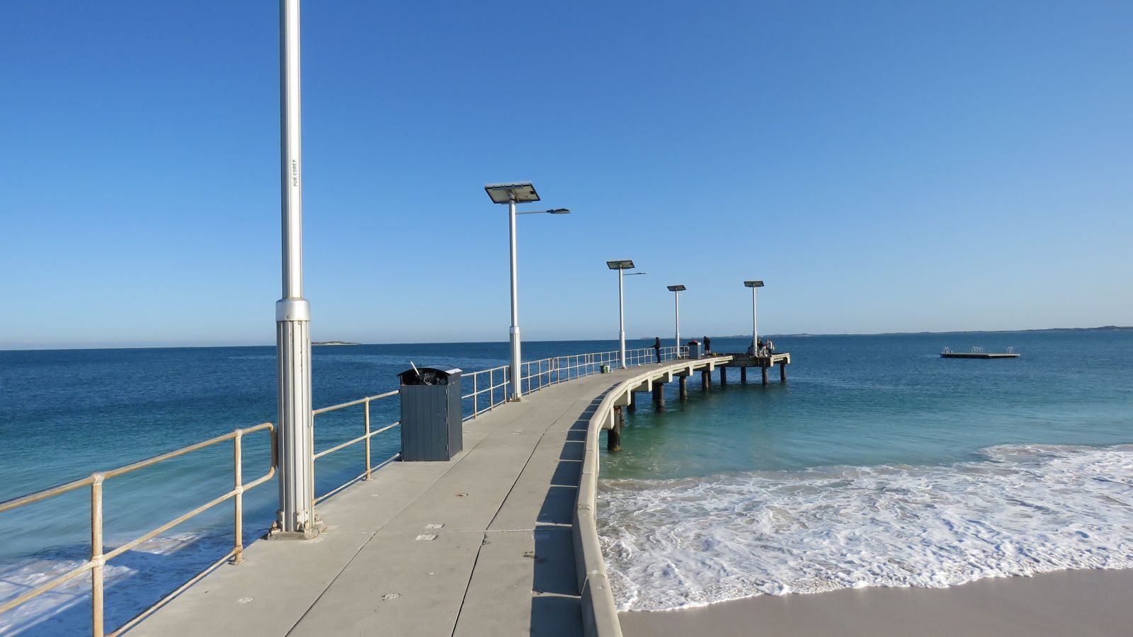 © Calistemon
The spot
Community-maintained
Community contribution: submitted by Daniel
Know before you go
Logged by the community, confirmed by mods
Moderate risk: Boat traffic
The jetty is used by fishing boats and recreational vessels. Snorkelers must stay aware and keep clear of the main boating lanes.
Low risk: Boat traffic near jetty
The fishing jetty and marina see regular boat traffic. Snorkelers should stay aware and avoid the main boating channel.
Low risk: Variable depth changes
Depth varies from 2.5 m to 6 m along the trail. Sudden drop-offs near the old jetty piles can surprise inexperienced swimmers.
Low risk: Summer holiday crowding
The boat ramp and jetty area get very crowded over summer school holidays and Easter, increasing the chance of collisions.
Low risk: Marine stingers
Marine stingers may be present in warmer months. Swimmers should consider protective clothing.
Low risk: Outgoing tide current
Tidal flow around the jetty piles can create unexpected currents, especially during an outgoing tide. Swim with caution near the structure.
Low risk: Sand-covered trail hazards
The marked underwater interpretive trail is now covered with sand, meaning underwater visibility and navigation markers may be obscured.
Low risk: Sharp reef and jetty debris
Old jetty piles and reef ball concrete structures can have sharp edges. Wearing protective footwear and a wetsuit is recommended.
Low risk: Sharp reef structures and jetty remains
The old wooden jetty piles and reef balls can be sharp and may cause cuts or abrasions. Care should be taken when entering the water and navigating the artificial reef structure.
Low risk: Strong summer sea breeze
Afternoon sea breezes can chop up the surface and reduce visibility, particularly from mid-morning onward in summer months (November to March).
Low risk: Shifting sand over reef trail
The underwater interpretive trail has been periodically covered with sand, indicating shifting sandbars and variable bottom conditions.
Low risk: Shifting sand cover
The underwater interpretive trail markers have been covered by sand movement over time, making navigation less clear.
Low risk: Boat traffic near boat ramp
The boat ramp and marina can get busy, especially during peak holiday periods. Snorkellers should stay clear of vessel channels.
Low risk: Sandy reef trail covered
The original underwater interpretive snorkel trail markers have become covered with sand, making navigation more difficult.
Low risk: Strong sea breezes
Afternoon sea breezes can chop up the surface and reduce visibility, particularly in open sections outside the main sheltered lagoon.
Low risk: Sea Lion Interactions
Australian sea lions frequent the area and may approach snorkellers; do not feed or touch them as they are wild, protected animals.
Low risk: Fishing Lines/Hooks
The beach is a popular fishing spot from the old jetty piles; submerged fishing line and hooks may present a snagging hazard.
Low risk: Boat traffic in harbour channel
The adjacent boat harbour and marina see moderate vessel traffic, particularly during summer holidays and Easter. Snorkelers should stay aware and within the marked shallows near the jetty piles.
Low risk: Sand-covered snorkel trail markers
The original underwater interpretive trail markers and reef balls have become partially covered by shifting sand over time, reducing visibility of the artificial reef structures.
Low risk: Stingrays and stonefish on sandy bottom
The sandy bottom around the jetty is home to bottom-dwelling species. Shuffle feet when wading to avoid accidental contact with stingrays or stonefish.
Low risk: Marine stingers (Nov–Apr)
Seasonal presence of bluebottles and box jellyfish in warmer months along the Coral Coast.
Wildlife Guide
No wildlife notes for this spot yet.
Gallery
10 photos from the community
Getting in
Located 2.5 hours north of Perth via Indian Ocean Drive. The main beach is easily accessible from the Jurien Bay town centre at the corner of Roberts and Heaton Streets.
Public car parking available near the beach and at the Jurien Bay Boat Harbour. Trailer parking is located east of the harbour. Day-visitor parking also at the Tourist Park.
Free day-use access to the beach. Camp fees apply at Jurien Bay Tourist Park ($20/night for 2 adults + 2 children).
Spot Map
Community
Trust
Is this spot real, accurate, still loved?
Spots near Western Australia

No nearby spots yet.
Quick verify
One tap helps the community keep this spot honest.
About this data
- Conditions last evaluated
- Spot data last updated
- Data sources
- Open-Meteo (marine & weather conditions), tide predictions via UTide, community contributors (descriptions, hazards, marine life).
- License
- Spot content licensed under CC BY-SA 4.0. How's the Spot is open source.