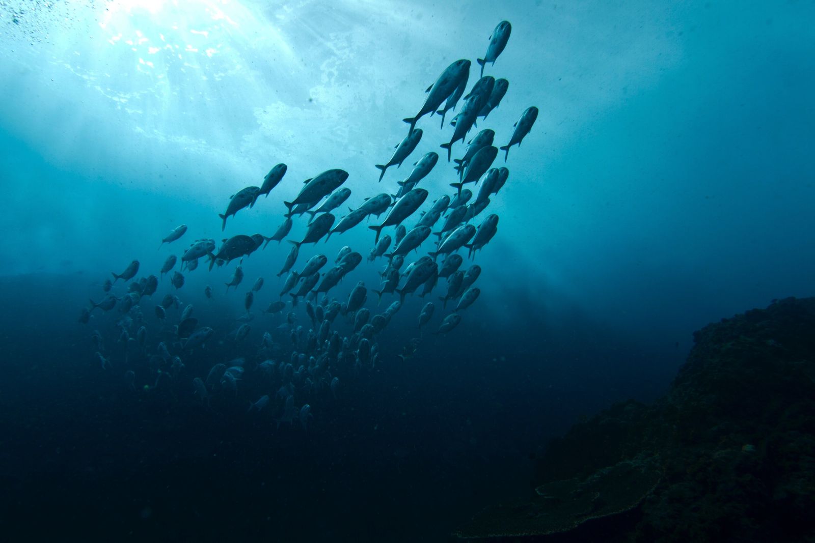
Rising from the Pacific 2.5 km off Byron Bay's Main Beach, Julian Rocks (Nguthungulli) is a protected nature reserve and marine sanctuary often called Australia's 'mini Galapagos'. This ancient rock formation — sacred to the Arakwal people as the resting place of Nguthungulli, Father of the World — sits at the convergence of warm tropical and cool temperate currents, creating an extraordinary biodiversity hotspot with over 1,000 marine species. Snorkelers explore shallow sites like The Nursery (5–12 m) on the sheltered western side, where green, hawksbill and loggerhead turtles glide past colourful reef fish, wobbegong sharks, rays and octopus. From May to November, migrating humpback whales pass between the rocks and the mainland, often visible from the short boat ride out.
Julian Rocks (Nguthungulli)
Fair. Experienced snorkellers only.
Showing last known conditions
Last evaluated
 © JulianGWilson
The spot
Community-maintained
Community contribution: submitted by Daniel
Know before you go
Logged by the community, confirmed by mods
Moderate risk: Strong currents at depth
Currents can be strong around the rock outcrops and deeper dive sites like Hugo's Trench and The Cod Hole. Snorkellers should stay in the shallower western side.
Moderate risk: Ocean swell surge
Ocean swell can create surge inside the trench, reducing visibility and making it harder to navigate the narrow rock passages.
Moderate risk: Ocean current around bommies
Current can run strongly around the bommies and rock formations; operators assess conditions daily and select sites accordingly.
Moderate risk: Strong ocean currents
The East Australian Current can create swift tidal flows around the rock formation, requiring reasonable swimming fitness.
Moderate risk: Open ocean exposure
Located 2.5 km offshore with no sheltered beach access; conditions can change rapidly with wind and swell.
Moderate risk: Strong tidal currents
The convergence of currents around the rocks can create powerful surges, especially around Hugo's Trench and The Needles. Snorkelers should be confident swimmers.
Moderate risk: Swell and surf exposure
Exposed to open ocean swells, conditions can change rapidly with increased wind. The south-eastern side gets rougher in southerly swells.
Moderate risk: Strong currents at tide changes
The convergence of warm and cool currents around Julian Rocks can create unpredictable surge and sweeping currents, especially near the rock edges during outgoing tide.
Moderate risk: Tidal current
Moderate currents can sweep through the trench, particularly on changing tides. Best visited on slack tide.
Moderate risk: Swell and surge
Being an offshore oceanic site exposed to the Pacific, conditions can change rapidly. Swell can create surge through the trench passages, requiring careful navigation.
Moderate risk: Ocean current
Current can run strongly around the bommies depending on tide and weather. Site selection made on the day by operators based on conditions.
Moderate risk: Depth
The Cod Hole swim-through ranges from 15 to 20 metres — suitable for experienced snorkellers with good breath-hold or certified divers.
Low risk: Boat traffic
Julian Rocks is accessed by tour boats. Snorkellers share the area with dive boats — stay aware of vessel movements.
Low risk: Marine stingers
Bluebottles and jellyfish may be present, particularly in warmer months (November to March).
Low risk: Grey nurse shark presence
Julian Rocks is a critical grey nurse shark habitat. These protected sharks are generally docile but should be observed with respect and not approached closely.
Low risk: Outgoing tide current
A surface current can develop around the rocks on an outgoing tide, especially near the south-eastern side. Snorkellers should stay close to the boat or guide.
Low risk: Humpback whale migration
May to September is the annual humpback whale migration corridor between the rocks and mainland. Maintain safe distances from whales.
Low risk: Shallow reef bommies
Shallow reef shelves (5-12 m) at The Nursery have rocky outcrops and bommies that can cause scrapes. Wear a full wetsuit or rash guard.
Low risk: Strong Currents
The East Australian Current can create strong, unpredictable flows around the rocks, particularly on the outer edges. Best to stay with a guide.
Low risk: Sharp Reef
Shallow reef areas have sharp coral and rock formations. Snorkelers should wear fins and avoid standing on the reef.
Low risk: Cold water upwelling
Southern ocean swells can bring cooler water and reduced visibility, particularly in winter months.
Low risk: Rough sea conditions (boat transit)
When the swell picks up, the boat ride out and back from Byron Bay can be very rough. Not recommended for those prone to seasickness.
Low risk: Variable visibility
Visibility ranges 10–20 m but can drop during plankton blooms (summer) or after heavy rain.
Low risk: Cold water temperature (winter)
Water temperature from 18°C (winter) to 27°C (summer); cold shock/increased exertion risk in winter without appropriate wetsuit.
Low risk: Strong currents at convergence zone
Tropical and temperate currents meet here, creating unpredictable water movement around the rocks.
Low risk: Limited visibility after weather
Visibility can drop significantly after storms or strong swell, making navigation challenging.
Low risk: Depth variation
Drop-offs from shallow nursery areas (5 m) to deeper swim-throughs (18-25 m) can surprise inexperienced snorkelers staying near the rocks.
Low risk: Cold Water Thermoclines
Seasonal upwelling can cause sudden temperature drops of several degrees, especially in deeper sections like Cod Hole.
Low risk: Sharp Reef & Rock Outcrops
Exposed rock pinnacles and shallow reef ledges at The Nursery and Cod Hole can cause cuts and scrapes.
Low risk: Ocean currents
Tidal currents can run through the trench creating sudden changes in water movement, particularly around the narrow canyon sections.
Low risk: Sharp volcanic rock
The volcanic rock formations have sharp edges; care needed when entering/exiting the water or swimming near walls.
Low risk: Swell Exposure
The pinnacles are exposed to open ocean swell. Conditions can change quickly, reducing visibility or creating surge around the rocks. Best in calm conditions.
Low risk: Wobbegong sharks
Tasselled wobbegong sharks rest camouflaged on the rocky ledges. They are not aggressive but can bite if stepped on or provoked. Snorkellers should keep a respectful distance.
Low risk: Cool Winter Water
Water temperature drops to around 18°C in winter (June–August), requiring a wetsuit for comfort.
Low risk: Shark presence
Grey nurse sharks (endangered but generally docile) and wobbegong sharks are common. Keep respectful distance and do not touch.
Low risk: Cold water temperatures
Waters can be cooler than expected, especially in winter (May–Sep). 5 mm wetsuit recommended.
Low risk: Depth changes
Depth varies from 5m at the shallowest points to 17-22m in and around the trench. Snorkelers should stay aware of their position relative to the reef.
Low risk: River outflow reducing visibility
Runoff from the Tweed, Brunswick, and Richmond Rivers can significantly reduce underwater visibility after heavy rain, particularly during the wet season (Nov–Mar).
Low risk: Grey Nurse Sharks (winter)
Grey nurse sharks aggregate around The Cod Hole during the cooler months (May to November). These are generally docile but should be treated with respect.
Wildlife Guide
No wildlife notes for this spot yet.
Gallery
1 photo from the community
Getting in
Julian Rocks is located 2.5 km offshore from Byron Bay's Main Beach on the NSW North Coast. Access is exclusively by boat — several licensed tour operators depart from Byron Bay (most commonly from The Pass or Main Beach). The boat ride takes approximately 5–15 minutes.
Parking is available at Byron Bay's Main Beach car park and surrounding streets. Paid parking applies in many areas — check signage.
No fee to enter the reserve, but you must join a guided snorkel tour (prices vary by operator, typically AUD $70–$150 per person).
Spot Map
Community
Trust
Is this spot real, accurate, still loved?
Spots near New South Wales

No nearby spots yet.
Quick verify
One tap helps the community keep this spot honest.
About this data
- Conditions last evaluated
- Spot data last updated
- Data sources
- Open-Meteo (marine & weather conditions), tide predictions via UTide, community contributors (descriptions, hazards, marine life).
- License
- Spot content licensed under CC BY-SA 4.0. How's the Spot is open source.