Tucked within Sydney Harbour's inner-west, Iron Cove Bay is a sheltered tidal embayment fringed by the popular Bay Run walking path. Its calm, murky-green waters sit against a backdrop of parkland at Callan Park, where a new tidal bath is under development. While not a classic snorkelling reef, the cove offers a quiet urban swim spot with seagrass beds and mangrove-lined edges, home to small fish, crabs and the occasional pipefish — a mellow paddle for those seeking a harbour dip close to the city.
Iron Cove Bay
BeginnerGO
GO
It's a go.
Showing last known conditions
Wave Height 0.3 mSwell Period 6.5 sWind Speed 7.9 knPrecipitation 6.9 mmTidal Phase flood
Last evaluated
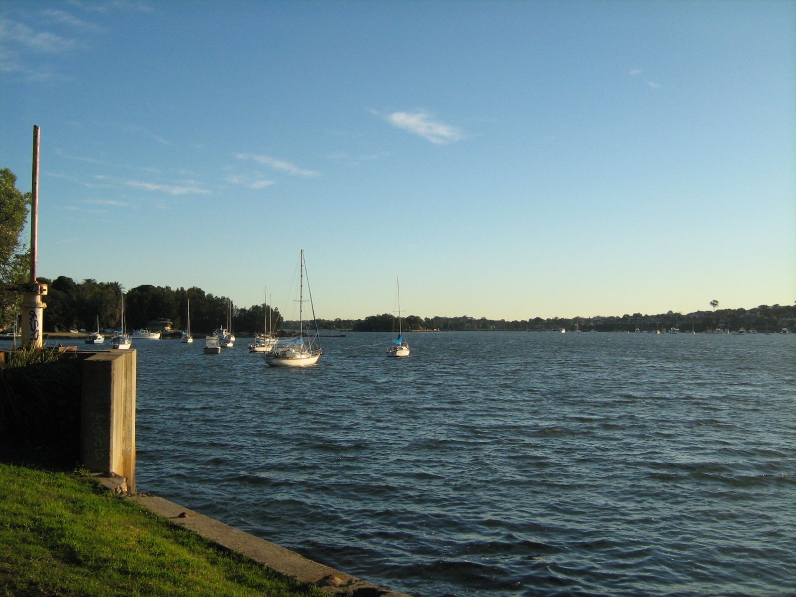
The spot
Community-maintained
Community contribution: submitted by Daniel
Know before you go
Logged by the community, confirmed by mods
Moderate risk: Sewage Overflow Risk
Sydney Water has issued overflow warnings at Iron Cove Bay after heavy rainfall. Avoid swimming for at least 24–48 hours following significant rain.
Low risk: Boat Traffic
Iron Cove is used by recreational powerboats and kayaks, especially on weekends. Snorkelers should stay near the shoreline and remain vigilant.
Low risk: Murky Water Visibility
Being a sheltered inner-harbour bay, silt and runoff can reduce underwater visibility to less than 2 metres, especially after rain or tidal movement.
Low risk: Tidal Currents
While generally mild, tidal flows through the Parramatta River system can create subtle currents near the bay's entrance. Best snorkeled on a slack high tide.
Wildlife Guide
No wildlife notes for this spot yet.
Gallery
4 photos from the community
Getting in
Shore entry
Entry
Iron Cove Bay lies within the Bay Run circuit in Sydney's inner-west, accessible from Callan Park off Wharf Road, Lilyfield. Public transport: take the bus to Victoria Road then walk east through Callan Park. From the city, it's a 15-minute drive via the Anzac Bridge and City West Link.
Parking & facilities
Limited street parking along Wharf Road and around Callan Park. The Bay Run is popular, so arrive early on weekends. More parking available near the Leichhardt Park side of the cove.
parkingtoiletspicnic_tablesdrinking_water
Free entry. No fees for swimming or snorkeling.
Spot Map
Community
Gallery ┬╖ 4 photos
Trust
Is this spot real, accurate, still loved?
Spots near New South Wales

No nearby spots yet.
Needs verification
Quick verify
One tap helps the community keep this spot honest.
About this data
- Conditions last evaluated
- Spot data last updated
- Data sources
- Open-Meteo (marine & weather conditions), tide predictions via UTide, community contributors (descriptions, hazards, marine life).
- License
- Spot content licensed under CC BY-SA 4.0. How's the Spot is open source.
Weather & swell ┬╖ Open-Meteo marine & weather APIs Tides ┬╖ UTide harmonic analysis Sea & safety ┬╖ community reports