Tucked away in Booderee National Park, Hole in the Wall (Scottish Rocks) is a stunning stretch of Jervis Bay coastline where a collapsed sandstone arch has left a dramatic U-shaped gap in the rock wall. The adjacent Scottish Rocks — unusual low rocky mounds scattered along the shoreline — form a snorkeler's paradise of clear, calm waters, shallow reefs, and abundant rock pools. A short 400 m bush walk through coastal scrub leads to this secluded beach, where the protected waters of Jervis Bay create near-perfect conditions for exploring the underwater world.
Hole in the Wall (Scottish Rocks)
IntermediateGO
GO
It's a go.
Showing last known conditions
Wave Height 0.1 mSwell Period 9.3 sWind Speed 14 knPrecipitation 19 mmTidal Phase slack
Last evaluated
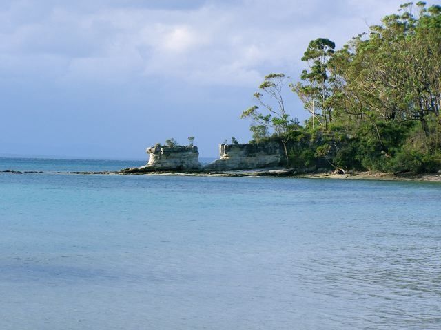 © DVernon at en.wikipedia
The spot
Community-maintained
Community contribution: submitted by Daniel
Know before you go
Logged by the community, confirmed by mods
Moderate risk: Tide-dependent access to rock formation
The collapsed sandstone arch and U-shaped gap can only be safely accessed at low tide. High tide cuts off the route along the beach, and seaweed/boggy sand patches make passage treacherous.
Moderate risk: No lifeguard supervision
None of the Booderee beaches are patrolled by lifeguards. Swimmers and snorkelers are entirely responsible for their own safety.
Low risk: Unstable beach substrate near rocks
Thick seaweed and unstable sand patches along the beach at the base of the rock wall can be boggy and difficult to traverse, especially at mid-to-high tide.
Low risk: Wildlife on walking track
Snakes and ticks are present in the coastal bush along the walking track to the beach, most active in warmer months.
Low risk: Potential rip currents near rock gap
Strong rips and currents may develop near the rock wall gap, particularly on an outgoing tide.
Low risk: Sharp rock platforms
Rock platforms adjacent to the beach can be sharp and slippery when wet. Care is needed when entering or exiting the water.
Low risk: Variable tidal currents
Around the rocky headlands and the Hole in the Wall area, tidal movement can create unexpected currents, especially during changing tides.
Wildlife Guide
No wildlife notes for this spot yet.
Gallery
1 photo from the community
Getting in
Shore entry
Entry
Located in Booderee National Park on the northern edge of Jervis Bay. From the Princes Highway (A1), take Jervis Bay Road into the park. Follow signs past Bristol Point; the Hole in the Wall car park is a small unpaved lay-by on the left with room for ~12 vehicles. A 400 m gravel walking track leads down to the beach.
Parking & facilities
Small unpaved car park (Hole in the Wall Car Park) with space for about 12 vehicles. Located off Jervis Bay Road. Turnover is quick due to the short walk.
parkingtoilets
Booderee National Park entry fee applies (approx. $13 per vehicle for a 2-day pass; free for walk-ins/cyclists). Camping fees include park entry.
Spot Map
Community
Gallery ┬╖ 1 photos
Trust
Is this spot real, accurate, still loved?
Spots near New South Wales

No nearby spots yet.
Needs verification
Quick verify
One tap helps the community keep this spot honest.
About this data
- Conditions last evaluated
- Spot data last updated
- Data sources
- Open-Meteo (marine & weather conditions), tide predictions via UTide, community contributors (descriptions, hazards, marine life).
- License
- Spot content licensed under CC BY-SA 4.0. How's the Spot is open source.
Weather & swell ┬╖ Open-Meteo marine & weather APIs Tides ┬╖ UTide harmonic analysis Sea & safety ┬╖ community reports