Sunk in 2001 in King George Sound, the 133-metre-long HMAS Perth II guided missile destroyer rests upright at 5–36 m depth, creating one of Australia's premier artificial reef experiences. The wreck has transformed into a vibrant ecosystem, festooned with colourful sponges, soft corals and sea fans, while resident wobbegong (carpet) sharks lurk on decks and yellowtail kingfish patrol the superstructure. Snorkelers can explore the shallower portions from the surface; divers follow an interpretive trail past remnants of Vietnam War shellfire damage, the gun deck, bridge and skipper's chair. Humpback whales occasionally pass through the sound during migration season.
HMAS Perth Dive Wreck
IntermediateSKIP
SKIP
Poor conditions. Stay out today.
Showing last known conditions
Wave Height 1.3 mSwell Period 12 sWind Speed 4.0 knPrecipitation 5.5 mmTidal Phase ebb
Last evaluated
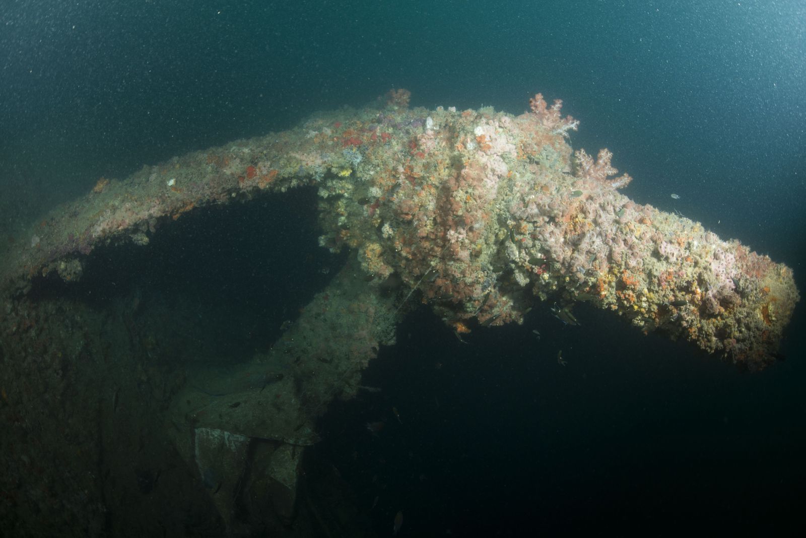 © U.S. Navy photo by Mass Communication Specialist 2nd Class Arthurgwain L. Marquez
The spot
Community-maintained
Community contribution: submitted by Daniel
Know before you go
Logged by the community, confirmed by mods
Moderate risk: Cold water temperatures
Water temperatures in King George Sound can be very cold year-round (12–18°C), increasing the risk of hypothermia without adequate exposure protection.
Moderate risk: Strong currents
Tidal currents in King George Sound can run strongly around the wreck structure, particularly during tide changes.
Moderate risk: Depth and decompression risk
The wreck sits at ~35 m depth; snorkeling the surface is safe but free-diving to structure requires experience. For scuba, this is a deep dive requiring certifications.
Moderate risk: Strong tidal currents
King George Sound can experience strong tidal flows that sweep around Seal Island. Currents can be unpredictable and may push snorkelers/divers off course.
Moderate risk: Strong Currents in King George Sound
Tidal flows in the sound can create unpredictable currents, especially around the wreck structure.
Moderate risk: Enclosed Spaces and Entanglement
The wreck interior has tight compartments and potential entanglement hazards for divers entering the superstructure.
Low risk: Marine traffic
The wreck is in an active shipping channel and boating area; snorkelers must stay aware of vessel traffic and use a dive flag.
Low risk: Depth and entanglement
The wreck rises to only 5m from the surface in places but has many protrusions, cables, and snag hazards for snorkelers exploring close to the structure.
Low risk: Boat traffic
The wreck is accessed by boat from Albany with regular dive-charter and private vessel traffic in the Sound.
Low risk: Limited visibility
Visibility varies with swell and wind conditions; can drop suddenly during southern ocean fronts.
Wildlife Guide
No wildlife notes for this spot yet.
Gallery
2 photos from the community
Getting in
Boat
Entry
The wreck lies 8 km south-east of Albany in King George Sound, off Seal Island. Access is by private or charter boat only — no shore access. Several Albany dive operators (e.g. Albany Dive Centre, South West Dive) run regular trips to the site. Albany is a 4.5-hour drive south of Perth via the Albany Highway.
Parking & facilities
Parking available at the Albany marina and boat ramp areas. Street parking also available near the Emu Point boat ramp.
parkingtoiletsboat_ramp
Free to access if using your own boat. Charter dive trips range from approximately AUD $100–$180 per person depending on gear hire. No entry fee for the site itself.
Spot Map
Community
Gallery ┬╖ 2 photos
Trust
Is this spot real, accurate, still loved?
Spots near Western Australia

No nearby spots yet.
Needs verification
Quick verify
One tap helps the community keep this spot honest.
About this data
- Conditions last evaluated
- Spot data last updated
- Data sources
- Open-Meteo (marine & weather conditions), tide predictions via UTide, community contributors (descriptions, hazards, marine life).
- License
- Spot content licensed under CC BY-SA 4.0. How's the Spot is open source.
Weather & swell ┬╖ Open-Meteo marine & weather APIs Tides ┬╖ UTide harmonic analysis Sea & safety ┬╖ community reports