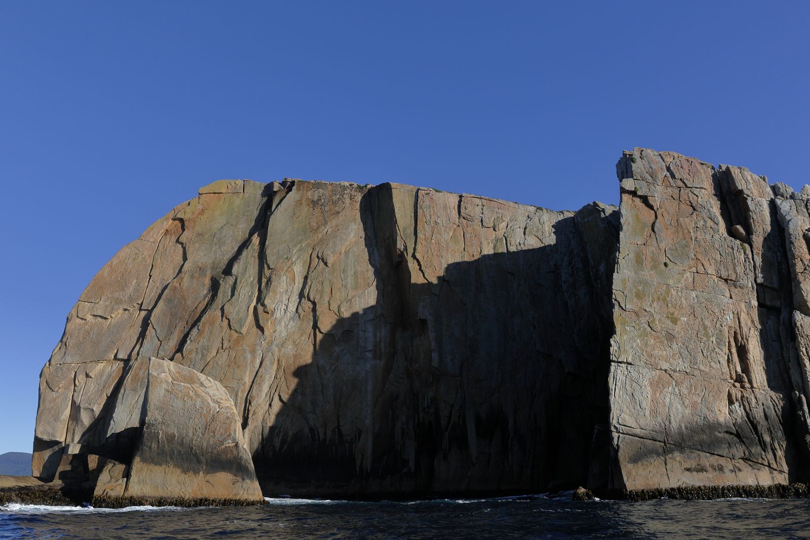
Rising 65 metres from the Tasman Sea off the Tasman Peninsula, Hippolyte Rocks is an exposed granite island group renowned as one of Tasmania's finest dive and snorkel destinations. Beneath the surface, bull kelp gives way at 30 metres to a vibrant temperate reef of colourful sponges, sea whips, coral, and anemones that rivals tropical systems. Swim-throughs carved into Big Hippolyte by erosion teem with fish, while a resident seal colony often investigates visitors. The site also harbours two historic shipwrecks — the Tasman (1883) and Nord (1915) — adding a layer of underwater exploration. Accessible only by boat from Pirates Bay or Fortescue Bay, this remote spot demands calm westerly winds and near-zero swell, making it a challenging but unforgettable adventure for experienced snorkellers and divers.
Hippolyte Rocks
Fair. Experienced snorkellers only.
Showing last known conditions
Last evaluated
DANGER: Explicit Risks Present
Hippolyte Rocks has hazards marked as danger. Entering the water here means you may face serious risks to your personal safety.
- Ocean swell & exposed conditions danger
The rocks are fully exposed to the Tasman Sea. Requires near-zero swell and westerly winds; large swells make the site inaccessible and dangerous.
- Uncharted needle rocks & shipwrecks danger
Submerged rocks such as The Needle and The Pie lie just below the surface. Two shipwrecks (Tasman and Nord) are present at depth — navigational hazard for boats.
- Swell and Wave Action danger
Exposed to prevailing westerly swells and storms; calm westerly winds and no swell are required for safe conditions.
- Open Ocean Swell danger
Hippolyte Rock is fully exposed to the Tasman Sea. Large swells can roll in suddenly, making the site inaccessible. Requires no swell and westerly winds.
- Submerged Rock - The Needle danger
A partially submerged rock pinnacle between Big and Little Hippolyte that has claimed multiple ships. Extremely hazardous for boat traffic and surface swimmers.
The spot
Community-maintained
Community contribution: submitted by Daniel
Know before you go
Logged by the community, confirmed by mods
High risk: Ocean swell & exposed conditions
The rocks are fully exposed to the Tasman Sea. Requires near-zero swell and westerly winds; large swells make the site inaccessible and dangerous.
High risk: Uncharted needle rocks & shipwrecks
Submerged rocks such as The Needle and The Pie lie just below the surface. Two shipwrecks (Tasman and Nord) are present at depth — navigational hazard for boats.
High risk: Swell and Wave Action
Exposed to prevailing westerly swells and storms; calm westerly winds and no swell are required for safe conditions.
High risk: Open Ocean Swell
Hippolyte Rock is fully exposed to the Tasman Sea. Large swells can roll in suddenly, making the site inaccessible. Requires no swell and westerly winds.
High risk: Submerged Rock - The Needle
A partially submerged rock pinnacle between Big and Little Hippolyte that has claimed multiple ships. Extremely hazardous for boat traffic and surface swimmers.
Moderate risk: Strong ocean currents
Exposed to ocean currents that can be unpredictable. Snorkellers and divers must be alert to sudden changes in water movement.
Moderate risk: Deep water & cold temperatures
Reef drops to 65 metres; bull kelp grows to 15m. Cold temperate water requires appropriate exposure protection. Advanced certification needed below 30m.
Moderate risk: Rocky Reefs and Submerged Hazards
Treacherous rocky reefs and submerged granite outcrops surround the islands, with documented shipwrecks including the SS Tasman.
Moderate risk: Remote Offshore Location
Located ~10 km offshore with no land-based emergency services nearby; self-sufficiency and boat support essential.
Moderate risk: Deep Water Drops
The sea bed drops to 100 m around the rocks. Snorkelers must stay close to the reef edges; the bottom is beyond recreational depths.
Low risk: Boat traffic from tuna fishermen
Fishing boats targeting bluefin tuna often operate in the area, creating a hazard for snorkellers and divers on the surface.
Low risk: Cold Water Temperature
Water temperatures range from 11–18°C year-round, posing cold-water risks without proper exposure protection.
Low risk: Boat Traffic - Fishing Charters
The area is a popular recreational fishing ground for Bluefin Tuna. Fishermen may be active overhead, posing a collision risk to snorkelers.
Wildlife Guide
No wildlife notes for this spot yet.
Gallery
4 photos from the community
Getting in
Located approximately 10 km south of Pirates Bay and 8 km east of Fortescue Bay on the Tasman Peninsula. Boat access only — launch from Pirates Bay boat ramp or Fortescue Bay boat ramp. The site is about 10–20 minutes by boat from either ramp.
Parking available at Pirates Bay and Fortescue Bay boat ramps (Tasman National Park — Parks Pass may be required).
Tasman National Park vehicle entry fee applies for parking (around $40–$60/day interstate).
Spot Map
Community
Trust
Is this spot real, accurate, still loved?
Spots near Tasmania

No nearby spots yet.
Quick verify
One tap helps the community keep this spot honest.
About this data
- Conditions last evaluated
- Spot data last updated
- Data sources
- Open-Meteo (marine & weather conditions), tide predictions via UTide, community contributors (descriptions, hazards, marine life).
- License
- Spot content licensed under CC BY-SA 4.0. How's the Spot is open source.