The south mole at Hillarys Boat Harbour offers a unique snorkeling experience sheltered by the harbour's breakwater walls on Perth's Sunset Coast. This artificial granite boulder structure attracts a surprising diversity of fish and marine life, with calm protected waters inside the harbour making it ideal for relaxed snorkeling. Located 24 km north of Perth's CBD, the south mole provides easy shore access from the sandy coves adjacent to the harbour entrance, where clearer water and rocky habitat meet sandy patches — a quiet alternative to the busier swimming beaches within the harbour precinct.
Hillarys Boat Harbour (south mole)
BeginnerMAYBE
MAYBE
Fair. Experienced snorkellers only.
Showing last known conditions
Wave Height 0.7 mSwell Period 11 sWind Speed 2.6 knPrecipitation 1.0 mmTidal Phase ebb
Last evaluated
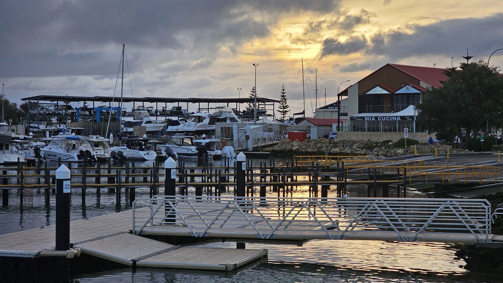
The spot
Community-maintained
Community contribution: submitted by Daniel
Know before you go
Logged by the community, confirmed by mods
Moderate risk: Boat traffic at harbour entrance
The south mole sits near the active boat harbour entrance where vessels transit. Snorkelers should stay clear of the marked channel and keep watch for boat movements.
Moderate risk: Boat traffic near marina entrance
The marina entrance channel has active boat traffic. Snorkelers should stay well inside the swimming enclosure and marked beach areas.
Low risk: Boat traffic
Active marina with frequent boat movements near the harbour entrance
Low risk: Outgoing tide current
Moderate currents can develop near the harbour mouth on an outgoing tide
Low risk: Marine stingers
Bluebottles and box jellyfish may be present during warmer months (Nov–Apr)
Low risk: Granite boulder sharp edges
The south mole is constructed from large granite blocks with barnacle-encrusted, sharp surfaces. Wetsuit or protective footwear is recommended to avoid cuts.
Low risk: Stingrays
Common benthic stingrays rest on the sandy patches adjacent to the mole. Shuffle feet when entering the water to avoid accidental contact.
Low risk: Strong sea breeze chop
Afternoon south-westerly sea breezes (the 'Fremantle Doctor') can stir up surface chop and reduce visibility in the shallows, especially in summer months (Nov–Mar).
Wildlife Guide
No wildlife notes for this spot yet.
Gallery
4 photos from the community
Getting in
Shore entry
Entry
Located at 86 Southside Drive, Hillarys, approximately 24 km north of Perth CBD and 20 minutes by car. From Perth, take the Mitchell Freeway north to Hepburn Avenue exit, then head west to West Coast Drive and turn right onto Southside Drive. Public transport: catch the Yanchep line to Warwick station, then the 423 bus to Hillarys Boat Harbour.
Parking & facilities
Free parking with over 2,700 car bays available throughout the harbour precinct, including disabled parking close to the precinct.
toiletsparkingshowersdrinking_waterpicnic_tables
No fees for parking or beach access. Free public BBQ and picnic areas available.
Spot Map
Community
Gallery ┬╖ 4 photos
Trust
Is this spot real, accurate, still loved?
Spots near Western Australia

No nearby spots yet.
Needs verification
Quick verify
One tap helps the community keep this spot honest.
About this data
- Conditions last evaluated
- Spot data last updated
- Data sources
- Open-Meteo (marine & weather conditions), tide predictions via UTide, community contributors (descriptions, hazards, marine life).
- License
- Spot content licensed under CC BY-SA 4.0. How's the Spot is open source.
Weather & swell ┬╖ Open-Meteo marine & weather APIs Tides ┬╖ UTide harmonic analysis Sea & safety ┬╖ community reports