Just off Rottnest Island's northeastern shore, Henrietta Rocks is a spectacular snorkeling site centered around the historic wreck of the SS Shark. This 19th-century iron steamship lies in shallow, crystal-clear water just 20 metres from the beach, encrusted with vibrant corals and thriving with fish life. The surrounding limestone reef forms a natural cove with calm, protected waters, making it easy to swim out to the wreck and explore. With its white sandy beach, turquoise lagoon, and the haunting silhouette of the wreck just below the surface, Henrietta Rocks offers one of the most accessible and rewarding snorkeling experiences in the Perth region.
Henrietta Rocks
BeginnerGO
GO
It's a go.
Showing last known conditions
Wave Height 0.3 mSwell Period 12 sWind Speed 0.7 knPrecipitation 0.5 mmTidal Phase ebb
Last evaluated
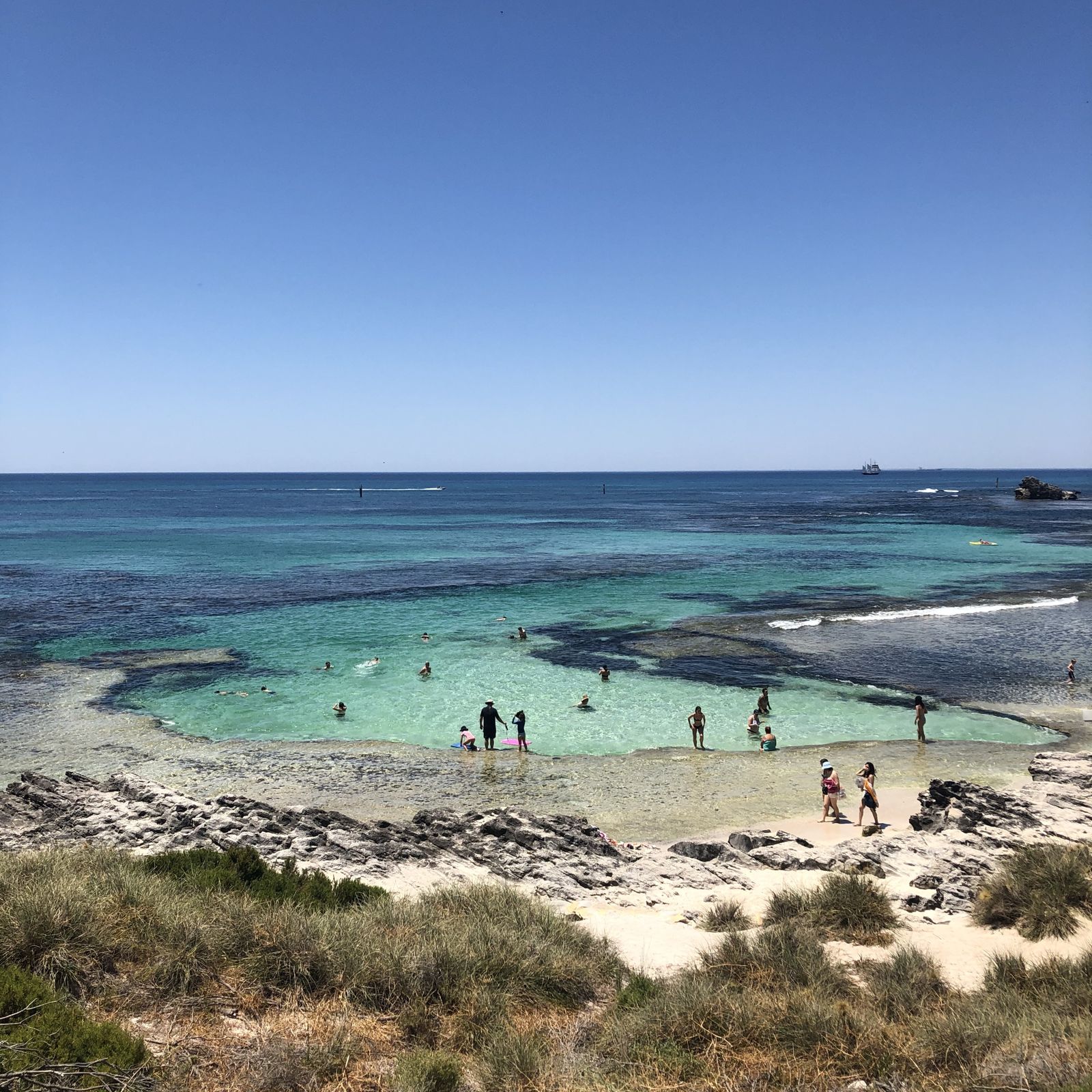
The spot
Community-maintained
Community contribution: submitted by Daniel
Know before you go
Logged by the community, confirmed by mods
Moderate risk: Stinging Jellyfish
Box jellyfish and bluebottles can occasionally be present during warmer months in nearshore waters.
Moderate risk: Strong offshore winds
Southerly sea breezes can pick up quickly in the afternoon, making conditions choppy and creating a risk of being blown offshore.
Low risk: Swell and Surge
Southern and western beaches (e.g., Strickland Bay) can experience strong swell and wave surge, especially in winter months.
Low risk: Strong Winds
Afternoon sea breezes (the 'Fremantle Doctor') can pick up suddenly, creating choppy surface conditions and making swimming back to shore tiring.
Low risk: Boat Traffic
Ferries, charter vessels, and private boats operate year-round in the main channels near Thomson Bay and the jetty area.
Low risk: Sharp limestone reef
The limestone reef formations have sharp edges; cuts and scrapes are common without reef shoes or fins.
Low risk: Sharp limestone reef edges
The reef surrounding the wreck has sharp limestone edges that can cut exposed skin. Wear reef shoes or fins.
Low risk: Boat traffic near wreck
The wreck site is occasionally visited by small boats and kayaks. Stay aware of your surroundings.
Low risk: Changing tide conditions
Water clarity and current can shift with the tide. Check conditions before entering and avoid strong outgoing tides.
Low risk: Sharp reef limestone
The limestone reef edge has sharp, jagged edges that can cause cuts and scrapes. Wear reef shoes or fins.
Low risk: Sharp wreckage
Exposed metal and broken sections of the Shark shipwreck can cause cuts if touched.
Low risk: Boat traffic
The spot is offshore near a navigation channel; occasional boat traffic nearby.
Low risk: Marine stingers (summer)
Warmer summer waters may bring box jellyfish and other marine stingers.
Wildlife Guide
No wildlife notes for this spot yet.
Gallery
7 photos from the community
Getting in
Shore entry
Entry
From the main settlement on Rottnest Island, Henrietta Rocks is about a 30-minute walk east along the coastline or an 8-minute bike ride. Follow the sealed path past the golf course towards the northeastern side of the island. The Rottnest Island bus also stops nearby.
Parking & facilities
Bicycle racks are available near the beach; no car parking on Rottnest Island — visitors use bicycles or the bus service.
parking
No additional fee beyond Rottnest Island entry and ferry costs. Bicycle hire or bus pass extra.
Spot Map
Community
Gallery ┬╖ 7 photos
Trust
Is this spot real, accurate, still loved?
Spots near Western Australia

No nearby spots yet.
Needs verification
Quick verify
One tap helps the community keep this spot honest.
About this data
- Conditions last evaluated
- Spot data last updated
- Data sources
- Open-Meteo (marine & weather conditions), tide predictions via UTide, community contributors (descriptions, hazards, marine life).
- License
- Spot content licensed under CC BY-SA 4.0. How's the Spot is open source.
Weather & swell ┬╖ Open-Meteo marine & weather APIs Tides ┬╖ UTide harmonic analysis Sea & safety ┬╖ community reports