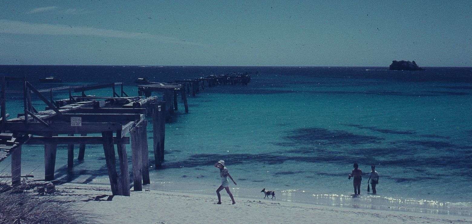
Hamelin Bay, a former timber port within Ngari Capes Marine Park, is famed for its crystal-clear shallow waters and the scattered remains of 11 historic shipwrecks dating back to the late 19th and early 20th centuries. Four wrecks lie close to shore in just 6 metres of water, visible from the coast on calm days and accessible by snorkel in good weather. Beyond the wrecks, snorkellers can explore Mushroom Rock — a small offshore island reef 500 m from the boat ramp — and encounter the bay's iconic friendly stingrays that glide through the shallows year-round. Sheltered coves and rocky formations provide additional underwater terrain dotted with colourful fish, seagrass beds, and crabs.
Hamelin Bay Shipwrecks
IntermediateSKIP
SKIP
Poor conditions. Stay out today.
Showing last known conditions
Wave Height 2.2 mSwell Period 12 sWind Speed 2.1 knPrecipitation 2.2 mmTidal Phase ebb
Last evaluated
 © JarrahTree
The spot
Community-maintained
Community contribution: submitted by Daniel
Know before you go
Logged by the community, confirmed by mods
Moderate risk: Strong currents
Hamelin Bay can experience strong currents, especially during changing tides. Always check local conditions before entering the water.
Moderate risk: Winter storm swell
The bay is exposed to powerful winter storms that can create dangerous conditions; the same storms that sank the historic ships.
Moderate risk: Northwest storm fronts (winter)
Winter northwesterly storms can create hazardous conditions with large swells and strong winds, affecting visibility and safety.
Moderate risk: Strong offshore swim required
Mushroom Rock is a 500 m swim from the beach/boat ramp; snorkelers must be confident in open water with no rest stops.
Moderate risk: Long open-water swim
Mushroom Rock requires a 500 m swim from the old jetty or beach entry, with no rest stops along the way. Moderate fitness and strong swimming ability are essential.
Low risk: Sharp wreck debris
Shipwreck remains may have sharp metal edges, entanglement hazards, and unstable structures. Snorkellers should exercise caution and avoid touching.
Low risk: Boat traffic
The boat ramp area is active with fishing boats launching and retrieving. Snorkellers should stay clear of the ramp and be mindful of vessels.
Low risk: Swell above 1m at boat ramp
The wooden boat ramp near the old jetty becomes difficult and dangerous to use when swell exceeds 1 metre.
Low risk: Unstable limestone cliffs
Limestone cliff areas around the bay can be unstable; stick to marked paths to avoid rockfall hazards.
Low risk: Stingray interaction
Large resident stingrays approach the shore; do not harass or corner them. Give them space and avoid sudden movements.
Low risk: Old timber piles and submerged cross-members
Remaining jetty structure can be difficult to see in low light; sharp splinters or nails may be present.
Low risk: Seaweed-covered piles
Thick marine growth on piles can be slippery underfoot if standing or wading.
Low risk: Stingray encounters
Stingrays commonly swim in the shallows and may brush against swimmers. Although generally docile, they are wild animals — shuffle your feet and never corner or touch them.
Low risk: Boat traffic near boat ramp
The bay has an active boat ramp and trailer parking area. Snorkelers should stay clear of the ramp channel and be aware of approaching vessels.
Low risk: Swell and wind chop
While usually sheltered, strong south-westerly winds can create choppy conditions and reduce visibility. Best snorkeled in calm conditions on low-wind days.
Low risk: Variable water depths (1–6 m)
Depth changes quickly over reef ledges; unexpected drops can surprise less experienced snorkelers.
Low risk: Summer holiday crowds
Car parks fill quickly during peak summer (December–February), requiring early arrival.
Low risk: Crowded Car Parks
Summer holiday crowds fill the two beach car parks early. Arrive before 9 am or visit outside January for space. Peak season December–February.
Low risk: Marine Park Restrictions
Wardandi traditional lands; no dogs permitted on the beach. Respect all marine park regulations including no boating or snorkelling within 300 m of stromatolites.
Low risk: Boat traffic in bay
Hamelin Bay is used by fishing and recreational boats. Snorkelers should stay aware of boat activity, especially near the boat ramp and moorings.
Low risk: Stingrays underfoot
Friendly stingrays frequent the shallow sandy areas. Shuffle your feet when entering the water to avoid stepping on them.
Wildlife Guide
No wildlife notes for this spot yet.
Gallery
7 photos from the community
Getting in
Shore entry
Entry
From Augusta, head north on Caves Road and follow signs to Hamelin Bay. Turn into Hamelin Bay Road and continue to the beach carpark. Approximately 20 minutes north of Augusta.
Parking & facilities
Two car parks serve the main beach. Spaces fill quickly during peak summer holiday periods.
toiletsparkingboat_ramp
Free access. No entry fee.
Spot Map
Community
Gallery ┬╖ 7 photos
Trust
Is this spot real, accurate, still loved?
Spots near Western Australia

No nearby spots yet.
Needs verification
Quick verify
One tap helps the community keep this spot honest.
About this data
- Conditions last evaluated
- Spot data last updated
- Data sources
- Open-Meteo (marine & weather conditions), tide predictions via UTide, community contributors (descriptions, hazards, marine life).
- License
- Spot content licensed under CC BY-SA 4.0. How's the Spot is open source.
Weather & swell ┬╖ Open-Meteo marine & weather APIs Tides ┬╖ UTide harmonic analysis Sea & safety ┬╖ community reports