The south-eastern shores of Great Keppel Island (Wop-pa) offer some of the Southern Great Barrier Reef's most accessible snorkelling, with pristine coral gardens right off the beach. This side of the island features Shelving Point Reef and Monkey Beach Reef — two protected bays with exceptionally high coral cover and 38 recorded coral species. Shelving Point Reef lies directly off Fisherman's Beach, making it an easy shore-entry snorkel for all ages. Monkey Beach Reef, a 40-minute walk from the main beach, is considered the island's premier snorkel and dive site. From July to September, humpback whales pass offshore, while manta rays feed in the channel from May to August. The calm, protected waters and abundant marine life make this an ideal spot for both beginners and experienced snorkelers exploring the Keppel Bay Islands National Park.
Great Keppel Island south-eastern shores
It's a go.
Showing last known conditions
Last evaluated
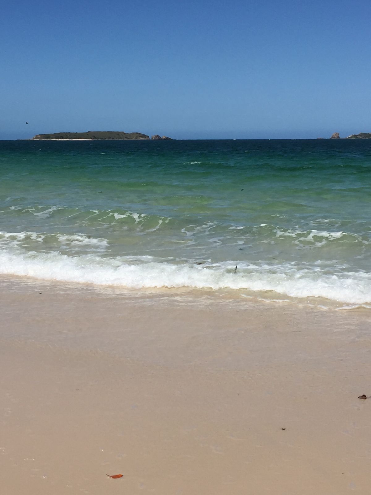 © Jhod7689
The spot
Community-maintained
Community contribution: submitted by Daniel
Know before you go
Logged by the community, confirmed by mods
Moderate risk: Marine stingers (box jellyfish)
Box jellyfish (stingers) are present in Keppel Bay waters during warmer months, typically November to May.
Moderate risk: Tidal currents
Strong tidal currents can sweep through the channels between the western bommies, especially during spring tides. Snorkelers must be confident swimmers and aware of tide times.
Moderate risk: Stinger jellyfish
Stinger jellyfish (box jellyfish and Irukandji) are present in the warmer months. Full-body stinger suits are strongly recommended from November to May.
Moderate risk: Stinger season (jellyfish)
Stinging jellyfish (box jellyfish and Irukandji) may be present in warmer months, particularly November to May.
Moderate risk: Strong tidal currents
Strong tidal currents can sweep through the channel around Egg Rock, requiring good swimming ability and confidence in the water.
Moderate risk: Depth up to 30m
Deep water requiring good buoyancy control and comfort at depth.
Moderate risk: Marine stingers (jellyfish)
Box jellyfish and Irukandji may be present in warmer months. Wear a stinger suit.
Moderate risk: Stinger season (marine stingers)
Marine stingers (box jellyfish and Irukandji) may be present in the warmer months from October to May.
Moderate risk: Marine Stingers
Stinging jellyfish (box jellyfish and Irukandji) may be present in warmer months, particularly November to May.
Moderate risk: Marine Stingers (Box Jellyfish & Irukandji)
Marine stingers (jellyfish) are present in Queensland waters. Wear a stinger suit during the stinger season.
Moderate risk: Strong ocean currents
Strong currents can sweep around the rock formations, especially on the seaward side. Drift snorkeling is common.
Moderate risk: Box jellyfish (marine stingers)
Box jellyfish may be present in the Keppel Islands region during the warmer months (October to May).
Moderate risk: Outgoing Tide Current
Strong tidal currents can flow through the channel between Fishermans Beach and Middle Island, especially during outgoing tides. This can make the paddle or snorkel return more challenging.
Moderate risk: Submerged Structure Remnants
The abandoned observatory structure has concrete and metal remnants submerged just below the surface. Snorkelers should avoid touching or swimming too close to avoid cuts or entanglement.
Moderate risk: Tidal currents on reef flat
Strong tidal currents flow through the reef passages and over the reef flat, especially during spring tides. Snorkelers should be mindful of being swept across the reef.
Moderate risk: Remote offshore location
Remote location ~96 km offshore with no immediate medical facilities. Self-sufficiency and boat safety equipment essential.
Low risk: Tidal movement
Tides can shift water levels significantly; best snorkeling at mid-to-low tide when reefs are closest to the surface. Snorkel at Clam Bay specifically recommended at mid-to-low tide.
Low risk: Wind conditions
Easterly and northerly winds can create choppy conditions on exposed eastern side reefs. Best conditions during northerly or easterly winds (the site is protected in these conditions).
Low risk: Sharp coral and rocks
Sharp coral heads and rocky outcrops near shore, especially at Butterfish Bay area. Avoid standing on coral; use sandy patches to rest.
Low risk: Sea lice (stinger larvae)
Sea lice (tiny jellyfish larvae) are commonly reported at Wreck Beach, especially during warmer months, causing skin irritation and stinging sensations while swimming.
Low risk: Sharp coral and sea urchins
The fringing reef has sharp coral rocks and sea urchins close to shore, particularly at the southern end of the beach. Care needed when entering and exiting the water.
Low risk: Submerged wreck debris and uneven footing
The wreck structure itself and submerged reef ledges can have strong surge and uneven footing, especially near the wreck site at low tide.
Low risk: Tidal currents and wind swell
Onshore winds and tidal currents can create moderate surge along the exposed eastern beach, requiring reasonable swimming fitness.
Low risk: Tidal currents & swell
The beach is exposed to open ocean swell and the tide can create strong currents, especially around the reef edge. Best snorkelled at mid-to-low tide during northerly or easterly winds.
Low risk: Remote access (long hike)
The 8–9 km hike to Wreck Beach from Fisherman's Beach is a strenuous walk across the island with limited shade and no facilities. Carry plenty of water and sun protection.
Low risk: Marine stingers
Marine stingers (box jellyfish) may be present in the waters of the Southern Great Barrier Reef, particularly during the warmer months.
Low risk: Boat traffic
Boat traffic from water taxis, charter vessels, and private boats accessing the western bommie sites. Snorkelers need to stay visible and surface with care.
Low risk: Sharp coral
Sharp coral on the bommies can cause cuts if snorkelers make contact. Reef-safe sunscreen and protective rash vests recommended.
Low risk: Sharp coral and reef cuts
Exposed reef with sharp corals. Never stand on or touch coral; use sandy patches to rest. Cuts and scrapes are common if proper care is not taken.
Low risk: Shallow coral bommies
Shallow bommies can surprise snorkelers who drift over them without noticing the rising coral. Maintain buoyancy awareness to avoid contact.
Low risk: Tidal currents in bommie channels
Outgoing tide can create moderate currents through the channels between bommies, especially on the western side. Snorkel on incoming or slack tide.
Low risk: Wind chop and reduced visibility
South-easterly winds can create choppy conditions and reduced visibility, particularly in winter.
Low risk: Sharp coral at low tide
Coral is very close to the shore at low tide — swimmers may scrape against sharp coral if not careful.
Low risk: Outgoing tide current
Strong tidal currents can develop around the island's points and reef edges, especially on outgoing tides.
Low risk: Deep water adjacent to walls
Depth drops quickly to 30m near the rock walls — snorkelers should stay near the surface and avoid descending into deeper water.
Low risk: Tide-dependent reef access
Mid-to-low tide offers the best visibility and easiest access to reef edges. At high tide, coral may be further from shore and harder to reach.
Low risk: Coral damage risk
Never rest or stand on coral — it is a living organism. Use sandy patches to stand. Avoid kicking coral with fins.
Low risk: Seasonal wind and swell
South-easterly winds can create choppy conditions, particularly in winter months. Best snorkel conditions occur during northerly or easterly winds.
Low risk: Coral cuts and scrapes
Shallow fringing reefs can cause cuts if touched. Avoid standing on or touching coral.
Low risk: Marine park vessel traffic
Boat traffic in ferry and tour boat zones near the jetty. Stay aware of your surroundings.
Low risk: Outgoing tide current at Passage Rocks
Strong tidal flows can develop in the channel at Passage Rocks on the northern side of the island, especially during outgoing tides.
Low risk: Wind chop (northerly / easterly winds)
Northerly and easterly winds can create choppy surface conditions, particularly on exposed eastern-facing beaches.
Low risk: Sharp coral at reef edges
Sharp coral bommies and reef edges near the shore — avoid standing on coral; use sandy patches to rest.
Low risk: Tidal Currents
Snorkelling is best at low tide to see corals up close, but outgoing tide currents can develop around reef bommies.
Low risk: Sun Exposure
Limited shade on beaches; the Queensland sun is intense year-round.
Low risk: Sharp Coral
Coral and rocky reef edges can be sharp; reef shoes recommended.
Low risk: Sharp Coral / Reef Cuts
Sharp coral and rocky reef edges close to shore can cause cuts if touched.
Low risk: Outgoing tide currents
Strong tidal currents can develop around the island's points, especially at the eastern fringes of the reef during outgoing tides. Swim with caution and check tide times.
Low risk: Uneven walking tracks
The bushwalking tracks to reef beaches like Monkey Beach are steep and rocky in sections; sturdy footwear is recommended.
Low risk: Open ocean exposure
The site is accessed by boat only and is several kilometres offshore. Open ocean conditions apply.
Low risk: Deep drop-offs near rocks
Maximum depth of 30 m exists close to the rocks. Snorkelers should remain aware of depth changes and boat traffic.
Low risk: Sharp coral / rock cuts
Sharp coral and rock platforms are exposed at low tide; avoid walking on coral.
Low risk: Challenging walking track
The 2.6 km walking track from Fisherman's Beach is moderately difficult with uneven terrain, steep sections, and full sun exposure.
Low risk: Deep drop-offs
The seaward side drops steeply to 30m depth. Snorkelers should stay within safe depth limits and avoid venturing beyond the shallow fringing reef.
Low risk: Afternoon Winds
The area can experience moderate to strong winds, particularly in the afternoon, which can create choppy conditions for kayaks and snorkelers.
Low risk: Vessel traffic
Boat traffic in the channel near the ferry jetty and popular beach areas.
Low risk: Exposed reef flat at low tide
The reef flat becomes extremely shallow at low tide, exposing sharp coral rubble and making swimming difficult. Walking on live coral is prohibited.
Low risk: Sharp coral rubble shoreline
The cay is a shingle/rubble cay with sharp coral fragments along the shoreline and intertidal zone — wear reef shoes.
Low risk: Coral Cuts
Sharp coral edges and rock outcrops near shore can cause cuts if wading or standing.
Low risk: Southerly wind chop
The beach is in a protected bay but wind from the south-east can create chop and reduce visibility, especially in winter and spring.
Low risk: Lateral shoreline current
A gentle but perceptible current may run along the shore, particularly around the headlands at either end of the beach.
Wildlife Guide
No wildlife notes for this spot yet.
Gallery
4 photos from the community
Getting in
Great Keppel Island is a 30-minute ferry ride from Rosslyn Bay Harbour, near Yeppoon (about 1 hour drive from Rockhampton). The south-eastern shores are accessible by walking from Fisherman's Beach or via water taxi. The island also has a small airstrip for chartered flights from Rockhampton.
Free long-term parking and secure paid parking available at Rosslyn Bay Marina car parks.
Ferry transfers from Rosslyn Bay Harbour cost approximately AU$70-105 per adult. Free and paid parking available at Rosslyn Bay Marina.
Spot Map
Community
Trust
Is this spot real, accurate, still loved?
Spots near Queensland

No nearby spots yet.
Quick verify
One tap helps the community keep this spot honest.
About this data
- Conditions last evaluated
- Spot data last updated
- Data sources
- Open-Meteo (marine & weather conditions), tide predictions via UTide, community contributors (descriptions, hazards, marine life).
- License
- Spot content licensed under CC BY-SA 4.0. How's the Spot is open source.