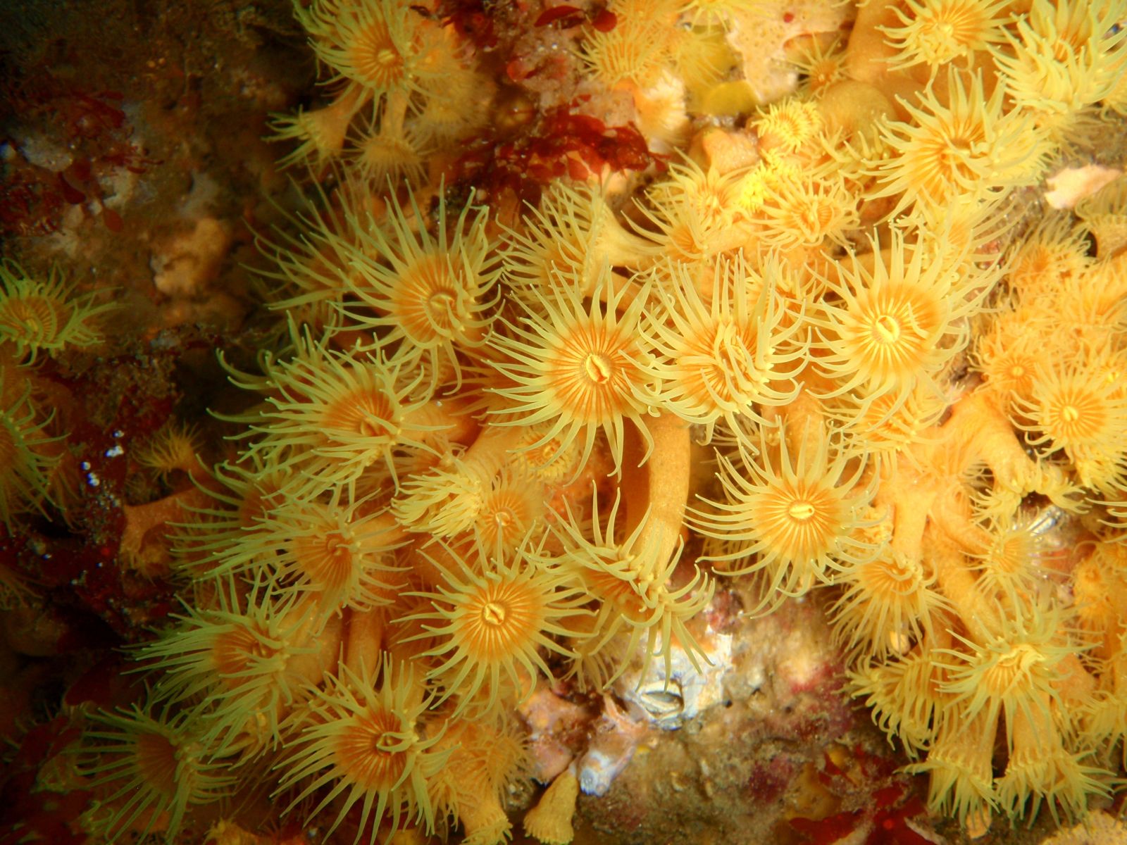
Governor's Island Marine Reserve, just offshore from Bicheno on Tasmania's wild east coast, is a celebrated no-take marine sanctuary offering over 35 dive and snorkel sites. This temperate underwater wonderland explodes with colour — vibrant sponge gardens, sea whips, and soft corals coating granite boulder reefs at sites like Magic Garden, Golden Bommies, The Canyon, and The Castle. The reserve's nutrient-rich waters attract schools of fish, Australian fur seals, and the occasional migrating whale. Sheltered by Governor Island itself, the reef system supports extraordinary biodiversity, making it one of Australia's finest temperate snorkelling destinations. Access is typically by boat tour or kayak from the Bicheno waterfront.
Governor's Island Marine Reserve
IntermediateGO
GO
It's a go.
Showing last known conditions
Wave Height 0.4 mSwell Period 4.0 sWind Speed 3.3 knPrecipitation 2.1 mmTidal Phase slack
Last evaluated
 © Peter Southwood
DANGER: Explicit Risks Present
Governor's Island Marine Reserve has hazards marked as danger. Entering the water here means you may face serious risks to your personal safety.
- Strong currents and swells in Waubs Gulch danger
Waubs Gulch on the western side of Governor Island is subject to frequent boating traffic and strong currents and swells. Snorkelers should avoid this area entirely.
- Strong currents and swells danger
Waubs Gulch is subject to frequent boating traffic and strong currents and swells — do not swim, snorkel, or dive there.
- Waubs Gulch danger area danger
Swimming, snorkelling and diving are strictly prohibited in Waubs Gulch due to dangerous and unpredictable conditions. Always enter the reserve from designated safe access points.
- Strong currents in Waubs Gulch danger
Frequent boating traffic and strong currents make Waubs Gulch dangerous for swimming, snorkeling, and diving. Avoid this area entirely.
The spot
Community-maintained
Community contribution: submitted by Daniel
Know before you go
Logged by the community, confirmed by mods
High risk: Strong currents and swells in Waubs Gulch
Waubs Gulch on the western side of Governor Island is subject to frequent boating traffic and strong currents and swells. Snorkelers should avoid this area entirely.
High risk: Strong currents and swells
Waubs Gulch is subject to frequent boating traffic and strong currents and swells — do not swim, snorkel, or dive there.
High risk: Waubs Gulch danger area
Swimming, snorkelling and diving are strictly prohibited in Waubs Gulch due to dangerous and unpredictable conditions. Always enter the reserve from designated safe access points.
High risk: Strong currents in Waubs Gulch
Frequent boating traffic and strong currents make Waubs Gulch dangerous for swimming, snorkeling, and diving. Avoid this area entirely.
Moderate risk: Strong currents and surge
Open ocean exposure on the eastern side of Governor Island can produce strong swell and currents, especially around the points and bommies.
Moderate risk: Restricted shore access
Swimming, snorkelling and diving are prohibited in Waubs Gulch. The marine reserve is best accessed via a commercial operator or kayak — do not attempt shore entry from the Bicheno side.
Moderate risk: Boat traffic (summer)
The channel between Bicheno and Governor Island sees increased boat traffic in summer. Snorkelers near the mainland side should stay vigilant.
Moderate risk: Wind and sea state for boat access
Access is primarily by boat; strong winds can create hazardous sea states for small vessels crossing from Bicheno to the reserve.
Moderate risk: Strong currents
Strong ocean currents can occur around the point and between Governor Island and the mainland, particularly on outgoing tides.
Moderate risk: Boat traffic in Waubs Gulch
Waubs Gulch is subject to frequent boating traffic and strong currents. Do not swim, snorkel or dive in this area.
Moderate risk: Boating traffic in Waubs Gulch
Waubs Gulch is subject to frequent boating traffic; swimming, snorkeling and diving are not advised there.
Low risk: Boat traffic
The reserve is accessed by boat from Bicheno; snorkellers must be vigilant of dive boats and other vessels operating in the area.
Low risk: Cold water temperatures
Tasmanian east coast water temperatures are cool year-round (12–18°C), requiring a thick wetsuit (5–7mm) even in summer.
Low risk: Variable visibility
Visibility can change rapidly with wind and swell conditions. Best conditions are typically found in calm easterly weather with offshore winds.
Low risk: Boat traffic and strong currents in Waubs Gulch
Waubs Gulch is subject to frequent boating traffic and strong currents and swells. Do not swim, snorkel or dive in this area.
Low risk: Ocean swells
Open ocean swells can surge through the reserve, particularly in easterly conditions, creating challenging conditions for snorkelers.
Low risk: Rocky shore entry
Access points involve rocky shorelines which can be slippery and hazardous, especially in surge conditions.
Low risk: Limited shore access
Most dive sites require a boat to access; few suitable shore-entry points exist. Snorkelers should join a guided tour.
Low risk: Remote access
The reef surrounds Governor Island and is best reached by boat or commercial tour — limited shore access and no nearby facilities on the island.
Low risk: Cold water temperature (7mm+ wetsuit required)
Water temperature ranges 11–18°C year-round; cold shock and hypothermia risk without adequate exposure protection.
Low risk: Southerly swell exposure
The site is exposed to southerly swells; sea conditions can deteriorate quickly on windy days.
Low risk: Slippery rocky entry
Shallow nearshore rocks and boulders can be slippery and uneven for entry and exit.
Low risk: Tidal current around the point
Tidal currents can strengthen around the point near the marine reserve boundary.
Wildlife Guide
No wildlife notes for this spot yet.
Gallery
8 photos from the community
Getting in
Boat
Entry
Governor's Island Marine Reserve is located off the coast of Bicheno, Tasmania, approximately 2.5 hours north-east of Hobart via the Tasman Highway (A3). The reserve extends 400 m seaward from Governor Island and surrounding islets. Access to the actual snorkel/dive sites is by boat — several local operators run snorkel and dive charters from the Bicheno boat ramp on Waubs Esplanade.
Parking & facilities
Parking is available at the Bicheno boat ramp area on Waubs Esplanade and at nearby beach car parks in town.
parkingtoiletsshowers
No fee to enter the marine reserve, but snorkel/dive charters are charged by local operators (typically $80-150 per person).
Spot Map
Community
Gallery ┬╖ 8 photos
Trust
Is this spot real, accurate, still loved?
Spots near Tasmania

No nearby spots yet.
Needs verification
Quick verify
One tap helps the community keep this spot honest.
About this data
- Conditions last evaluated
- Spot data last updated
- Data sources
- Open-Meteo (marine & weather conditions), tide predictions via UTide, community contributors (descriptions, hazards, marine life).
- License
- Spot content licensed under CC BY-SA 4.0. How's the Spot is open source.
Weather & swell ┬╖ Open-Meteo marine & weather APIs Tides ┬╖ UTide harmonic analysis Sea & safety ┬╖ community reports