The Gold Coast Seaway, at the mouth of the Nerang River in Main Beach, is Queensland's most popular shore-diving and snorkelling spot. Created in the late 80s to stabilise the river mouth, the channel's permanent sand-bypass system improved tidal exchange and brought back remarkable biodiversity — over 400 species have been recorded. The south wall offers easy shore entry via stairs, with depths of just 5–7 metres and hundreds of fish hovering over the human-made rock structures. The sand pipe, starting about 50 metres right of the stairs, reaches 16 metres and is famous for schools of fish, rays, and the occasional Queensland grouper. Best visited around high tide for optimal visibility.
Gold Coast Seaway (Southport Seaway)
IntermediateGO
GO
It's a go.
Showing last known conditions
Wave Height 0.2 mSwell Period 6.7 sWind Speed 6.8 knPrecipitation 0.0 mmTidal Phase flood
Last evaluated
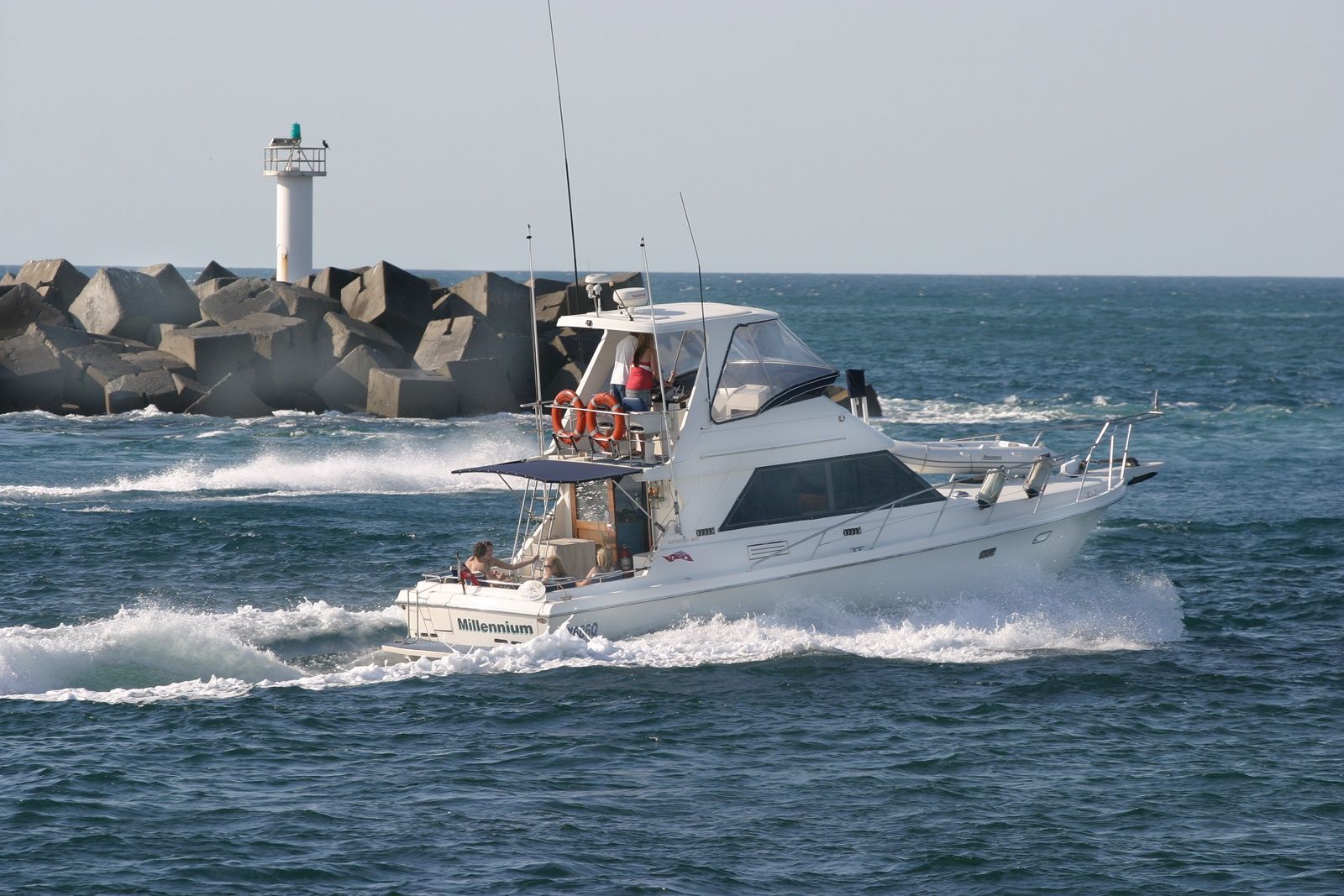 © Sheba_Also 43,000 photos
DANGER: Explicit Risks Present
Gold Coast Seaway (Southport Seaway) has hazards marked as danger. Entering the water here means you may face serious risks to your personal safety.
- Sewage outflow on outgoing tide danger
Recycled water from treatment plants is released about 30 minutes into the outgoing tide, severely reducing visibility and water quality. Snorkel on incoming or high tide only.
- Stonefish danger
Stonefish are known to hide under objects on the sandy bottom near the sand pipe. Never grab anything without looking first.
- Strong tidal current danger
The seaway channel can experience very strong currents, especially on an outgoing tide. Snorkel only on the incoming tide (starting about 1 hour before high tide) to avoid being swept out to sea.
The spot
Community-maintained
Community contribution: submitted by Daniel
Know before you go
Logged by the community, confirmed by mods
High risk: Sewage outflow on outgoing tide
Recycled water from treatment plants is released about 30 minutes into the outgoing tide, severely reducing visibility and water quality. Snorkel on incoming or high tide only.
High risk: Stonefish
Stonefish are known to hide under objects on the sandy bottom near the sand pipe. Never grab anything without looking first.
High risk: Strong tidal current
The seaway channel can experience very strong currents, especially on an outgoing tide. Snorkel only on the incoming tide (starting about 1 hour before high tide) to avoid being swept out to sea.
Moderate risk: Boat traffic
Active navigation channel used by large vessels entering and exiting the Broadwater. Stay close to the rock wall.
Moderate risk: Strong tidal currents
Tides create strong currents through the channel, especially away from slack tide. Snorkellers should stay along the south wall and never venture into the middle of the channel.
Moderate risk: Boat traffic in the channel
Boats exit through the seaway channel. Snorkellers must stay close to the south wall and never enter the centre of the channel.
Moderate risk: Strong currents at tidal changes
Tides create strong currents through the passage. Best snorkelled at slack water on top of high tide.
Moderate risk: Fishing lines and entanglements
Fishing lines are common along the walls. A dive knife is recommended in case of entanglement.
Moderate risk: Tidal currents
Strong tidal flows can develop through the seaway entrance, especially on outgoing tides. Snorkel on incoming tides for safest conditions.
Moderate risk: Outgoing tide current at Seaway
Strong currents develop at the Seaway entrance during outgoing tides, especially around the rock walls. Snorkelers should avoid the main channel.
Moderate risk: Boat traffic in Seaway
The Southport Seaway is a navigable channel used by vessels entering/exiting the Broadwater, creating collision hazards for snorkelers near the channel.
Moderate risk: Strong tidal currents at Seaway
Tidal exchange between the Broadwater and Pacific Ocean creates strong currents near the seaway entrance, particularly during outgoing tides.
Moderate risk: Strong tidal currents in seaway channel
During outgoing tides, currents can run strongly through the seaway channel near the rock walls.
Moderate risk: Boat traffic at seaway entrance
Boats traversing the seaway entrance can pose a hazard — stay clear of the channel markers.
Low risk: Incoming tide current
Moderate current flows into the channel on rising tide, creating a drift. Best timed 1 hour before high tide.
Low risk: Marine stingers
Box jellyfish and other stingers may be present during warmer months, especially November to May.
Low risk: Fishing lines and entanglement
Numerous fishing lines are present on the bottom. A dive knife is recommended in case of entanglement.
Low risk: Sewage outfall pipe
A treated sewage outfall pipe runs along the seabed. Best avoided in the hours after high tide when discharge occurs. Check local conditions before entering.
Low risk: Rocky shore exit
Entry and exit are over slippery, uneven boulders with no sandy beach. Care is needed when climbing in and out of the water.
Low risk: Sewage Outfall Discharge
A treated sewage outfall pipe runs along the bottom. Treated effluent is typically discharged after high tide; visibility may be reduced and water quality affected if timing is wrong.
Low risk: Sharp Rocks
Entry and exit involve clambering over large, jagged breakwater rocks. Slippery when wet. Sturdy footwear advised for getting in and out of the water.
Low risk: Recycled water outflow
Recycled water pipes open about 30 minutes into the run-out tide, potentially affecting water quality and visibility.
Low risk: Limited shore access at high tide
The entry/exit rocks can become slippery and partially submerged, making exits more challenging at high tide.
Low risk: Stinging marine life
Bluebottles and jellyfish can be present, particularly during summer months (November to March).
Low risk: No lifeguard patrol (off-peak)
The Spit typically lacks lifeguard supervision outside school holiday periods and peak season, increasing risk for swimmers and snorkelers.
Low risk: Rip currents (ocean side)
The ocean beach can experience unpredictable rips, particularly around the northern end near the sand pumping jetty.
Low risk: Rocky reef terrain
The South Wall area features submerged rock walls and boulders that can cause injury if not approached carefully.
Low risk: Sharp rocks on South Wall
The rock wall and submerged boulders have sharp edges; fins and booties recommended.
Low risk: No lifeguard outside holiday season
The Spit beach typically has no lifeguard supervision outside peak holiday periods.
Low risk: Stinging jellyfish (summer)
Box jellyfish and bluebottles can be present in warmer months; stinger suits recommended.
Wildlife Guide
No wildlife notes for this spot yet.
Gallery
7 photos from the community
Getting in
Shore entry
Entry
Located at the end of Seaworld Drive, Main Beach QLD. From the M1 motorway, follow the Gold Coast Highway to Southport, then turn east onto Seaworld Drive and continue to the car park at the end.
Parking & facilities
Free car park available at the end of Seaworld Drive, directly adjacent to the entry point. Toilets are located in the carpark.
toiletsparkingshowers
Free
Spot Map
Community
Gallery ┬╖ 7 photos
Trust
Is this spot real, accurate, still loved?
Spots near Queensland

No nearby spots yet.
Needs verification
Quick verify
One tap helps the community keep this spot honest.
About this data
- Conditions last evaluated
- Spot data last updated
- Data sources
- Open-Meteo (marine & weather conditions), tide predictions via UTide, community contributors (descriptions, hazards, marine life).
- License
- Spot content licensed under CC BY-SA 4.0. How's the Spot is open source.
Weather & swell ┬╖ Open-Meteo marine & weather APIs Tides ┬╖ UTide harmonic analysis Sea & safety ┬╖ community reports