Gnarabup Bay, part of the Margaret River coastline, is a protected sandy beach with a limestone seabed and offshore bomboras that create calm, clear conditions ideal for snorkeling. The bay features a dedicated snorkel dive trail marked by free waterproof dive slates available from the White Elephant Beach Café. Two trails cater to different abilities — a beginner trail in shallower waters and an advanced trail for more confident snorkelers, with depths ranging from 2 to 6 metres. The reef is part of the biodiverse Great Southern Reef, home to Western Rock Lobsters and colourful reef fish. This is the Margaret River region's very first formalised snorkel dive trail, created by local youth marine stewards to educate visitors about the underwater ecosystem.
Gnarabup Bay (dive trail)
Poor conditions. Stay out today.
Showing last known conditions
Last evaluated
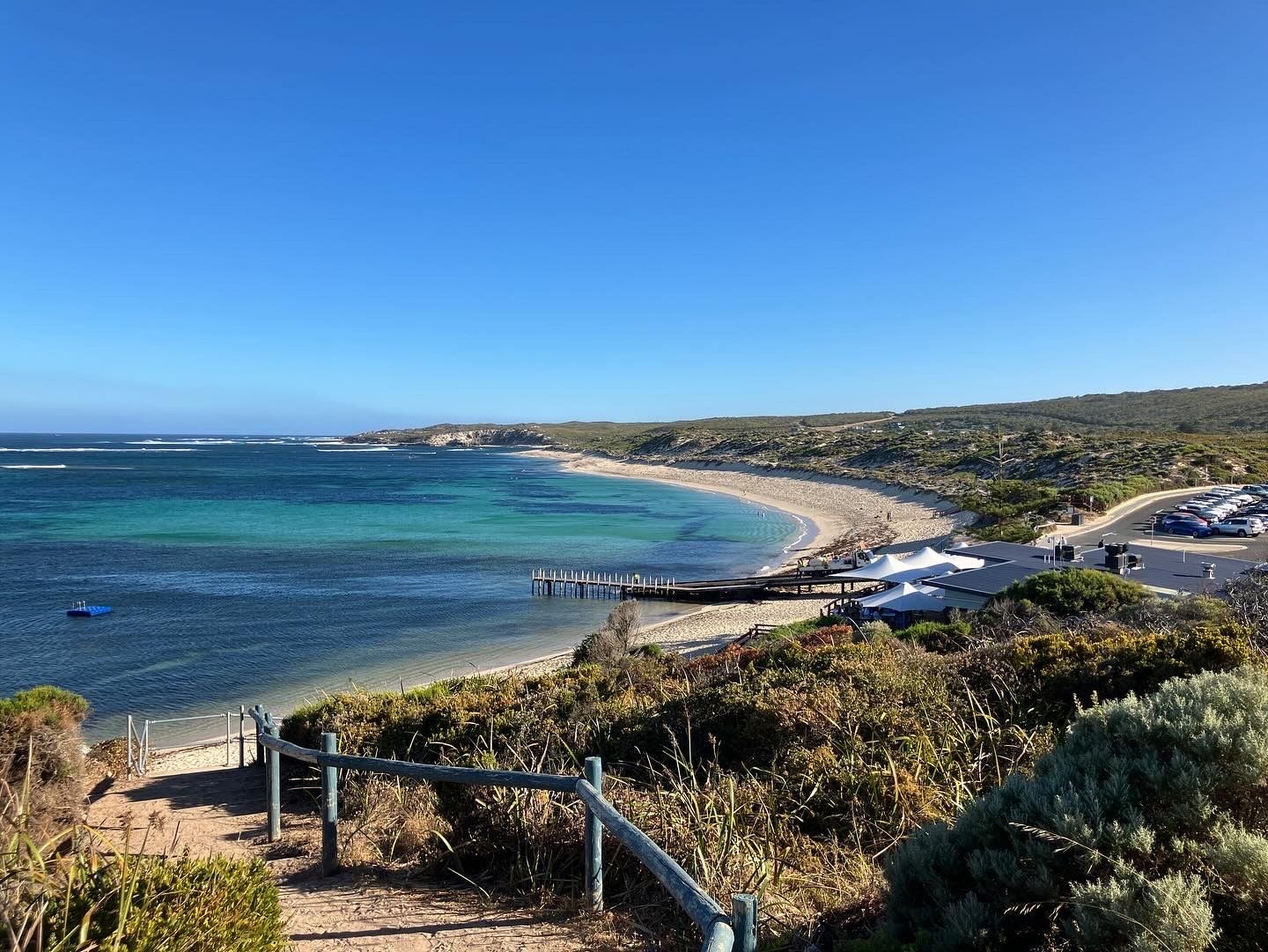 © Dr-ziego
The spot
Community-maintained
Community contribution: submitted by Daniel
Know before you go
Logged by the community, confirmed by mods
Low risk: Swell surges around headland
Larger swells can push against the limestone headland, creating surge conditions near the ledges and caves.
Low risk: Boat traffic near ramp
The boat ramp area has occasional vessel traffic; stay clear of the ramp channel.
Low risk: Variable depth along trail
The dive trail ranges from 2 to 6 metres depth. Snorkelers on the advanced trail should be confident in deeper water and have good buoyancy control.
Low risk: Offshore bomboras (reef breaks)
Offshore bomboras protect the bay but can create surge conditions on their outer edges. Stay within the marked bay area.
Low risk: Seasonal swell and wind
Summer offers the calmest conditions. Winter and spring can bring stronger southerly winds and larger swell, reducing visibility and increasing wave action.
Low risk: Outer reef break
Offshore bomboras can create dumping waves and strong surge in rough conditions, though they mostly protect the inner beach.
Low risk: Marine stingers
Bluebottles (Physalia) may be present in summer when northerly winds blow them ashore.
Low risk: Boat traffic near jetty
The jetty is used for boat launching and fishing, so snorkelers should stay clear of the ramp and channel.
Wildlife Guide
No wildlife notes for this spot yet.
Gallery
1 photo from the community
Getting in
Gnarabup Beach is located approximately 10 km south-west of Margaret River town centre. From Margaret River, follow Wallcliffe Road west to the coast, then turn left onto Gnarabup Road and follow it to the beach carpark. The White Elephant Beach Café overlooks the bay, and free dive slates can be borrowed from the café.
There is a carpark at Gnarabup Beach adjacent to the White Elephant Beach Café. Parking is generally free but can fill up on busy summer weekends and public holidays.
Free entry. Free parking. Dive slates can be borrowed for free from the White Elephant Beach Café (deposit may apply).
Spot Map
Community
Trust
Is this spot real, accurate, still loved?
Spots near Western Australia

No nearby spots yet.
Quick verify
One tap helps the community keep this spot honest.
About this data
- Conditions last evaluated
- Spot data last updated
- Data sources
- Open-Meteo (marine & weather conditions), tide predictions via UTide, community contributors (descriptions, hazards, marine life).
- License
- Spot content licensed under CC BY-SA 4.0. How's the Spot is open source.