Sheltered on the lee side of the Torndirrup Peninsula, Frenchman Bay Beach offers calm, turquoise waters ideal for snorkeling, swimming, and paddleboarding. The Flinders Peninsula keeps the bay nearly wave-less through the milder months, while the nearby wreck of HMAS Perth creates an artificial reef just offshore. Between June and October, humpback and southern right whales may be spotted from the shore during their annual migration. White sandy shores, picnic areas with barbecues, and a boat ramp make it a well-equipped coastal escape 20 minutes south of Albany.
Frenchman Bay Beach
BeginnerGO
GO
It's a go.
Showing last known conditions
Wave Height 0.3 mSwell Period 12 sWind Speed 4.8 knPrecipitation 5.5 mmTidal Phase ebb
Last evaluated
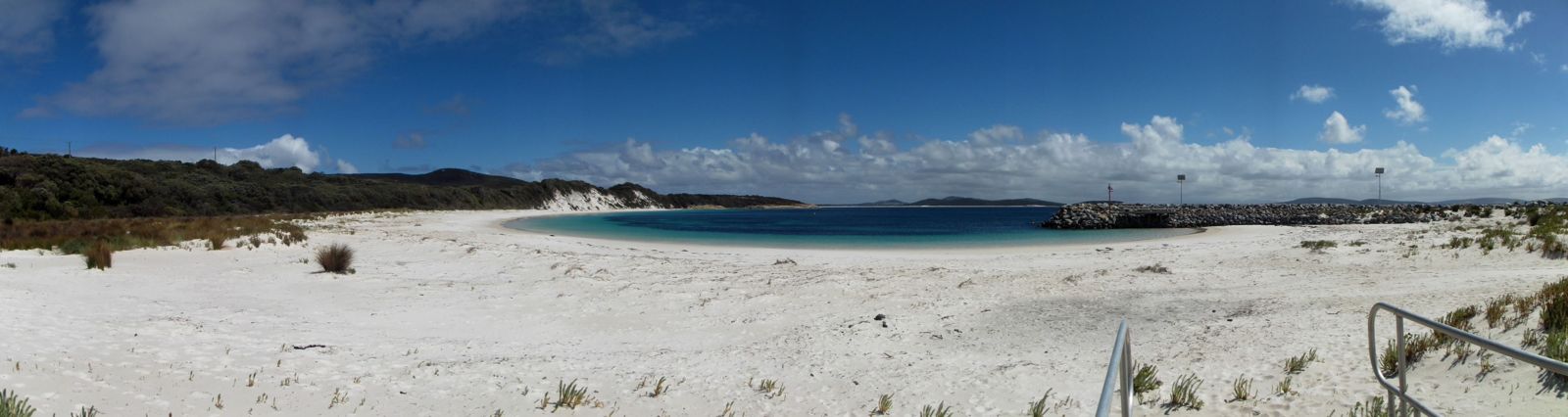 © Ché Lydia Xyang
The spot
Community-maintained
Community contribution: submitted by Daniel
Know before you go
Logged by the community, confirmed by mods
Low risk: Swell and wind sensitivity
Best snorkelling conditions occur during low swell and low winds. When southerly winds pick up or swell increases, water clarity and safety can degrade rapidly.
Low risk: Cold water temperatures
Southern Ocean waters can be chilly year-round, particularly outside summer months, increasing the risk of cold-water shock or hypothermia on longer snorkels.
Low risk: HMAS Perth Wreck (offshore)
Dive wreck located in the bay; snorkelers should stay aware of boat traffic around the dive site and avoid swimming over the wreck without proper gear.
Low risk: Boat traffic near boat ramp
The bay has a public boat ramp, so boat traffic can be present, especially on weekends and holidays.
Wildlife Guide
No wildlife notes for this spot yet.
Gallery
4 photos from the community
Getting in
Shore entry
Entry
Take Frenchman Bay Road south from Albany City Centre. The beach is a 20-minute drive (approx. 9 km) along the Torndirrup Peninsula. From Perth, take the Albany Highway (5 hours drive) or a direct 1-hour 15-minute flight to Albany Airport.
Parking & facilities
Car parking available near the picnic area and boat ramp.
parkingtoiletspicnic_tablesboat_ramp
No entry fee; free public access.
Spot Map
Community
Gallery ┬╖ 4 photos
Trust
Is this spot real, accurate, still loved?
Spots near Western Australia

No nearby spots yet.
Needs verification
Quick verify
One tap helps the community keep this spot honest.
About this data
- Conditions last evaluated
- Spot data last updated
- Data sources
- Open-Meteo (marine & weather conditions), tide predictions via UTide, community contributors (descriptions, hazards, marine life).
- License
- Spot content licensed under CC BY-SA 4.0. How's the Spot is open source.
Weather & swell ┬╖ Open-Meteo marine & weather APIs Tides ┬╖ UTide harmonic analysis Sea & safety ┬╖ community reports