Forresters Beach — known to locals as "Forries" — is a broad, east-facing Pacific beach on the Central Coast between Wamberal and Bateau Bay. Its shallow inshore waters and exposed rocky headlands create varied snorkeling terrain. Best explored at mid-to-high tide, the sandy bottom gives way to kelp-covered reefs along the northern and southern headlands where you can spot rays, turtles, and schools of bream among the boulders. The beach is unpatrolled, so conditions change with swell and tide.
Forresters Beach
IntermediateGO
GO
It's a go.
Showing last known conditions
Wave Height 0.3 mSwell Period 6.4 sWind Speed 3.6 knPrecipitation 6.4 mmTidal Phase slack
Last evaluated
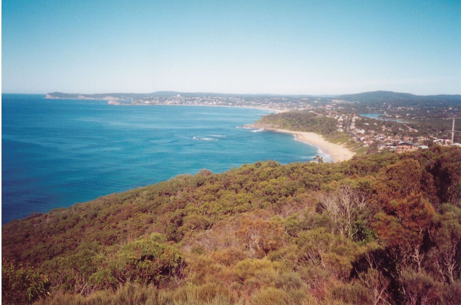 © Stubbo of oz
The spot
Community-maintained
Community contribution: submitted by Daniel
Know before you go
Logged by the community, confirmed by mods
Moderate risk: Unpatrolled beach
Forresters Beach is not patrolled by lifeguards. No flags or supervision.
Moderate risk: Ocean swell and rip currents
Exposed to the Pacific Ocean; moderate to large swells can produce strong rips, especially near the headlands.
Low risk: Rocky headlands
Sharp rocks and boulders along the northern and southern headlands can cause cuts and injuries, especially in surf.
Low risk: Low tide shallowness
At low tide the water becomes very shallow, limiting snorkeling areas and increasing risk of scraping on sandbars.
Wildlife Guide
No wildlife notes for this spot yet.
Gallery
3 photos from the community
Getting in
Shore entry
Entry
From the Sydney-Newcastle Freeway (M1), take the Bateau Bay exit and follow Bateau Bay Road east toward the coast. Turn onto Forresters Beach Road and continue to Kalakau Avenue, which runs along the beachfront.
Parking & facilities
Free street parking along Kalakau Avenue and a formal parking area near the central beach access point. Paid parking options also available nearby.
toiletsparking
Free
Spot Map
Community
Gallery ┬╖ 3 photos
Trust
Is this spot real, accurate, still loved?
Spots near New South Wales

No nearby spots yet.
Needs verification
Quick verify
One tap helps the community keep this spot honest.
About this data
- Conditions last evaluated
- Spot data last updated
- Data sources
- Open-Meteo (marine & weather conditions), tide predictions via UTide, community contributors (descriptions, hazards, marine life).
- License
- Spot content licensed under CC BY-SA 4.0. How's the Spot is open source.
Weather & swell ┬╖ Open-Meteo marine & weather APIs Tides ┬╖ UTide harmonic analysis Sea & safety ┬╖ community reports