Tucked along the wild southern coast of the Eyre Peninsula, Fishery Bay Rock Pools are a series of crystal-clear, granite-framed tidal pools just a 20-minute drive south of Port Lincoln. Accessed via Right Whale Road to a cliffside carpark and a metal ladder descent, these secluded natural baths offer calm, sheltered snorkeling with strikingly clear water perfect for spotting starfish and small reef fish. The pools sit near Fishery Bay's surf beach, combining the best of rugged coastal scenery with a safe, nearshore snorkeling habitat sheltered from the open ocean swell.
Fishery Bay Rock Pools
BeginnerGO
GO
It's a go.
Showing last known conditions
Wave Height 0.3 mSwell Period 11 sWind Speed 5.1 knPrecipitation 6.0 mmTidal Phase slack
Last evaluated
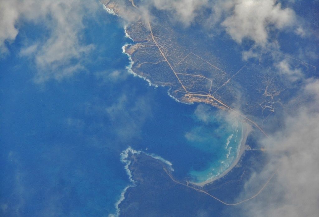 © Michael Coghlan
The spot
Community-maintained
Community contribution: submitted by Daniel
Know before you go
Logged by the community, confirmed by mods
Moderate risk: Ocean swell over-topping
During high swell events, waves can wash over the rock pools, creating sudden surges. Best visited in calm conditions.
Moderate risk: Surf breaks and rips
Fishery Bay is a popular surf beach with multiple breaks. Strong rips and shorebreak can develop when the swell picks up, especially around the main break peaks.
Low risk: Cliff access via metal ladder
Access to the rock pools requires descending a metal ladder down a cliff face, which can be slippery when wet and requires care.
Low risk: Slippery rocks
Granite rock surfaces around the pools can be extremely slippery, especially when wet.
Low risk: No lifeguard patrol
Fishery Bay and the rock pools are unpatrolled. Snorkelers should exercise personal responsibility.
Low risk: 4WD vehicles on beach
Vehicles are permitted to drive on the beach at Fishery Bay, posing a hazard to swimmers and snorkellers entering or exiting the water. Stay alert near vehicle access points.
Low risk: Variable conditions
The bay can switch quickly from serene calm to rough conditions with onshore winds. Swell and wind chop can reduce visibility for snorkelling and make shore entries challenging.
Low risk: Southerly wind swell
When strong southerly winds blow, the bay can become choppy and reduce visibility.
Low risk: Limited facilities
Remote beach with no lifeguards, toilets or amenities — come prepared.
Wildlife Guide
No wildlife notes for this spot yet.
Gallery
1 photo from the community
Getting in
Shore entry
Entry
Drive 20 minutes south of Port Lincoln on Fishery Bay Road. Before reaching the beach, turn right onto Right Whale Road and drive to the end of the road to the last carpark. Look for a metal ladder that descends the cliff to the rock pools. Use Google Maps satellite view to spot the pools for navigation.
Parking & facilities
Unsealed carpark at the end of Right Whale Road. No dedicated accessible parking.
parking
Free access. No permit required.
Spot Map
Community
Gallery ┬╖ 1 photos
Trust
Is this spot real, accurate, still loved?
Spots near South Australia

No nearby spots yet.
Needs verification
Quick verify
One tap helps the community keep this spot honest.
About this data
- Conditions last evaluated
- Spot data last updated
- Data sources
- Open-Meteo (marine & weather conditions), tide predictions via UTide, community contributors (descriptions, hazards, marine life).
- License
- Spot content licensed under CC BY-SA 4.0. How's the Spot is open source.
Weather & swell ┬╖ Open-Meteo marine & weather APIs Tides ┬╖ UTide harmonic analysis Sea & safety ┬╖ community reports