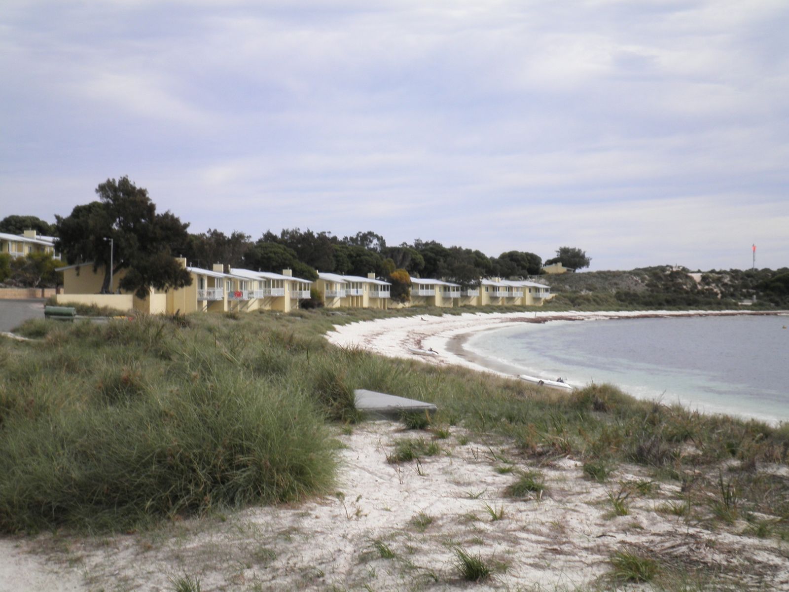
A small, sheltered cove on the northernmost tip of Wadjemup / Rottnest Island, Fay's Bay offers pristine white sand and crystal-clear waters protected by a shallow limestone reef riddled with caves and crevices. The bay is home to lush green seagrass meadows that thrive in the calm, protected environment, making it an idyllic spot for snorkellers of all levels. Its northerly aspect and sheltered position provide excellent protection from gusty winds, and the water remains calm and clear throughout the warmer months.
Fay's Bay
BeginnerGO
GO
It's a go.
Showing last known conditions
Wave Height 0.4 mSwell Period 12 sWind Speed 0.6 knPrecipitation 0.8 mmTidal Phase ebb
Last evaluated
The spot
Community-maintained
Community contribution: submitted by Daniel
Know before you go
Logged by the community, confirmed by mods
Low risk: Sharp limestone reef
The shallow limestone reef that shelters the bay can be sharp underfoot and has hidden caves and crevices. Wear reef shoes when entering and exiting.
Low risk: Swell surge
Occasional northerly swells can push into the bay, creating choppy conditions and flushing currents over the reef.
Low risk: Boat traffic
Boat traffic can enter the bay during peak season as it is a popular anchorage spot.
Wildlife Guide
No wildlife notes for this spot yet.
Gallery
1 photo from the community
Getting in
Snorkel tour
Entry
Fay's Bay is located on the northern coast of Wadjemup / Rottnest Island, between Longreach Bay and Geordie Bay. Access via ferry from Fremantle or Perth to Rottnest Island, then cycle or take the bus to the northern side. It is a short walk from the Geordie Bay settlement area.
Parking & facilities
No parking at the bay itself. Ferry parking available at Fremantle's B Shed or Rous Head (paid, ~$12-$14/day via Wilson Parking). On Rottnest, bicycles are the primary mode of transport; no vehicle parking exists at the cove.
Spot Map
Community
Gallery ┬╖ 1 photos
Trust
Is this spot real, accurate, still loved?
Spots near Western Australia

No nearby spots yet.
Needs verification
Quick verify
One tap helps the community keep this spot honest.
About this data
- Conditions last evaluated
- Spot data last updated
- Data sources
- Open-Meteo (marine & weather conditions), tide predictions via UTide, community contributors (descriptions, hazards, marine life).
- License
- Spot content licensed under CC BY-SA 4.0. How's the Spot is open source.
Weather & swell ┬╖ Open-Meteo marine & weather APIs Tides ┬╖ UTide harmonic analysis Sea & safety ┬╖ community reports