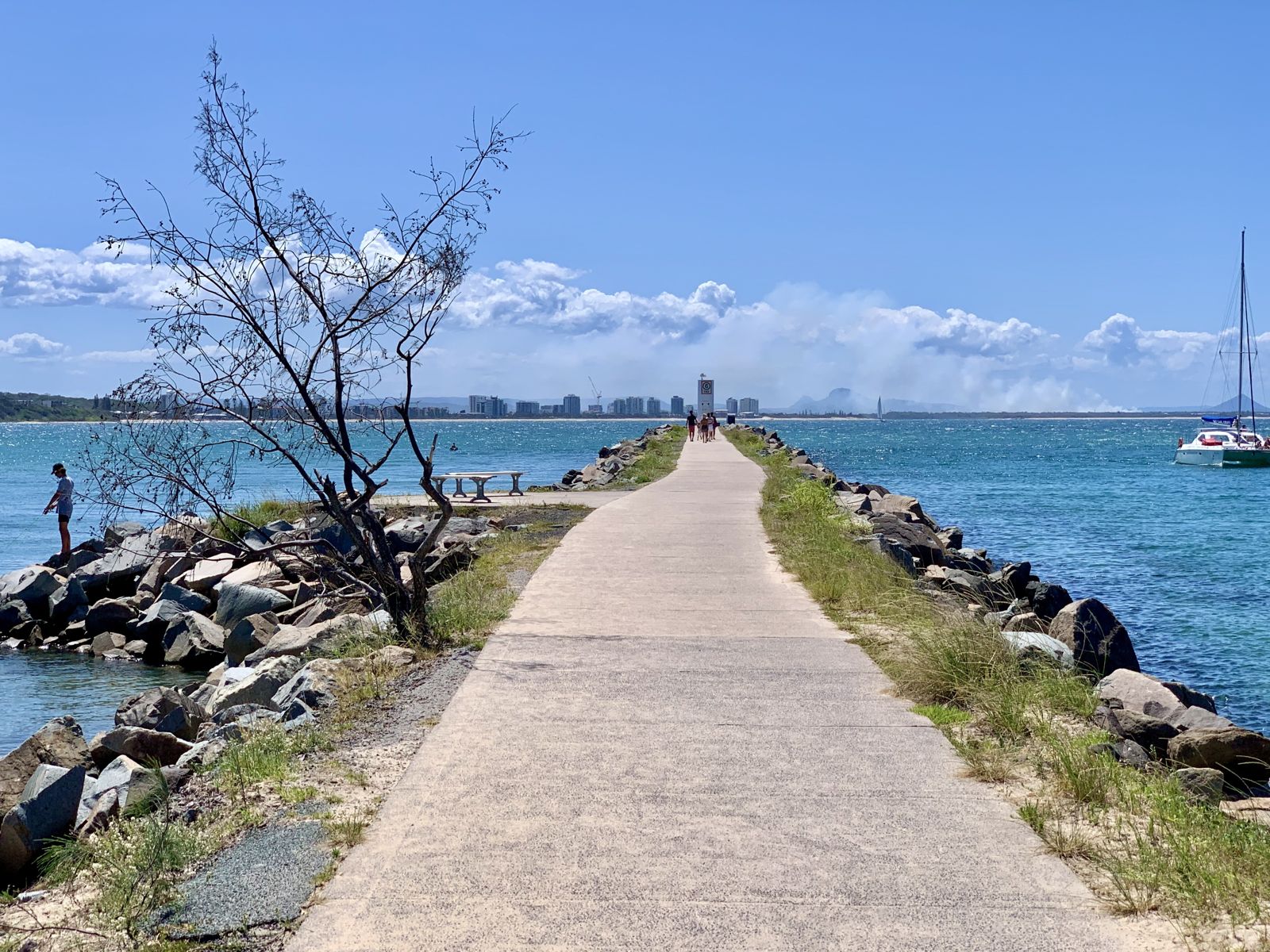
Fairyland is a captivating shore-access snorkel site nestled along the rocky headland between Mooloolaba Beach and the Mooloolaba River mouth on the Sunshine Coast. This inshore reef area is known locally for its surprisingly rich coral growth and diverse fish life hugging the rock wall. The terrain features shallow, protected ledges and boulder-strewn seabed that shelter colorful reef fish, wobbegong sharks, rays, and the occasional green sea turtle. The reef runs along the inside of the Mooloolaba rock wall — the sheltered side offers calm conditions ideal for snorkelers wanting close-up encounters without a boat. Best explored on a rising or high tide for optimal water clarity.
Fairyland (Mooloolaba reef)
IntermediateGO
GO
It's a go.
Showing last known conditions
Wave Height 0.8 mSwell Period 6.0 sWind Speed 2.4 knPrecipitation 0.0 mmTidal Phase flood
Last evaluated
 © Kgbo
The spot
Community-maintained
Community contribution: submitted by Daniel
Know before you go
Logged by the community, confirmed by mods
Moderate risk: Boat traffic near river mouth
The Mooloolaba River entrance is a busy boating channel. Snorkelers near the rock wall must stay vigilant and use a dive float with flag.
Moderate risk: Outgoing tide current
A strong outgoing tide can create a current pulling toward the open ocean from the river mouth. Snorkel on incoming or high tide for safest conditions.
Moderate risk: Ocean Swell
Summer conditions (Nov–May) bring uncomfortable ocean swells that can make snorkeling challenging and lead to trip cancellations ~50% of the time.
Moderate risk: Strong currents
Ocean currents can develop around the reef structure and swim-throughs, particularly on changing tides.
Moderate risk: Strong outgoing tide current
During outgoing tides, water funnels out of the river mouth creating a strong current near the rock wall that can sweep snorkelers seaward.
Low risk: Reduced visibility after rain
Runoff from the Mooloolah River can significantly reduce water clarity, especially after heavy rainfall. Avoid snorkeling within 24-48 hours of rain.
Low risk: Sharp rocks and barnacles
The rock wall surface is encrusted with barnacles and oysters. Wear reef shoes or booties to avoid cuts when entering or exiting.
Low risk: Low Visibility
Summer swells and wind stir up sand, dropping visibility significantly from November to May.
Low risk: Cold Water
Winter water temperatures (Jun–Oct) drop to 20–22°C, requiring a wetsuit for comfort.
Low risk: Boat Traffic
The reef is accessed by boat from Mooloolaba Marina; snorkelers must be aware of vessel traffic in the channel and around Mudjimba Island.
Low risk: Limited visibility
After rain or swell, visibility can drop significantly, making navigation around rock formations more challenging.
Low risk: Reduced visibility after rain runoff
Being located between river systems, the reef is affected by freshwater runoff after heavy rain, significantly reducing water clarity.
Low risk: Depth variability
Snorkel depths vary around the reef complex. Some areas drop off quickly near cave entrances and ledges — stay within comfortable depths.
Wildlife Guide
No wildlife notes for this spot yet.
Gallery
2 photos from the community
Getting in
Shore entry
Entry
From the Mooloolaba Esplanade, head toward the southern end of Mooloolaba Beach near the Mooloolaba River rock wall. Park at the public car park at the end of Esplanade or along Parkyn Parade. Enter the water from the beach adjacent to the rock wall on the Mooloolaba Beach side (sheltered inside of the wall).
Parking & facilities
Public parking available along the Mooloolaba Esplanade and at the Parkyn Parade car park near the river mouth. Pay attention to signed time limits during peak season.
toiletsparkingshowerspicnic_tables
Free shore access. Snorkel gear rental available from local shops along the Esplanade.
Spot Map
Community
Gallery ┬╖ 2 photos
Trust
Is this spot real, accurate, still loved?
Spots near Queensland

No nearby spots yet.
Needs verification
Quick verify
One tap helps the community keep this spot honest.
About this data
- Conditions last evaluated
- Spot data last updated
- Data sources
- Open-Meteo (marine & weather conditions), tide predictions via UTide, community contributors (descriptions, hazards, marine life).
- License
- Spot content licensed under CC BY-SA 4.0. How's the Spot is open source.
Weather & swell ┬╖ Open-Meteo marine & weather APIs Tides ┬╖ UTide harmonic analysis Sea & safety ┬╖ community reports