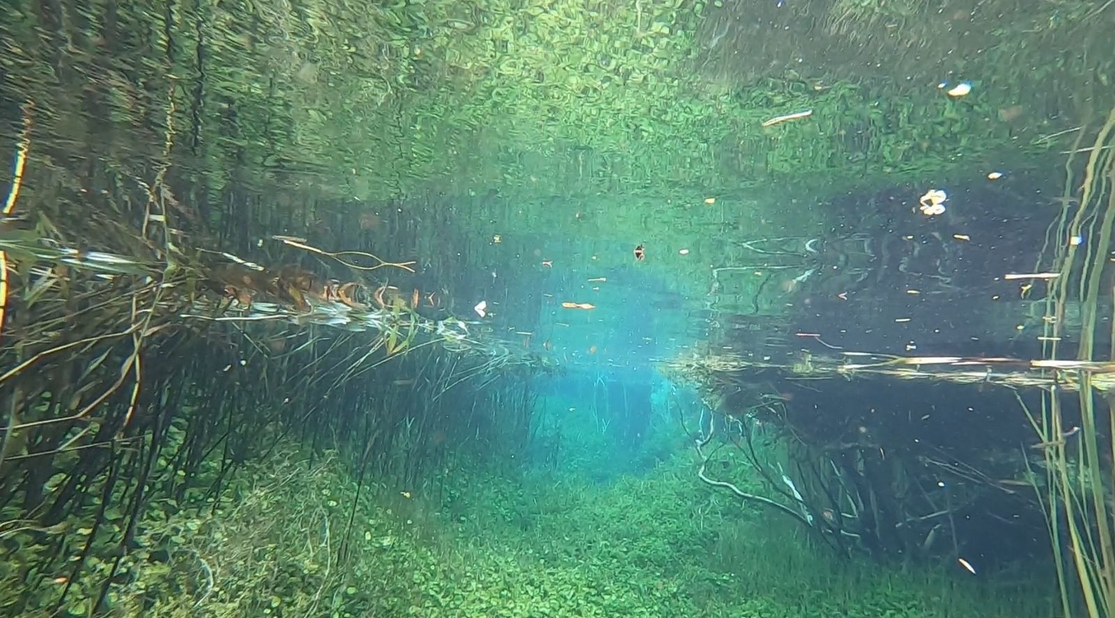
Ewens Ponds is a surreal series of three spring-fed limestone sinkholes connected by shallow, crystal-clear channels in South Australia's Limestone Coast, just 10 minutes east of Port MacDonnell. With visibility exceeding 80 metres — among the best of any freshwater site in Australia — these spring-fed ponds offer a dazzling underwater garden of luminous green submerged plants found nowhere else on Earth. Snorkellers drift effortlessly from Pond 1 through lush, gently current-pushed channels to Pond 3, passing through teal-coloured voids and past steep, plant-lined walls. The ponds remain a consistent 10–15 °C year-round, and the rare Ewens pygmy perch and freshwater crayfish can be spotted among the reeds and along the pond floor.
Ewens Ponds
IntermediateSKIP
SKIP
Poor conditions. Stay out today.
Showing last known conditions
Wave Height 1.8 mSwell Period 11 sWind Speed 12 knPrecipitation 7.9 mmTidal Phase slack
Last evaluated
 © Luridation
The spot
Community-maintained
Community contribution: submitted by Daniel
Know before you go
Logged by the community, confirmed by mods
Moderate risk: Cold Water Hypothermia
Consistent water temperature of 15°C (59°F) year-round. A full-length wetsuit is mandatory; gloves, hood and boots strongly recommended. Even in summer the cold can quickly exhaust swimmers.
Moderate risk: Annual Seasonal Closure
The ponds are closed annually for snorkelling and diving from 1 September to 30 November to protect unique plant life.
Moderate risk: Cold water temperatures
Average water temperature is 10–15°C year-round; full-length wetsuits are mandatory to prevent hypothermia.
Moderate risk: Catastrophic fire danger closure
The park closes on days of Catastrophic Fire Danger and may close on Extreme Fire Danger days. This risk is highest during the dry summer months.
Moderate risk: Low Water Levels
Water levels can drop due to reduced groundwater inflows, occasionally forcing additional closures. Monitor park website before visiting.
Moderate risk: No Lifeguards / Remote Location
No on-site supervision. The ponds are in a remote conservation park with limited phone reception. Snorkel with a buddy.
Moderate risk: Seasonal Pond Closure
The ponds are closed annually from 1 September to 30 November for aquatic vegetation regeneration. No snorkeling permitted.
Moderate risk: Strong downstream current
The constant flow from the pond outflows creates a steady current that can sweep snorkelers downstream faster than expected, especially after rain.
Moderate risk: Cold freshwater temperature
The limestone-fed spring water remains very cold year-round (12–15°C), increasing the risk of cold shock and hypothermia without a wetsuit.
Low risk: Current in Connecting Channels
A gentle but persistent current flows through the narrow channels connecting the three ponds, pushing snorkellers from Pond 1 towards Pond 3.
Low risk: Deep Pockets & Cave
The third pond reaches 13 metres depth and contains a small cave. Snorkellers may inadvertently descend beyond safe breath-hold limits.
Low risk: Annual closure period
The ponds are closed for snorkelling and diving annually from 1 September to 30 November (inclusive) for environmental protection.
Low risk: Permit-only entry
Snorkelling requires a pre-booked one-hour time slot permit; entry without a permit is prohibited. Maximum two sessions per person per day.
Low risk: Annual Vegetation Closure
Ponds are closed annually from 1 September to 30 November (inclusive) to allow aquatic vegetation to regenerate after summer pressure.
Low risk: Cold Water Temperature
Spring-fed water remains cold year-round (12–14°C). A thick wetsuit (5mm+) is strongly recommended to prevent hypothermia.
Low risk: Current in Connecting Creeks
A gentle current flows through the channels connecting the three ponds. Drift snorkelling is the norm, but care is needed to avoid being swept downstream.
Low risk: Permit and time-limited sessions
A pre-booked permit is required; only one-hour time slots are available. You must exit by the end of your slot. Snorkellers must enter at Pond 1 and exit at Pond 3 — no out-and-back swimming is permitted.
Low risk: Buddy system required
You must snorkel with a buddy and complete an online indemnity form before entering the water.
Low risk: One-Way Route Only
Snorkelers must enter at Pond 1 and exit at Pond 3. Exiting at the wrong pond means a 1 km walk back along the roadside.
Low risk: Limited visibility in creek sections
While the ponds are famously clear, narrower sections of Eight Mile Creek can have reduced visibility due to vegetation and sediment.
Low risk: Seasonal closure for conservation
The ponds are closed annually from 1 September to 30 November for ecological protection.
Wildlife Guide
No wildlife notes for this spot yet.
Gallery
4 photos from the community
Getting in
Shore entry
Entry
Located 36 km south of Mount Gambier. Access via Port MacDonnell Road (turn off at Lower Nelson Road east of Port MacDonnell). The car park is at Pond 1.
Parking & facilities
Carpark available on-site at Pond 1.
parkingtoiletspicnic_tables
Free entry; permits required. 1-hr session: $33/2 people. Annual pass: $130/2 people. Book online.
Spot Map
Community
Gallery ┬╖ 4 photos
Trust
Is this spot real, accurate, still loved?
Spots near Victoria

No nearby spots yet.
Needs verification
Quick verify
One tap helps the community keep this spot honest.
About this data
- Conditions last evaluated
- Spot data last updated
- Data sources
- Open-Meteo (marine & weather conditions), tide predictions via UTide, community contributors (descriptions, hazards, marine life).
- License
- Spot content licensed under CC BY-SA 4.0. How's the Spot is open source.
Weather & swell ┬╖ Open-Meteo marine & weather APIs Tides ┬╖ UTide harmonic analysis Sea & safety ┬╖ community reports