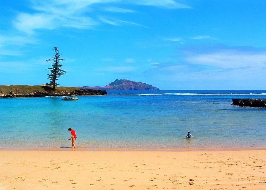
Sheltered by a natural offshore reef and framed by Norfolk Island pines, Emily Bay Lagoon is a sheltered, crystal-clear cove on the southern shore of Norfolk Island, within the Kingston UNESCO World Heritage Site. Named one of Australia's Best Beaches in 2025, its calm, shallow waters are perfect for snorkelling straight from the sand. Over 60 species of reef fish and colourful corals lie just metres offshore, making it the island's premier family-friendly snorkelling destination. A floating pontoon and glass-bottom boat tours add to the experience. The beach is fully equipped for a day out with barbecues, picnic tables, and shaded areas.
Emily Bay
BeginnerGO
GO
It's a go.
Showing last known conditions
Wave Height 0.8 mSwell Period 6.3 sWind Speed 2.5 knPrecipitation 20 mmTidal Phase ebb
Last evaluated
The spot
Community-maintained
Community contribution: submitted by Daniel
Know before you go
Logged by the community, confirmed by mods
Low risk: Tidal currents near reef edges
The offshore reef protects the lagoon, but strong tidal currents can develop near the reef edge and channel entry points. Always read signage and check conditions before entering.
Low risk: Swell over reef
Ocean swells can occasionally push over the protective reef, especially during southerly winds, creating sudden changes in water depth and conditions.
Low risk: Changing ocean conditions
Ocean conditions can shift unexpectedly; a calm lagoon can develop currents or swell. Always check signage and local conditions before entering.
Low risk: Reef-induced currents at channel edges
The lagoon is sheltered by a reef, but outside the protected area currents can be stronger. Swim within the marked safe zone.
Wildlife Guide
No wildlife notes for this spot yet.
Gallery
5 photos from the community
Getting in
Shore entry
Entry
Emily Bay is located on the southern coast of Norfolk Island adjacent to the historic Kingston settlement. From the main town of Burnt Pine, follow the signs south toward Kingston World Heritage Area. The beach is a short walk from the Kingston car park.
Parking & facilities
Parking available at the Kingston precinct car park, a short walk from the beach. Additional street parking along the bay road.
Spot Map
Community
Gallery ┬╖ 5 photos
Trust
Is this spot real, accurate, still loved?
Nearby spots

No nearby spots yet.
Needs verification
Quick verify
One tap helps the community keep this spot honest.
About this data
- Conditions last evaluated
- Spot data last updated
- Data sources
- Open-Meteo (marine & weather conditions), tide predictions via UTide, community contributors (descriptions, hazards, marine life).
- License
- Spot content licensed under CC BY-SA 4.0. How's the Spot is open source.
Weather & swell ┬╖ Open-Meteo marine & weather APIs Tides ┬╖ UTide harmonic analysis Sea & safety ┬╖ community reports