Elliott Heads sits 15 minutes south of Bundaberg, where the Elliott River meets the Coral Sea. At low tide, a vast rock shelf emerges with shallow pools teeming with small tropical fish — a natural aquarium perfect for beginners and families. The long stretch of white sand is flanked by rocky groynes that create calm swimming areas, while Dr Mays Island (a tidal sand island) appears offshore for exploring. The beach is patrolled on weekends and school holidays from September to May. Beyond the rock pools, you can spot dolphins, migrating humpback whales (August–September), and an incredible variety of shorebirds. This quiet, uncrowded beach village offers a laid-back snorkel-and-swim escape.
Elliot Heads
BeginnerGO
GO
It's a go.
Showing last known conditions
Wave Height 0.3 mSwell Period 4.0 sWind Speed 0.4 knPrecipitation 0.0 mmTidal Phase flood
Last evaluated
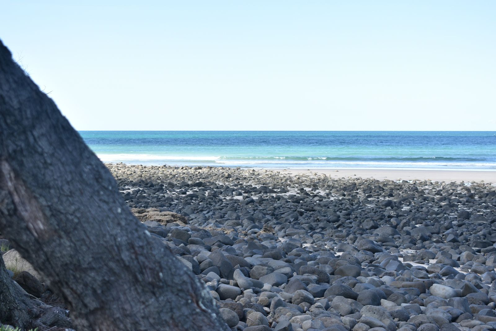 © $tormifyed
The spot
Community-maintained
Community contribution: submitted by Daniel
Know before you go
Logged by the community, confirmed by mods
Moderate risk: Outgoing tide current
The rock pools are only accessible and safely explored around low tide. The outgoing tide can create currents around the rock shelf.
Moderate risk: Tidal isolation
As the tide comes back in, the rock shelf becomes submerged. Snorkelers must be aware of tide times to avoid being cut off.
Moderate risk: Tidal exposure
Rock pools are only fully exposed and accessible at lower tides; at high tide the shelf is completely submerged and pools are not visible.
Moderate risk: Tidal currents at river mouth
The Elliott River mouth creates strong rips and deep channels. Swimming in the river itself is not recommended at any tide.
Low risk: Slippery rock shelf
The exposed volcanic rock shelf can be extremely slippery, especially when wet, requiring careful footing when walking between pools.
Low risk: Uneven entry and exit
Deeper pools further out on the shelf need care getting in and out due to uneven rock edges and sudden depth changes.
Low risk: Slippery volcanic rock
The rock shelf and edges of deeper pools can be very slippery when wet, requiring care when entering and exiting.
Low risk: Deep pools further out
Pools farther from shore on the rock shelf are deeper and require caution getting in and out, especially for weaker swimmers.
Low risk: Tidal currents at incoming tide
As the tide comes in, water movement across the rock shelf can create unexpected currents near the outer pools.
Low risk: Sea Urchins
Sharp-spined sea urchins commonly found among rock platforms and coral — avoid touching submerged rocks.
Low risk: Tide-Dependent Access
Best snorkelling is at high tide when submerged rock platforms are fully covered; low tide exposes rocks and reduces depth significantly.
Low risk: Strong Sun Exposure
Limited shade on the beach and exposed rock platforms — sunburn is a real risk midday.
Low risk: Rock shelf at low tide
The extensive rock platform can be slippery underfoot. Care needed when walking to and from the rock pools.
Low risk: Dr Mays Island bird nesting closure
The island is closed from September to April to protect nesting migratory shorebirds.
Wildlife Guide
No wildlife notes for this spot yet.
Gallery
1 photo from the community
Getting in
Shore entry
Entry
Located 15 minutes south of Bundaberg CBD via the Bundaberg–Bargara Road. Turn onto Elliot Heads Road and follow to Lihs Street.
Parking & facilities
Free street parking available near the beachfront and along Lihs Street. Vehicle access permits required for some areas ($55.90 for 1 month, $281.40 annual).
toiletsparkingshowerspicnic_tablesdrinking_water
Beach access is free. Holiday park camping fees apply for overnight stays.
Spot Map
Community
Gallery ┬╖ 1 photos
Trust
Is this spot real, accurate, still loved?
Spots near Queensland

No nearby spots yet.
Needs verification
Quick verify
One tap helps the community keep this spot honest.
About this data
- Conditions last evaluated
- Spot data last updated
- Data sources
- Open-Meteo (marine & weather conditions), tide predictions via UTide, community contributors (descriptions, hazards, marine life).
- License
- Spot content licensed under CC BY-SA 4.0. How's the Spot is open source.
Weather & swell ┬╖ Open-Meteo marine & weather APIs Tides ┬╖ UTide harmonic analysis Sea & safety ┬╖ community reports