Edithburgh Jetty stretches 308 metres into the calm, protected waters of the eastern Yorke Peninsula, making it one of South Australia's most beloved shore-dive and snorkel sites. The jetty's timber piles are encrusted with colourful sponges, ascidians, and soft corals that attract an incredible diversity of marine life. Snorkellers can glide among the pylons in depths of 2–8 metres, spotting leafy seadragons, rock lings, eagle rays, nudibranchs, crabs, and schools of fish. The site offers easy entry from the beach beside the jetty, with clear water visibility that often exceeds 10 metres in summer. It's a perfect blend of sheltered conditions and rich reef life, suitable for confident beginners and intermediate snorkellers alike.
Edithburgh Jetty
IntermediateGO
GO
It's a go.
Showing last known conditions
Wave Height 0.1 mSwell Period 11 sWind Speed 1.5 knPrecipitation 9.5 mmTidal Phase ebb
Last evaluated
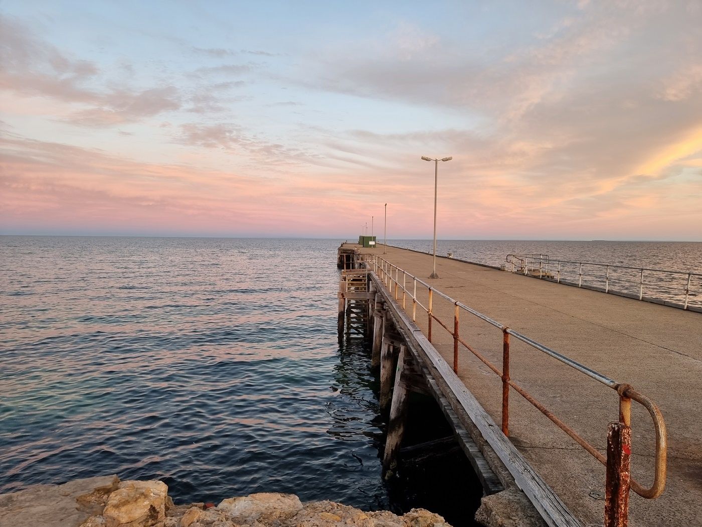 © Dreamofthedolphin
DANGER: Explicit Risks Present
Edithburgh Jetty has hazards marked as danger. Entering the water here means you may face serious risks to your personal safety.
- Blue-ringed octopus danger
Venomous blue-ringed octopuses are regularly sighted under the jetty. Do not touch or provoke — their neurotoxic venom can be fatal.
The spot
Community-maintained
Community contribution: submitted by Daniel
Know before you go
Logged by the community, confirmed by mods
High risk: Blue-ringed octopus
Venomous blue-ringed octopuses are regularly sighted under the jetty. Do not touch or provoke — their neurotoxic venom can be fatal.
Moderate risk: Onshore Wind & Swell
Easterly or onshore winds create choppy, murky conditions. Snorkel only when winds are light (westerly or northerly) and swell is less than 1 metre.
Moderate risk: Fishing Lines & Hooks
Fishing lines and hooks from anglers on the jetty pose entanglement and injury risks. Snorkelers should stay vigilant and give the jetty surface clear of fishing activity.
Moderate risk: Fishing lines and hooks
The jetty is a popular fishing spot; discarded lines and hooks can pose entanglement risks. Watch your surroundings.
Moderate risk: Outgoing tide current
Strong tidal flow during outgoing tide can pull snorkelers away from the jetty structure.
Moderate risk: Boat traffic
The jetty is an active fishing and boating area; snorkelers must stay aware of boats and fishing lines.
Low risk: Deep Water (5-8m)
The water depth ranges from 5-8 metres near the jetty pylons. Snorkelers who are not comfortable duck-diving to 5m may miss the best marine life.
Low risk: Cold Water Temperature
Winter water temperatures drop to 15-16°C. A wetsuit is essential even in summer (17-22°C). Hypothermia risk for inadequately equipped snorkelers.
Low risk: Tidal Current
Tidal flow can be moderate around the jetty pylons, especially at mid-tide. Best conditions are within 45 minutes either side of low tide.
Low risk: Boat traffic near jetty
Fishing boats and recreational vessels may use the jetty area. Stay alert and keep near the pylons away from the main channel.
Low risk: Slippery jetty steps
The steps leading into the water from the jetty can be slick with algae. Take care when entering and exiting.
Low risk: Slippery jetty stairs
Entry/exit steps on the jetty can become very slippery with algae and are challenging at low tide, posing a slip hazard.
Low risk: Harmful algal blooms
Seasonal algal blooms can reduce visibility and pose health risks; check local conditions before entering.
Wildlife Guide
No wildlife notes for this spot yet.
Gallery
6 photos from the community
Getting in
Shore entry
Entry
From Adelaide, take the Princes Highway south towards Cape Jervis, then head west along the Yorke Peninsula past Stansbury to Edithburgh. Turn onto Jetty Road and follow it to the foreshore carpark at the base of the jetty.
Parking & facilities
Free parking is available in the gravel carpark at the foreshore end of the jetty on Jetty Road.
toiletsparkingpicnic_tables
No fees for snorkelling. Jetty fishing may require a recreational fishing licence.
Spot Map
Community
Gallery ┬╖ 6 photos
Trust
Is this spot real, accurate, still loved?
Spots near South Australia

No nearby spots yet.
Needs verification
Quick verify
One tap helps the community keep this spot honest.
About this data
- Conditions last evaluated
- Spot data last updated
- Data sources
- Open-Meteo (marine & weather conditions), tide predictions via UTide, community contributors (descriptions, hazards, marine life).
- License
- Spot content licensed under CC BY-SA 4.0. How's the Spot is open source.
Weather & swell ┬╖ Open-Meteo marine & weather APIs Tides ┬╖ UTide harmonic analysis Sea & safety ┬╖ community reports