Eagles Nest is a striking sandstone sea stack rising from a wide rock platform just offshore near Inverloch, within the Yallock-Bulluk Marine and Coastal Park. At high tide the platform is awash, but at low tide extensive rock pools are exposed — perfect for exploring intertidal marine life. The site offers excellent snorkeling and diving opportunities in crystal-clear waters over a detailed seabed, with a short walk and staircase down to the shore. It is one of Gippsland's most popular snorkeling spots due to its accessibility and unique geological formation.
Eagles Nest
IntermediateMAYBE
MAYBE
Fair. Experienced snorkellers only.
Showing last known conditions
Wave Height 0.1 mSwell Period 12 sWind Speed 4.4 knPrecipitation 28 mmTidal Phase flood
Last evaluated
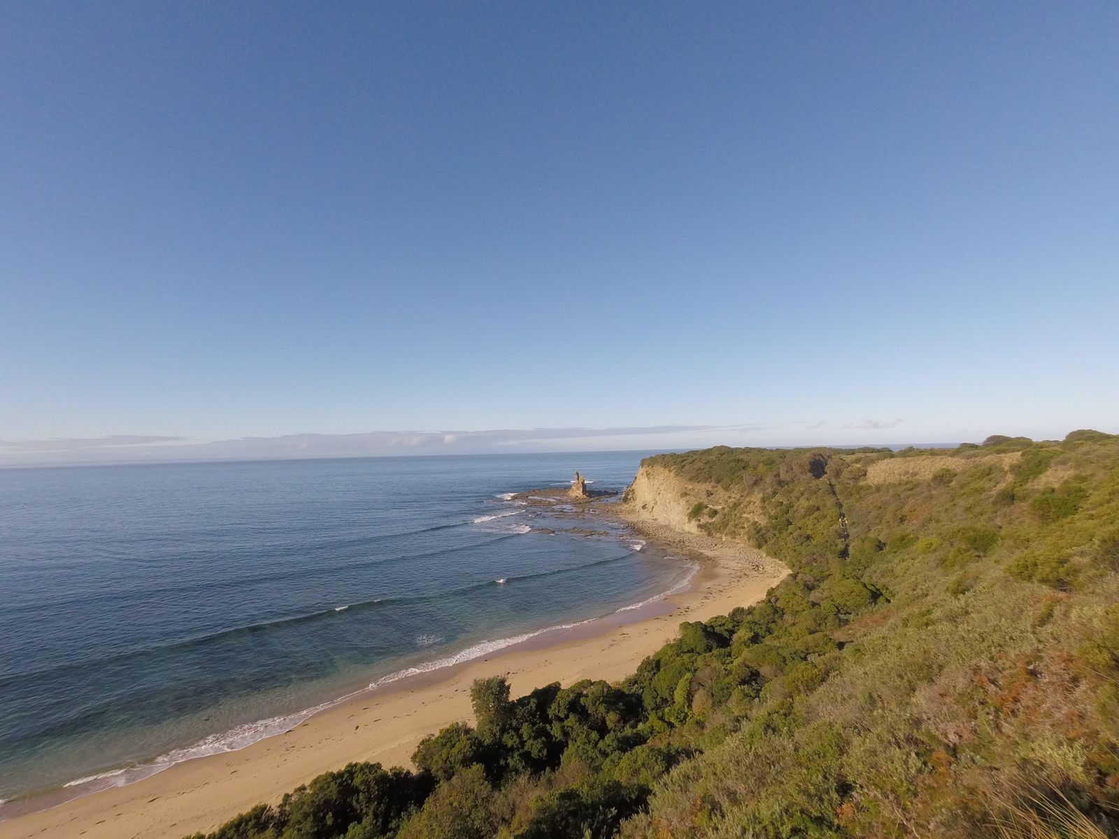 © MattSullivan17
The spot
Community-maintained
Community contribution: submitted by Daniel
Know before you go
Logged by the community, confirmed by mods
Moderate risk: Tidal flooding
The rock platform is awash at high tide, making access to the sea stack dangerous — swimmers and snorkelers can become trapped by rising water.
Low risk: Rough surf conditions
Swell and wave action can make entry and exit hazardous, particularly on the exposed seaward side of the stack.
Low risk: Slippery rocks
The sandstone platform and intertidal rocks are very slippery when wet, posing a slip-and-fall risk.
Wildlife Guide
No wildlife notes for this spot yet.
Gallery
4 photos from the community
Getting in
Shore entry
Entry
Located approximately 2 km west of Inverloch, Victoria, via the Inverloch-Venus Bay Road. Parking is available near the beach access point, followed by a short walk and staircase down to the rock platform.
Parking & facilities
Limited roadside parking available near the access point; can fill up during peak summer weekends.
No fees — located within the Yallock-Bulluk Marine and Coastal Park (Parks Victoria).
Spot Map
Community
Gallery ┬╖ 4 photos
Trust
Is this spot real, accurate, still loved?
Spots near Victoria

No nearby spots yet.
Needs verification
Quick verify
One tap helps the community keep this spot honest.
About this data
- Conditions last evaluated
- Spot data last updated
- Data sources
- Open-Meteo (marine & weather conditions), tide predictions via UTide, community contributors (descriptions, hazards, marine life).
- License
- Spot content licensed under CC BY-SA 4.0. How's the Spot is open source.
Weather & swell ┬╖ Open-Meteo marine & weather APIs Tides ┬╖ UTide harmonic analysis Sea & safety ┬╖ community reports