Dragon Rock, also known as the Shark Gutter, sits just off the protected Tollgate Islands Nature Reserve at the mouth of Batemans Bay on the NSW South Coast. This shallow rocky reef, reaching a maximum depth of 14 metres, is one of the region's premier sites for encountering Grey Nurse Sharks in their natural habitat. The underwater terrain features rock gutters and sandy patches that attract a diverse range of temperate reef fish. Accessible only by boat or kayak, the site offers clear waters in good conditions and is popular for both snorkelling and diving. The islands themselves are a protected seabird sanctuary — landing is prohibited — but the waters around Dragon Rock teem with marine life, particularly from late summer through autumn when Grey Nurse Sharks aggregate in the gutters.
Dragon Rock (Tollgate Islands)
It's a go.
Showing last known conditions
Last evaluated
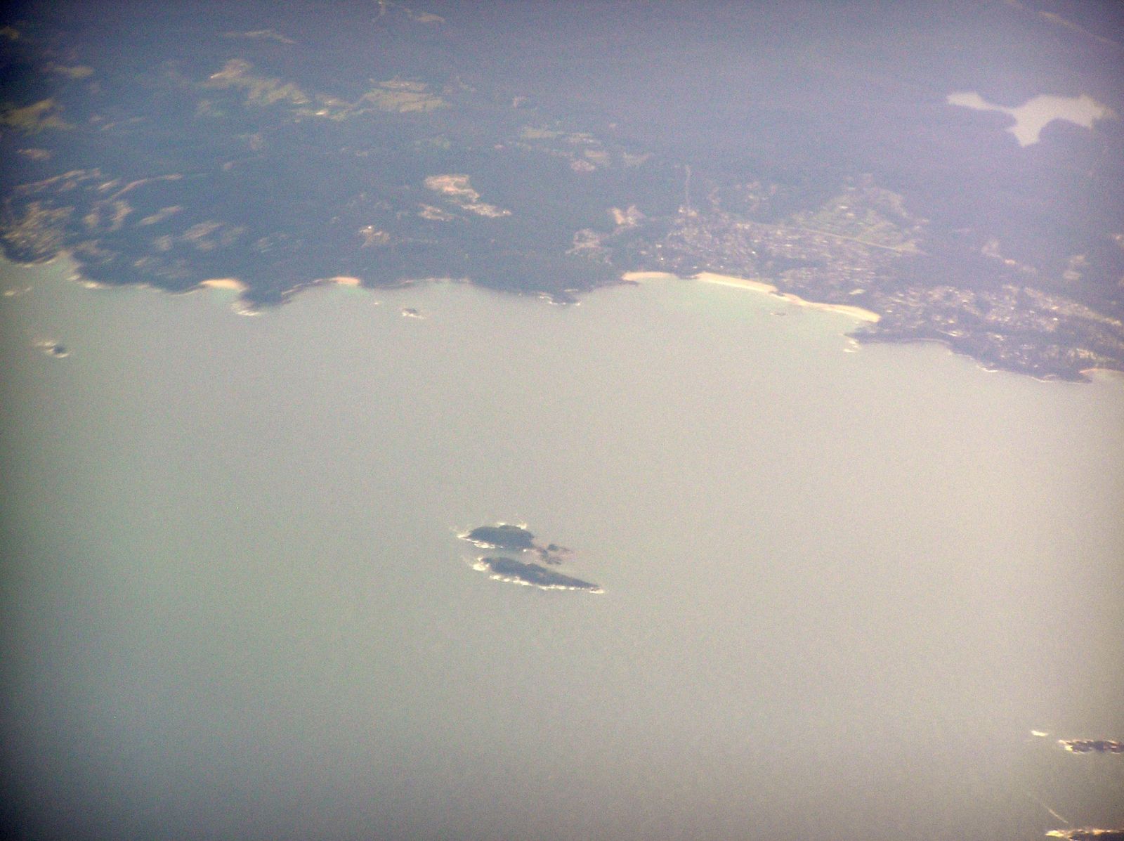 © Graeme Bartlett
The spot
Community-maintained
Community contribution: submitted by Daniel
Know before you go
Logged by the community, confirmed by mods
Moderate risk: Strong ocean currents
The site sits at the mouth of Batemans Bay where tidal flows and ocean swells can create ripping currents, especially on an outgoing tide.
Moderate risk: Swell exposure
The exposed position near the island group can experience sudden large swells from the Tasman Sea, making conditions unpredictable.
Moderate risk: Swell and choppy conditions
Exposed location means ocean swells and wind chop can develop quickly, especially in southerly winds.
Moderate risk: Marine park restrictions
Dragon Rock is a sanctuary zone — strict guidelines apply, including no-take rules. Fines apply for non-compliance.
Moderate risk: Ocean swells and exposed conditions
The islands are exposed to the Tasman Sea; swell and wind can create challenging conditions for snorkellers.
Moderate risk: Strong currents
Tidal currents can run strongly through the gutters and around Dragon Rock.
Moderate risk: Remote location
Offshore site with no immediate shore access; requires boat support and emergency preparedness.
Moderate risk: Open ocean swell exposure
The islands sit exposed to the Tasman Sea; large swells can create challenging conditions, strong surge, and reduced visibility.
Moderate risk: Depth change
The reef edge drops sharply from 9 m to 21 m; snorkelers should be aware of rapid depth changes and monitor their ability accordingly.
Low risk: Boat traffic
Boat-only access means snorkellers share the area with fishing and recreational vessels entering and exiting Batemans Bay.
Low risk: Cold water temperatures
South coast NSW waters are cool year-round, with winter temperatures dropping below 15°C, requiring a wetsuit.
Low risk: Variable visibility
Visibility can range from 5 m to 30 m depending on swell, wind, and recent weather. Check conditions before heading out.
Low risk: Cool water temperatures
Winter water temps drop to 13–14°C; even in summer (20–22°C) a 5 mm wetsuit with hood is recommended for extended snorkel sessions.
Low risk: Currents around islands
Tidal flows can create moderate currents around the island structure and bommies. Drift diving / snorkelling awareness recommended.
Low risk: Marine stingers
Bluebottles and occasional jellyfish can be present, especially during warmer months.
Low risk: Swell and surge
The reef drops quickly to 21 m and can experience ocean swell, surge around the tunnel/cave areas, and strong currents on rougher days.
Low risk: Sharp reef edges
Igneous rock reef with jagged edges and urchin-covered crevices; wear booties or fins with foot protection.
Wildlife Guide
No wildlife notes for this spot yet.
Gallery
1 photo from the community
Getting in
Located approximately 5 km east of Batemans Bay at the mouth of the Clyde River, surrounding the Tollgate Islands. Launch from Batemans Bay boat ramp (Hanging Rock boat ramp) or join a local dive charter from Batemans Bay or Broulee. Kayak access is also possible from Batemans Bay beaches (approximately 3–4 km paddle).
Parking available at Hanging Rock boat ramp off Beach Road, Batemans Bay. Additional street parking near Corrigans Beach Reserve.
No fee to snorkel the site. Tollgate Islands Nature Reserve is free to visit (waters only — landing on the islands is prohibited). Dive charters charge a fee.
Spot Map
Community
Trust
Is this spot real, accurate, still loved?
Spots near Victoria

No nearby spots yet.
Quick verify
One tap helps the community keep this spot honest.
About this data
- Conditions last evaluated
- Spot data last updated
- Data sources
- Open-Meteo (marine & weather conditions), tide predictions via UTide, community contributors (descriptions, hazards, marine life).
- License
- Spot content licensed under CC BY-SA 4.0. How's the Spot is open source.